Bakersville, Maryland
| Bakersville, Maryland | |
|---|---|
| Unincorporated community | |
 Bakersville, Maryland  Bakersville, Maryland | |
| Coordinates: 39°30′53″N 77°45′27″W / 39.51472°N 77.75750°WCoordinates: 39°30′53″N 77°45′27″W / 39.51472°N 77.75750°W | |
| Country | United States |
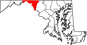
| State | Maryland |
| County | Washington |
| Area[1] | |
| • Total | 0.051 sq mi (0.13 km2) |
| • Land | 0.051 sq mi (0.13 km2) |
| • Water | 0 sq mi (0 km2) |
| Elevation | 423 ft (129 m) |
| Population (2010)[1] | |
| • Total | 30 |
| • Density | 590/sq mi (230/km2) |
| Time zone | UTC−5 (Eastern (EST)) |
| • Summer (DST) | UTC−4 (EDT) |
| Area code(s) | 240 & 301 |
| GNIS feature ID | 589683[2] |
Bakersville is an unincorporated community and census-designated place in Washington County, Maryland, United States. Its population was 30 as of the 2010 census.[1]
History
Bakersville is an historic rural crossroads community located where one of the earliest east-west roads through western Maryland crossed the main north-south road from the Sharpsburg area. Once being home to a store, post office, and grist mill, Salem Evangelical Lutheran Church and cemetery is the only public entity remaining along with the several clustered homes making up the rural village.
Geography
According to the U.S. Census Bureau, the community has an area of 0.051 square miles (0.13 km2), all of it land.[1]
References
- 1 2 3 4 "2010 Census Gazetteer Files - Places: Maryland". U.S. Census Bureau. Retrieved February 10, 2017.
- ↑ "Bakersville". Geographic Names Information System. United States Geological Survey.
This article is issued from
Wikipedia.
The text is licensed under Creative Commons - Attribution - Sharealike.
Additional terms may apply for the media files.