Charlton, Maryland
| Charlton, Maryland | |
|---|---|
| CDP | |
 Charlton, Maryland  Charlton, Maryland | |
| Coordinates: 39°38′4″N 77°53′40″W / 39.63444°N 77.89444°WCoordinates: 39°38′4″N 77°53′40″W / 39.63444°N 77.89444°W | |
| Country |
|
| State |
|
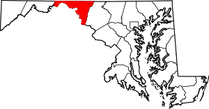
| County |
|
| Area[1] | |
| • Total | 0.42 km2 (0.163 sq mi) |
| • Land | 0.42 km2 (0.163 sq mi) |
| • Water | 0 km2 (0 sq mi) |
| Population (2010)[1] | |
| • Total | 171 |
| • Density | 410/km2 (1,000/sq mi) |
| Time zone | UTC−5 (Eastern (EST)) |
| • Summer (DST) | UTC−4 (EDT) |
| Area code(s) | 240 & 301 |
| GNIS feature ID | 2583597[2] |
Charlton is an unincorporated community and census-designated place in Washington County, Maryland, United States. Its population was 171 as of the 2010 census.[1]
Geography
According to the U.S. Census Bureau, the community has an area of 0.163 square miles (0.42 km2), all of it land.[1]
References
- 1 2 3 4 "2010 Census Gazetteer Files - Places: Maryland". U.S. Census Bureau. Retrieved February 11, 2017.
- ↑ "Charlton". Geographic Names Information System. United States Geological Survey.
This article is issued from
Wikipedia.
The text is licensed under Creative Commons - Attribution - Sharealike.
Additional terms may apply for the media files.