Big Pool, Maryland
| Big Pool, Maryland | |
|---|---|
| Unincorporated community | |
 Big Pool, the body of water formed when the Chesapeake and Ohio Canal was made, which gave the name to the area | |
 Big Pool, Maryland  Big Pool, Maryland | |
| Coordinates: 39°37′25″N 78°00′57″W / 39.62361°N 78.01583°WCoordinates: 39°37′25″N 78°00′57″W / 39.62361°N 78.01583°W | |
| Country | United States |
| State | Maryland |
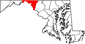
| County | Washington |
| Area[1] | |
| • Total | 0.107 sq mi (0.28 km2) |
| • Land | 0.107 sq mi (0.28 km2) |
| • Water | 0 sq mi (0 km2) |
| Elevation | 430 ft (130 m) |
| Population (2010)[1] | |
| • Total | 82 |
| • Density | 770/sq mi (300/km2) |
| Time zone | UTC−5 (Eastern (EST)) |
| • Summer (DST) | UTC−4 (EDT) |
| Area code(s) | 240 & 301 |
| GNIS feature ID | 589753[2] |
.jpg)
Fort Frederick State Park is located just south of Big Pool.
Big Pool is an unincorporated community in western Washington County, Maryland, United States. Its population was 82 as of the 2010 census.[1] It is between Clear Spring, Maryland and Hancock, Maryland along U.S. Route 40 and is officially a part of the Hagerstown Metropolitan Area.
To the south of Big Pool lies Fort Frederick State Park, a restored fort used during the French and Indian War. Also nearby is the Chesapeake and Ohio Canal National Historical Park, which lies near Ft. Frederick alongside the Potomac River.
Big Pool is also the name of a large body of water which is part of the Chesapeake and Ohio Canal. This pool occurs roughly at the 113 mile mark, and it is on what the canallers called the 14 mile level.
References
- 1 2 3 "2010 Census Gazetteer Files - Places: Maryland". U.S. Census Bureau. Retrieved February 11, 2017.
- ↑ "Big Pool". Geographic Names Information System. United States Geological Survey.
External links
This article is issued from
Wikipedia.
The text is licensed under Creative Commons - Attribution - Sharealike.
Additional terms may apply for the media files.