Bondsville, Massachusetts
| Bondsville, Massachusetts | |
|---|---|
| Village | |
 Corner of State St. and Main St. | |
 Bondsville  Bondsville | |
| Coordinates: 42°13′N 72°21′W / 42.217°N 72.350°WCoordinates: 42°13′N 72°21′W / 42.217°N 72.350°W | |
| Country | United States |
| State | Massachusetts |
| Counties | Hampden, Hampshire |
| City and town | Palmer, Belchertown |
| Area | |
| • Total | 3.7 sq mi (9.6 km2) |
| • Land | 3.7 sq mi (9.5 km2) |
| • Water | 0.0 sq mi (0.1 km2) |
| Elevation | 354 ft (108 m) |
| Population (2000) | |
| • Total | 1,876 |
| • Density | 512.1/sq mi (197.7/km2) |
| Time zone | UTC-5 (Eastern (EST)) |
| • Summer (DST) | UTC-4 (EDT) |
| ZIP code | 01009 |
| Area code(s) | 413 |
| FIPS code | 25-06400 |
| GNIS feature ID | 0609514 |
Bondsville is a village and former census-designated place (CDP) located primarily in the town of Palmer in Hampden County in the western part of the U.S. state of Massachusetts. The CDP boundaries extend slightly into the adjacent town of Belchertown in Hampshire County. The population of the CDP was 1,876 at the 2000 census. It is part of the Springfield, Massachusetts Metropolitan Statistical Area.
Geography
Bondsville is located at 42°13′N 72°21′W / 42.217°N 72.350°W (42.2089, -72.3439).[1]
According to the United States Census Bureau, the CDP has a total area of 9.6 km² (3.7 mi²), of which 9.5 km² (3.7 mi²) is land and 0.1 km² (0.1 mi²) (1.35%) is water.
Demographics
As of the census[2] of 2000, there were 1,876 people, 734 households, and 515 families residing in the CDP. The population density was 197.9/km² (512.1/mi²). There were 787 housing units at an average density of 83.0/km² (214.8/mi²). The racial makeup of the CDP was 98.03% White, 0.21% African American, 0.21% Native American, 0.48% from other races, and 1.07% from two or more races. Hispanic or Latino of any race were 1.07% of the population.
There were 734 households out of which 35.1% had children under the age of 18 living with them, 50.0% were married couples living together, 14.4% had a female householder with no husband present, and 29.8% were non-families. 24.7% of all households were made up of individuals and 12.7% had someone living alone who was 65 years of age or older. The average household size was 2.56 and the average family size was 3.05.
In the CDP the population was spread out with 26.9% under the age of 18, 7.1% from 18 to 24, 27.8% from 25 to 44, 23.8% from 45 to 64, and 14.5% who were 65 years of age or older. The median age was 38 years. For every 100 females, there were 94.8 males. For every 100 females age 18 and over, there were 87.9 males.
The median income for a household in the CDP was $45,875, and the median income for a family was $54,125. Males had a median income of $40,490 versus $29,856 for females. The per capita income for the CDP was $20,097. About 3.2% of families and 6.9% of the population were below the poverty line, including 9.9% of those under age 18 and 11.7% of those age 65 or over.
See also
References
- ↑ "US Gazetteer files: 2010, 2000, and 1990". United States Census Bureau. 2011-02-12. Retrieved 2011-04-23.
- ↑ "American FactFinder". United States Census Bureau. Archived from the original on 2013-09-11. Retrieved 2008-01-31.
Municipalities and communities of Hampden County, Massachusetts, United States | ||
|---|---|---|
| Cities | 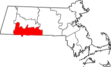 | |
| Towns | ||
| CDPs | ||
| Other villages | ||
| Footnotes | ‡This populated place also has portions in an adjacent county or counties | |
Municipalities and communities of Hampshire County, Massachusetts, United States | ||
|---|---|---|
| Cities | 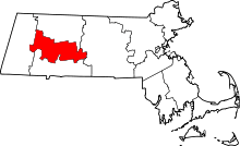 | |
| Towns | ||
| CDPs | ||
| Other villages | ||
| Footnotes | ‡This populated place also has portions in an adjacent county or counties | |