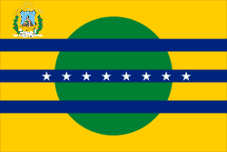
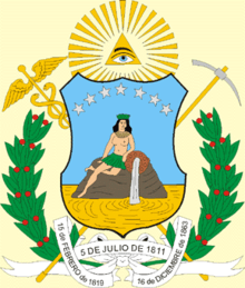
Bolívar (state)
| Bolívar | |||
|---|---|---|---|
| State of Venezuela | |||
| |||
| Anthem: Himno del Estado Bolívar | |||
 Location within Venezuela | |||
| Country | Venezuela | ||
| Created | 1901 | ||
| Capital | Ciudad Bolívar | ||
| Government | |||
| • Governor | Francisco Rangel Gomez (2012–2017) | ||
| Area | |||
| • Total | 240,528 km2 (92,868 sq mi) | ||
| Area rank | 1st | ||
| 26.24% of Venezuela | |||
| Population (2011 census) | |||
| • Total | 1,410,964 | ||
| • Rank | 7th | ||
| 5.62% of Venezuela | |||
| Time zone | UTC-04:00 | ||
| ISO 3166 code | VE-F | ||
| Emblematic tree | Sarrapia (Diphysa punctata) | ||
| Website |
www | ||

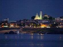
Bolívar (Spanish: Estado Bolívar, IPA: [esˈtaðo βoˈliβaɾ]), is one of the 23 states (estados) into which Venezuela is divided. The state capital city is Ciudad Bolívar, but the largest city is Ciudad Guayana. Bolívar State covers a total surface area of 240,500 km² and as of the 2011 census, had a population of 1,410,964.
History
The territory covered by present-day Bolívar was previously part of the Guayana Province, a Province of the Spanish Empire (from 1585) and later of Venezuela (until 1864, when the Provinces of Venezuela were replaced by the States of Venezuela, following the Federal War).
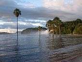
Places of interest
- Historical Zone of Ciudad Bolívar
- Canaima National Park
- La Gran Sabana (Spanish: Great Plains)
- Angel Falls
- Roraima
- Sarisariñama
- Kavanayén
- Santa Elena de Uairen
- Cerro Bolivar, a large iron mine
- Caroni River
Municipalities
Bolívar State is sub-divided into eleven municipalities (municipios), given below with their administrative centres, areas and populations:[1]
| Municipality | Capital | Area (km2) |
Population (Census 2011) |
Population Estimate 30 June 2016 | |
|---|---|---|---|---|---|
| 1. | Angostura | Ciudad Piar | 56,916 | 40,927 | 52,205 |
| 2. | Caroní | Ciudad Guayana | 1,612 | 704,585 | 892,269 |
| 3. | Cedeño | Caicara del Orinoco | 46,020 | 67,000 | 101,800 |
| 4. | El Callao | El Callao | 2,223 | 21,769 | 25,338 |
| 5. | Gran Sabana | (Santa Elena de Uairén) | 32,990 | 28,450 | 37,930 |
| 6. | Heres | Ciudad Bolívar | 5,851 | 342,280 | 414,154 |
| 7. | Padre Pedro Chien | El Palmar | 2,275 | 15,488 | 18,376 |
| 8. | Piar | Upata | 15,900 | 98,274 | 124,476 |
| 9. | Roscio | Guasipati | 6,182 | 21,750 | 27,226 |
| 10. | Sifontes | Tumeremo | 24,393 | 50,082 | 62,798 |
| 11. | Sucre | Maripa | 46,166 | 20,359 | 24,327 |
| Total State | Ciudad Bolívar | 240,528 | 1,410,964 | 1,780,899 |
Population
Race and ethnicity
According to the 2011 Census, the racial composition of the population was:[2]
| Racial composition | Population | % |
|---|---|---|
| Mestizo | N/A | 55.1 |
| White | 646,059 | 39.2 |
| Black | 67,573 | 4.1 |
| Other race | N/A | 1.6 |
See also
| Wikimedia Commons has media related to Bolívar (state). |
References
- ↑ Instituto Nacional de Estadistica, Caracas.
- ↑ "Resultado Básico del XIV Censo Nacional de Población y Vivienda 2011 (Mayo 2014)" (PDF). Ine.gov.ve. p. 29. Retrieved 8 September 2015.