Boissy-l'Aillerie
| Boissy-l'Aillerie | ||
|---|---|---|
| Commune | ||
%2C_mairie%2C_rue_de_la_R%C3%A9publique.jpg) The town hall in Boissy-l'Aillerie | ||
| ||
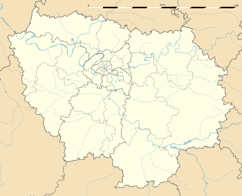
 Boissy-l'Aillerie Location within Île-de-France region  Boissy-l'Aillerie | ||
| Coordinates: 49°04′45″N 2°01′56″E / 49.0792°N 2.0322°ECoordinates: 49°04′45″N 2°01′56″E / 49.0792°N 2.0322°E | ||
| Country | France | |
| Region | Île-de-France | |
| Department | Val-d'Oise | |
| Arrondissement | Pontoise | |
| Canton | Pontoise | |
| Intercommunality | Val de Viosne | |
| Government | ||
| • Mayor (2001–2008) | Michel Guiard | |
| Area1 | 6.53 km2 (2.52 sq mi) | |
| Population (2006)2 | 1,781 | |
| • Density | 270/km2 (710/sq mi) | |
| Time zone | UTC+1 (CET) | |
| • Summer (DST) | UTC+2 (CEST) | |
| INSEE/Postal code | 95078 /95650 | |
| Elevation | 37–99 m (121–325 ft) | |
|
1 French Land Register data, which excludes lakes, ponds, glaciers > 1 km2 (0.386 sq mi or 247 acres) and river estuaries. 2 Population without double counting: residents of multiple communes (e.g., students and military personnel) only counted once. | ||
Boissy-l'Aillerie is a commune in the Val-d'Oise department in Île-de-France in northern France.
Pontoise – Cormeilles Aerodrome is located in the commune. At one time Aigle Azur's head office was on the grounds of the airport.[1][2]
Education
As of 2015, the communal preschool (maternelle) had 65 students and the communal elementary school had 128 students.[3]
See also
References
- INSEE
- Association of Mayors of the Val d’Oise (in French)
- ↑ "Directory: World airlines." Flight International. 16-22 March 2004. 53.
- ↑ LFPT – Pontoise Cormeilles en Vexin. AIP from French Service d'information aéronautique, effective 11 October 2018.
- ↑ "Affaires scolaires." Boissy l'Aillerie. Retrieved on September 6, 2016.
External links
- Official website (in French)
- Official website (in French) (Archive)
- Mérimée database - Cultural heritage (in French)
- Land use (IAURIF)
| Wikimedia Commons has media related to Boissy-l'Aillerie. |
This article is issued from
Wikipedia.
The text is licensed under Creative Commons - Attribution - Sharealike.
Additional terms may apply for the media files.
.svg.png)