Bishop, Texas
| Bishop, Texas | |
|---|---|
| City | |
 Location of Bishop, Texas | |
 | |
| Coordinates: 27°35′7″N 97°47′58″W / 27.58528°N 97.79944°WCoordinates: 27°35′7″N 97°47′58″W / 27.58528°N 97.79944°W | |
| Country | United States |
| State | Texas |
| County | Nueces |
| Area | |
| • Total | 2.4 sq mi (6.1 km2) |
| • Land | 2.4 sq mi (6.1 km2) |
| • Water | 0.0 sq mi (0.0 km2) |
| Elevation | 59 ft (18 m) |
| Population (2010) | |
| • Total | 3,134 |
| • Density | 1,300/sq mi (510/km2) |
| Time zone | UTC-6 (Central (CST)) |
| • Summer (DST) | UTC-5 (CDT) |
| ZIP code | 78343 |
| Area code(s) | 361 |
| FIPS code | 48-08392[1] |
| GNIS feature ID | 1330715[2] |
| Website | bishoptx.com |
Bishop is a city in Nueces County, Texas, United States. The population was 3,134 in the 2010 census, down from 3305 in 2000 census.
History
Bishop is a small town in south Texas, it was a planned town from its beginning. In 1910, F.Z. Bishop, an insurance agent turned promoter, acquired 2,300 acres (9.3 km2) of land in South Texas along the railroad line and laid out a model community surrounded by farm tracts.
Bishop laid out zoned business, industrial and residential districts and built a water and power system. In just two years, the town grew to a population of 1,200. Bishop closed his operation as World War I started. He had sold more than 80,000 acres (320 km2) of land and established a prosperous community.
The city was built on agriculture as its economic mainstay. The economy is also bolstered by a large chemical plant opened in 1945 by Celanese Corporation of America.
Geography
Bishop is located at 27°35′7″N 97°47′58″W / 27.58528°N 97.79944°W (27.585178, -97.799437).[3] According to the United States Census Bureau, the city has a total area of 2.4 square miles (6.2 km2), all of it land.
It is located on U.S. Highway 77 (Future Interstate 69E) and Farm-to-Market Road 70, Bishop is located eight miles north of Kingsville and about thirty miles southwest of Corpus Christi.[4]
Climate
The climate in this area is characterized by hot, humid summers and generally mild to cool winters. According to the Köppen Climate Classification system, Bishop has a humid subtropical climate, abbreviated "Cfa" on climate maps.[5]
Demographics
| Historical population | |||
|---|---|---|---|
| Census | Pop. | %± | |
| 1930 | 953 | — | |
| 1940 | 1,329 | 39.5% | |
| 1950 | 2,731 | 105.5% | |
| 1960 | 3,722 | 36.3% | |
| 1970 | 3,466 | −6.9% | |
| 1980 | 3,706 | 6.9% | |
| 1990 | 3,337 | −10.0% | |
| 2000 | 3,305 | −1.0% | |
| 2010 | 3,134 | −5.2% | |
| Est. 2016 | 3,134 | [6] | 0.0% |
| U.S. Decennial Census[7] | |||
As of the census[1] of 2000, there were 3,305 people, 1,132 households, and 868 families residing in the city. The population density was 1,394.1 people per square mile (538.4/km²). There were 1,269 housing units at an average density of 535.3 per square mile (206.7/km²). The racial makeup of the city was 84.11% White, 0.97% African American, 0.57% Native American, 0.12% Asian, 0.06% Pacific Islander, 11.71% from other races, and 2.45% from two or more races. Hispanic or Latino of any race were 60.00% of the population.
There were 1,132 households out of which 38.3% had children under the age of 18 living with them, 58.9% were married couples living together, 14.3% had a female householder with no husband present, and 23.3% were non-families. 20.4% of all households were made up of individuals and 11.5% had someone living alone who was 65 years of age or older. The average household size was 2.92 and the average family size was 3.41.
In the city, the population was spread out with 30.0% under the age of 18, 8.6% from 18 to 24, 27.2% from 25 to 44, 21.3% from 45 to 64, and 12.9% who were 65 years of age or older. The median age was 34 years. For every 100 females, there were 93.0 males. For every 100 females age 18 and over, there were 89.3 males.
The median income for a household in the city was $35,434, and the median income for a family was $41,250. Males had a median income of $30,469 versus $22,316 for females. The per capita income for the city was $14,974. About 12.2% of families and 14.1% of the population were below the poverty line, including 17.6% of those under age 18 and 13.5% of those ages 65 or over.
Education
The City of Bishop is served by the Bishop Consolidated Independent School District, which has five schools:
- Bishop High (Grades 9-12)
- Luehrs Junior High (Grades 6-8)
- Bishop Elementary (Grades 4-5)
- Bishop Primary School (Grades PK-3)
Petronila Elementary (Grades PK-5)
- Bishop Primary (Grades PK-3)
The BCISD now has a new high school that opened in the fall of 2010.
Transportation
The Bishop Municipal Airport is located three nautical miles (4 mi, 6 km) northeast of Bishop's central business district.][8]
Government
- Government Officials:
- Mayor Tem Miller
- Mayor Pro Tem - Albert Guajardo
- City Councilmember - Bill Boswell
- City Councilmember - Nathan Garza
- City Councilmember - Janie Dominguez
- City Councilmember - Robert Gaona
- City Secretary - Cynthia L. Contreras
- City Attorney - Gerald Benadum
- Director of Communications- Norma B Gonzalez
- Director of Public Works- Panfilo Flores
- Chief of Police - Billy Durbin
Culture
Bishop in popular culture
- Ronnie Bull, a running back for the Chicago Bears and the Philadelphia Eagles, grew up in Bishop, TX and played football for Bishop High School.
- Season 2, Episode 2 of Person of Interest, "Bad Code" takes place in a fictional representation of Bishop, TX, which is revealed as the birthplace of the hacker known as Root.[9]
- The Season 1 "MacGyver" episode "Can Opener" takes place at a low-security Federal Correctional Institute near Bishop (Bishop Correctional Facility) where the main character has to break a drug kingpin out of what is portrayed as a maximum-security facility.
References
- 1 2 "American FactFinder". United States Census Bureau. Archived from the original on 2013-09-11. Retrieved 2008-01-31.
- ↑ "US Board on Geographic Names". United States Geological Survey. 2007-10-25. Retrieved 2008-01-31.
- ↑ "US Gazetteer files: 2010, 2000, and 1990". United States Census Bureau. 2011-02-12. Retrieved 2011-04-23.
- ↑ TexasEscapes Profile on Bishop
- ↑ Climate Summary for Bishop, Texas
- ↑ "Population and Housing Unit Estimates". Retrieved June 9, 2017.
- ↑ U.S. Decennial Census; census.gov
- ↑ FAA Airport Master Record for 07R (Form 5010 PDF). Federal Aviation Administration. Effective 30 June 2011.
- ↑ "Person of Interest: Bad Code". IMDB.
External links
- Bishop Chamber of Commerce
- Bishop, TX from the Handbook of Texas Online
Municipalities and communities of Nueces County, Texas, United States | ||
|---|---|---|
| Cities | 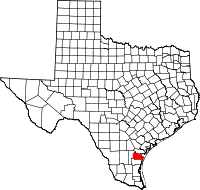 | |
| CDPs | ||
| Other unincorporated communities | ||
| Footnotes | ‡This populated place also has portions in an adjacent county or counties | |
