Bernau bei Berlin
| Bernau bei Berlin | ||
|---|---|---|
| ||
 Bernau bei Berlin Location of Bernau bei Berlin within Barnim district 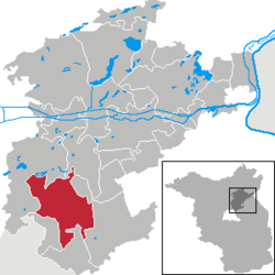 | ||
| Coordinates: 52°40′00″N 13°34′59″E / 52.66667°N 13.58306°ECoordinates: 52°40′00″N 13°34′59″E / 52.66667°N 13.58306°E | ||
| Country | Germany | |
| State | Brandenburg | |
| District | Barnim | |
| Government | ||
| • Mayor | André Stahl (Die Linke) | |
| Area | ||
| • Total | 103.73 km2 (40.05 sq mi) | |
| Elevation | 68 m (223 ft) | |
| Population (2017-12-31)[1] | ||
| • Total | 38,194 | |
| • Density | 370/km2 (950/sq mi) | |
| Time zone | CET/CEST (UTC+1/+2) | |
| Postal codes | 16321 | |
| Dialling codes | 03338 | |
| Vehicle registration | BAR, BER, EW | |
| Website | www.bernau-bei-berlin.de | |

Bernau bei Berlin (English Bernau by Berlin, commonly named Bernau) is a German town in the Barnim district. The town is located about 10 km (6.2 mi) northeast of Berlin.
History
Archaeological excavations of Mesolithic prove the fact that this area has been inhabited since about 8800 BC. The city was first mentioned in 1232. The true reasons of its founding are not known. According to a legend Albert I of Brandenburg permitted the founding of the city in 1140 because of the good beer which was offered to him. It is true that beer has been brewed with the water of the river Panke. Therefore, it was forbidden by law to pollute this river with waste and excrement before the days the brewing took place.
Bernau had its boom years before the Thirty Years' War. Large parts of the defensive wall with town gate and wet moats are relics of that time. These helped Bernau defend itself successfully against attackers, e.g. the Hussites in 1432. Following the plague and war Bernau was poor and bleak. Frederick I of Prussia settled 25 Huguenotic families (craftsmen, farmers, traders and scientists) in 1699.
In 1842 a railway line was opened. One of the first electrical suburban railway lines in the world began operation in 1924. This line of the Berlin S-Bahn connected Bernau with the Stettiner Bahnhof (today Berlin Nordbahnhof) in Berlin. The Bundesschule des Allgemeinen Deutschen Gewerkschaftsbundes, (ADGB Trade Union School), designed by Bauhaus director Hannes Meyer, opened in 1930. The Waldsiedlung (engl. residential area in the wood) is a district of the city where the political leaders of the GDR lived isolated from the people.
Demography
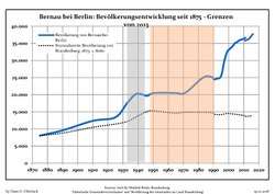 Development of Population since 1875 within the Current Boundaries (Blue Line: Population; Dotted Line: Comparison to Population Development of Brandenburg state; Grey Background: Time of Nazi rule; Red Background: Time of Communist rule)
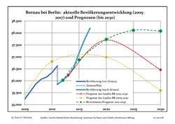 Recent Population Development and Projections (Population Development before Census 2011 (blue line); Recent Population Development according to the Census in Germany in 2011 (blue bordered line); Projection by the Brandenburg state for 2005-2030 (yellow line); Projection by the Brandenburg state for 2014-2030 (red line); Projection by the Bertelsmann Foundation for 2012-2030 (green line)
| Bernau bei Berlin: Population development within the current boundaries (2017)[2] | ||||||||||||||||||||||||||||||||||||||||||||||||||||||||||||||||||||||||||||||||||||||||||||||||||||||||||||||||||||||||||||||||||||||
|---|---|---|---|---|---|---|---|---|---|---|---|---|---|---|---|---|---|---|---|---|---|---|---|---|---|---|---|---|---|---|---|---|---|---|---|---|---|---|---|---|---|---|---|---|---|---|---|---|---|---|---|---|---|---|---|---|---|---|---|---|---|---|---|---|---|---|---|---|---|---|---|---|---|---|---|---|---|---|---|---|---|---|---|---|---|---|---|---|---|---|---|---|---|---|---|---|---|---|---|---|---|---|---|---|---|---|---|---|---|---|---|---|---|---|---|---|---|---|---|---|---|---|---|---|---|---|---|---|---|---|---|---|---|---|
|
|
| ||||||||||||||||||||||||||||||||||||||||||||||||||||||||||||||||||||||||||||||||||||||||||||||||||||||||||||||||||||||||||||||||||||
Main sights
Museums
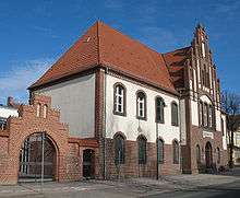
The museum of local history has two locations. One is the town gate with the former prison Hungerturm (engl. Tower of Hunger). It is one of formerly three town gates, that were part of the defensive wall. Today armours and instruments of torture of the Middle Ages are shown there. Common furniture of several epochs and utensils of the executioner are exhibited in the Henkerhaus (engl. executioner's house) to demonstrate the life in the small town.
In 2005 the Wolf Kahlen Museum opened. Media art from 40 years is shown.
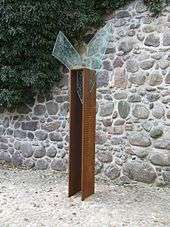
In 2005 Annelie Grund created the monument for the victims of witch-hunt.
Buildings
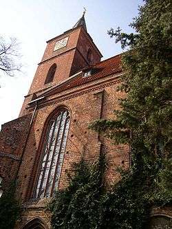
The church St. Marien (Late Gothic style) dominates the skyline of the town. The nave was built in the 15th century.
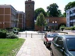
Large parts of the defensive walls and wet moats of the Middle Ages are preserved. The defensive wall is supplemented by several lookout houses, the Pulverturm (armoury) and a town gate.
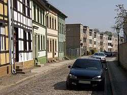
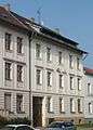
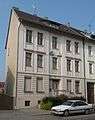
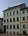
Until the 1960s the city centre, enclosed by the defensive wall, consisted of small old buildings with timber framed construction. Most of them were in a bad state because no funds were available in the GDR to renovate these buildings. It was decided to change Bernau into an exemplary city of socialist architecture. Nearly all the old houses were torn down in the 1960s and 1970s and new so-called Plattenbauten (buildings constructed of prefabricated concrete slabs) were built. The new houses had a maximum of four storeys to fit in with the architecture to the historic structure of the city.
The former ADGB school is located in the northeast of the town. It is the largest building in the Bauhaus style besides the Bauhaus itself.
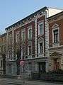
- Breitscheidstraße


Transportation
The line S2 of the Berlin S-Bahn (suburban railway) connects Bernau with Berlin Friedrichstraße's station, in the center of that city Regional rail services connect Bernau with Eberswalde, Schwedt, Stralsund, Frankfurt (Oder) in northbound direction and with Berlin Hauptbahnhof, Berlin Lichtenberg and Elsterwerda in southbound direction. Long-distance trains go to Stralsund, Dortmund, Düsseldorf, Dresden and Amsterdam.
The Bundesautobahn A11 from Berlin to Prenzlau and Szczecin has the two exits Bernau Nord (number 15) and Bernau Süd (number 16).
International relations
Twin towns — sister cities
Bernau bei Berlin is twinned with:
Personalities
Honorary citizen
- Konrad Wolf (1925-1982), film director, President of the Academy of Arts, was the first city commander of Bernau after the Second World War (April 1945) at the age of 19, honorary citizen since 1975
Sons and daughters of the city
- Charlotte Mäder (born 1905; † unknown), athlete
- Hans-Jürgen Buchner (born 1944), musician and composer
- Jeanette Biedermann (born 1980), entertainer
People associated with Bernau
- Marianne Buggenhagen (born 1953), several times Paralympics winner, lives in Bernau
- Wolf Kahlen (born 1940), performance, object and media artist, opened his museum in Bernau in 2005
- Günther Maleuda (1931-2012), politician (DBD), President of the GDR in the turn-time of the GDR
- Hannes Meyer (1889-1954), architect, built the Bundesschule des Allgemeine Deutscher Gewerkschaftsbundes (ADGB Trade Union School) in Bernau from 1928 to 1930
- Andreas Müller (born 1961), youth judge in Bernau
- Johanna Olbrich (1926-2004), spy, lived out her final years in Bernau
See also
References
- ↑ "Bevölkerung im Land Brandenburg nach amtsfreien Gemeinden, Ämtern und Gemeinden 31. Dezember 2017 (Fortgeschriebene amtliche Einwohnerzahlen auf Grundlage des Zensus 2011)". Amt für Statistik Berlin-Brandenburg (in German). 2018.
- ↑ Detailed data sources are to be found in the Wikimedia Commons.Population Projection Brandenburg at Wikimedia Commons
External links

- Official website

Towns and municipalities in Barnim district | ||
|---|---|---|
| Authority control |
|---|