Bell Court, Lexington
|
Bell Court Neighborhood Historic District | |
 Main Street east of Forest Street | |
  | |
| Location |
Roughly bounded by RR tracks, Main St., Boonesboro and Walton Aves. Lexington, Kentucky |
|---|---|
| Coordinates | 38°2′22″N 84°29′9″W / 38.03944°N 84.48583°WCoordinates: 38°2′22″N 84°29′9″W / 38.03944°N 84.48583°W |
| Area | 42.5 acres (17.2 ha) |
| Architect | Multiple |
| Architectural style | Italianate, Queen Anne, Romanesque |
| NRHP reference # | 80001507[1] |
| Added to NRHP | December 08, 1980 |
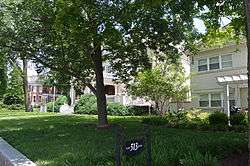
Bell Court is a neighborhood and historic district immediately southeast of Downtown Lexington, Kentucky, United States. Its boundaries are East Main Street to the south, Walton Avenue to the south, Midland Avenue to the north, and Boonesborough Avenue to the east.[2]
Neighborhood statistics
- Area: 0.102 square miles (0.26 km2)
- Population: 427
- Population density: 4,170 people per square mile
- Median household income: $55,512[2]
References
- ↑ National Park Service (2009-03-13). "National Register Information System". National Register of Historic Places. National Park Service.
- 1 2 Bell Court Neighborhood Profile Retrieved 2013-03-11.
External links


| Topics | |
|---|---|
| Lists by states |
|
| Lists by insular areas | |
| Lists by associated states | |
| Other areas | |
| |
This article is issued from
Wikipedia.
The text is licensed under Creative Commons - Attribution - Sharealike.
Additional terms may apply for the media files.