Autumn Ridge, Lexington
| Autumn Ridge | |
|---|---|
| Neighborhood of Lexington, Kentucky | |
| Country | United States |
| State | Kentucky |
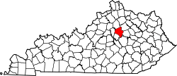
| County | Fayette |
| City | Lexington |
| Area | |
| • Total | .168 sq mi (0.44 km2) |
| • Water | 0.0 sq mi (0.0 km2) |
| Population (2000) | |
| • Total | 645 |
| • Density | 3,850/sq mi (1,490/km2) |
| Time zone | UTC-5 (Eastern (EST)) |
| • Summer (DST) | UTC-4 (EDT) |
| ZIP code | 40509 |
| Area code(s) | 859 |
| Website | autumnridge.org |
Autumn Ridge is a neighborhood in southeastern Lexington, Kentucky, United States. Its boundaries are I-75 to the east, Barnard Drive to the south, Todds Road to the west, and Vero Court to the north.[1]
Neighborhood statistics
- Area: 0.168 square miles (0.44 km2)
- Population: 645
- Population density: 3,850 people per square mile
- Median household income: $99,526[1]
References
- 1 2 Autumn Ridge Neighborhood Profile Retrieved 2013-02-23.


Coordinates: 38°00′04″N 84°24′22″W / 38.0011°N 84.4061°W
This article is issued from
Wikipedia.
The text is licensed under Creative Commons - Attribution - Sharealike.
Additional terms may apply for the media files.