Headley Green, Lexington
| Headley Green | |
|---|---|
| Neighborhood of Lexington, Kentucky | |
| Coordinates: 38°02′06″N 84°31′55″W / 38.035°N 84.532°WCoordinates: 38°02′06″N 84°31′55″W / 38.035°N 84.532°W | |
| Country | United States |
| State | Kentucky |
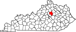
| County | Fayette |
| City | Lexington |
| Area | |
| • Total | 0.069 sq mi (0.18 km2) |
| • Water | 0.0 sq mi (0.0 km2) |
| Population (2000) | |
| • Total | 285 |
| • Density | 4,143/sq mi (1,600/km2) |
| Time zone | UTC-5 (Eastern (EST)) |
| • Summer (DST) | UTC-4 (EDT) |
| ZIP code | 40504 |
| Area code(s) | 859 |
Headley Green is a neighborhood in southwestern Lexington, Kentucky, United States. It was built in the early 1990s from land that had previously been a 18-hole par 3 golf course, a putt-putt course and a driving range for public use. It was also lighted so many people like to play at night . Its boundaries are Mason Headley Road to the north, Cold Harbor Drive to the west, Laurel Hill Road to the south, and the St. Joseph Medical Office Complex to the east.[1]
Neighborhood statistics
- Area: 0.069 square miles (0.18 km2)
- Population: 256
- Population density: 4,143 people per square mile
- Median household income: $31,647[1]
References
- 1 2 Headley Green Neighborhood Profile Retrieved 2014-07-11.


This article is issued from
Wikipedia.
The text is licensed under Creative Commons - Attribution - Sharealike.
Additional terms may apply for the media files.