Bassila
| Bassila | |
|---|---|
| Commune | |
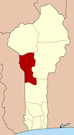
 Commune location in the Donga Department | |
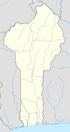 Bassila Location in Benin | |
| Coordinates: 9°01′N 1°40′E / 9.017°N 1.667°ECoordinates: 9°01′N 1°40′E / 9.017°N 1.667°E | |
| Country |
|
| Department | Donga Department |
| Area | |
| • Total | 5,661 km2 (2,186 sq mi) |
| Population (2013) | |
| • Total | 130,770 |
| • Density | 23/km2 (60/sq mi) |
| Time zone | UTC+0 (GMT 0) |
Bassila is a town, arrondissement, and commune located in the Donga Department of Benin. The commune covers an area of 120 square kilometres and as of 2013 had a population of 130,770 people.[1][2]
The RNIE 3 highway of Benin passes through the town of Bassila and the commune. The main ethnic groups in the commune are in the order of significance: Yoruba/Nagot who are the native dwellers, as well as smaller migrant communities of Anii and Tem people otherwise known as 'Kotokoli'. The Nagots historically migrated from Nigeria during a westward Yoruba expansion. The town of Bassila is largely Anii, and is the largest Anii-speaking village. Given that Bassila is located in proximity to the border with Togo, a significant proportion of the population are of Togolese origin (Anii and Kotokoli migrants).[3] Bassila is the second largest arrondissement in Benin by land area.
Towns and villages
Adeli, Afodiobo, Agougou, Akarade, Aledjo-Koura, Aletoutou, Alori, Assion, Aworo, Bakana-Kari, Bakperou, Baningli, Bassila, Bayakou, Biguina, Bodi, Bomako, Boutou, Diengou, Dogue, Gando, Gaougado, Gassagadi, Gatakpal, Goutoungadoni, Guiguizo, Igbere, Igbomakoro, Inkolonie, Iyo, Kadjimani, Kaoute, Katia, Kemeni, Kemetou Alidjo, Kemetou Penezoulou, Kikele, Koakoaliki, Kokotyi, Kominde, Kouloumizi, Kpartao, Kpendi, Lagbere, Liro, Madiatom, Manigri, Mborko, Ngioro, Ngmellang, Niala, Odokoriko, Odola, Ogougouworo, Okouta-Boussa, Penelan, Pénéssoulou, Prekete, Sakouna, Sakouna-Neugbawaperoun, Saramanga, Tchembere, Tiakpartia, Tiatiala, Touroumini, Wetietie, Yadia, Yari
Notable people
References
- ↑ "Bassila". Atlas Monographique des Communes du Benin. Retrieved January 5, 2013.
- ↑ "Communes of Benin". Statoids. Archived from the original on 2 January 2010. Retrieved January 5, 2013.
- ↑ Segnon, AC; Achigan-Dako, EG (2014). "Comparative analysis of diversity and utilization of edible plants in arid and semi-arid areas in Benin". J Ethnobiol Ethnomed. 10: 80. doi:10.1186/1746-4269-10-80. PMC 4290139. PMID 25539993.