Almeirim, Pará
| Almeirim | ||
|---|---|---|
| ||
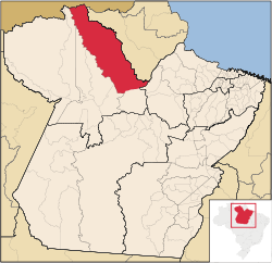 Location of Almeirim municipality in Pará | ||
| Coordinates: 01°31′22″S 52°34′55″W / 1.52278°S 52.58194°WCoordinates: 01°31′22″S 52°34′55″W / 1.52278°S 52.58194°W | ||
| Country | Brazil | |
| Region | Norte | |
| State | Pará | |
| Area | ||
| • Total | 72,960.274 km2 (28,170.119 sq mi) | |
| Elevation | 65 m (213 ft) | |
| Population (2008) | ||
| • Total | 31,475 | |
| • Density | 0.5/km2 (1/sq mi) | |
| [1] | ||
| HDI (2000) | 0.745 – medium[2] | |

Almeirim is a city on the Amazon and the northernmost municipality in the Brazilian state of Pará. It is also the fourth largest municipality in that state and the eighth largest in Brazil (by area). The municipality is crossed by the Equator.
The municipality includes a large part (94.49%) of the 11,518 square kilometres (4,447 sq mi) Maicuru Biological Reserve.[3] It also contains part of the Jari Ecological Station.[4] Serra do Areão Airport located in the district of Monte Dourado 73 km away serves the population residing and working for the Jari project.
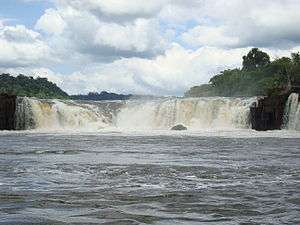 Panama Waterfalls, Paru River
.JPG) Cellulose factory, Jari project
Cellulose factory, Jari project
References
- ↑ IBGE 2008 statistics
- ↑ "Archived copy". Archived from the original on 2009-10-03. Retrieved 2009-12-17. - UNDP
- ↑ Maicuru Reserva Biológica (in Portuguese), ISA: Instituto Socioambiental, retrieved 2016-05-14
- ↑ Figueiredo, João (13 March 1984), "DECRETO Nº 89.440, DE 13 DE MARÇO DE 1984", Brazilian Federal Senate (in Portuguese), Brazilian Government, retrieved 10 March 2016
Capital: Belém | |||||||||||||||
| Mesoregion Baixo Amazonas |
|  | |||||||||||||
| Mesoregion Marajó |
| ||||||||||||||
| Mesoregion Metropolitana de Belém |
| ||||||||||||||
| Mesoregion Nordeste Paraense |
| ||||||||||||||
| Mesoregion Sudeste Paraense |
| ||||||||||||||
| Mesoregion Sudoeste Paraense |
| ||||||||||||||
This article is issued from
Wikipedia.
The text is licensed under Creative Commons - Attribution - Sharealike.
Additional terms may apply for the media files.