Curralinho
| Curralinho | ||
|---|---|---|
| Municipality | ||
| ||
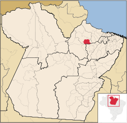 Location in the State of Pará | ||
| Coordinates: 01°48′50″S 49°47′42″W / 1.81389°S 49.79500°WCoordinates: 01°48′50″S 49°47′42″W / 1.81389°S 49.79500°W | ||
| Country |
| |
| Region | North | |
| State |
| |
| Area | ||
| • Total | 3,617.240 km2 (1,396.624 sq mi) | |
| Elevation | 15 m (49 ft) | |
| Population (2008) | ||
| • Total | 26,864 | |
| • Density | 6.5/km2 (17/sq mi) | |
| Time zone | UTC-3 (BST) | |
| Postal Code | 68815-000 | |

Curralinho is a Brazilian municipality located in the state of Pará. Its population as of 2008 is estimated to be 26,864 people. The area of the municipality is 3.617,240 km². The city belongs to the mesoregion Marajó and to the microregion of Furos de Breves.
Geography
The municipality is on the island of Marajó to the northwest of Belém in the delta region where the Amazon and Tocantins rivers empty into the Atlantic Ocean. It contains part of the 194,868 hectares (481,530 acres) Terra Grande-Pracuúba Extractive Reserve, a sustainable use conservation unit created in 2006.[1] It is contained within the 59,985 square kilometres (23,160 sq mi) Marajó Archipelago Environmental Protection Area, a sustainable use conservation unit established in 1989 to protect the environment of the delta region.[2]
References
- ↑ Unidade de Conservação: Reserva Extrativista Terra Grande-Pracuúba (in Portuguese), MMA: Ministério do Meio Ambiente, retrieved 2016-06-29
- ↑ APA Arquipélago do Marajó (in Portuguese), ISA: Instituto Socioambiental, retrieved 2016-06-27