Santana do Araguaia
| Santana do Araguaia | |||
|---|---|---|---|
| city | |||
| |||
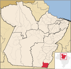 Location of Santana do Araguaia | |||
| Coordinates: 09°30′18″S 50°37′30″W / 9.50500°S 50.62500°W | |||
| Country | Brazil | ||
| Region | Norte | ||
| State | Pará | ||
| Government | |||
| • Mayor | Gilgleider Altino Ribeiro (Brazilian Social Democratic Party) | ||
| Area | |||
| • Total | 11,591.452 km2 (4,475.485 sq mi) | ||
| Elevation | 160 m (520 ft) | ||
| Population (2009) | |||
| • Total | 55,033 | ||
| • Density | 3.7/km2 (10/sq mi) | ||
| [1] | |||
| Postal code (CEP) | 68560 | ||
| HDI (2000) | 0.690 – medium[2] | ||


Santana do Araguaia is the southernmost city in the Brazilian state of Pará. The city lies near the Araguaia River, which marks the border with the state of Tocantins. The town was established on December 20, 1961 by then-governor of Pará, Aurélio do Carmo, after being split off from the municipality of Conceição do Araguaia.[3]
The city is served by Santana do Araguaia Airport.
References
- ↑ IBGE 2009 statistics
- ↑ "Índice de Desenvolvimento Humano - Municipal, 1991 e 2000". United Nations Development Programme.
- ↑ "Santana do Araguaia". 2010. Archived from the original on 2010-06-05. Retrieved December 8, 2010.
This article is issued from
Wikipedia.
The text is licensed under Creative Commons - Attribution - Sharealike.
Additional terms may apply for the media files.