Altamira, Pará
| Altamira | |||
|---|---|---|---|
 Panorama view of Altamira and Xingu River | |||
| |||
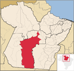 Location of Altamira | |||
| Country | Brazil | ||
| Region | Norte | ||
| State | Pará | ||
| Founded | November 6, 1911 | ||
| Government | |||
| • Mayor | Domingos Juvenil | ||
| Area | |||
| • Total | 159,533.73 km2 (61,596.32 sq mi) | ||
| Elevation | 109 m (358 ft) | ||
| Population (2016) | |||
| • Total | 109,938 | ||
| • Density | 0.69/km2 (1.8/sq mi) | ||


Altamira is one of one hundred and forty-four municipalities in the state of Pará, in northern Brazil. It has an area of 161,446 square kilometres or 62,335 square miles, making it the largest municipality by area both in Pará state and Brazil and until 2009 it was the world's largest municipal subdivision. It occupies 12.8% of the state's territory, 1.8% of the Brazilian territory and 0.8% of the South American territory. It also covers a more extensive area than 104 countries including Bangladesh, which covers 147,570 square kilometres (56,977 sq mi), and is comparable to the US State of Missouri and total area of Florida.
Altamira Municipality encompasses the Altamira city and district, the seat of local government, whose majority population lives in urban area, and nine other mostly rural districts (most of those covered by the Amazon rainforest), whose urban populations are minorities, and live in inhabited areas spaced by tens or hundreds of kilometers. According to the 2010 Brazilian National Census the municipality has 99,075 inhabitants, making a density of only 0.65 inhabitants per square kilometer at the same year. It is home to hundreds of indigenous communities and environmental protection areas. The infamous Belo Monte Dam, a hydroelectric dam complex is currently under construction in the area of the Xingu River in the municipality.
Economy
The municipal GDP is around US$450 million and is mainly linked to agricultural activities, trade and since 2010 has been driven by the construction of the Belo Monte Dam.
The municipality is served by Altamira Airport.
Belo Monte Dam
In Altamira the third-largest dam in the world by generating capacity (behind the Three Gorges Dam and Itaipu Dam), with a capacity of 11.233 GW, is being built; the construction work was started in 2010 and should be completed in 2019.
Geography
Altamira is located in a transition area between the Brazilian Highlands and Amazonian Lowlands, is situated on the shores of the Xingu River a tributary of the Amazon River, with average elevation of 109 meters.
The municipality contains part of the 724,965 hectares (1,791,430 acres) Altamira National Forest, a sustainable use conservation unit created in 1998.[1] The municipality contains part of the Jamanxim National Park, a protected area.[2] It contains part of the 3,373,134 hectares (8,335,200 acres) Terra do Meio Ecological Station, a strictly protected conservation unit created in 2005.[3] It also contains part of the 342,192 hectares (845,570 acres) Nascentes da Serra do Cachimbo Biological Reserve, a strictly protected conservation unit established in 2005.[4] The municipality contains 49% of the 445,408 hectares (1,100,630 acres) Serra do Pardo National Park, established at the same time.[5]
Climate
The climate of Altamira is tropical humid, with high temperatures all year and average rainfall of 1844 mm (72 inches) annually. The seasons are undefined, with only change in rainfall rate.
Summers are warm and rainy, with lows between 19 °C and 22 °C and highs of 26 °C and 35 °C.
Winters are warmer and drier with lows between 22 °C and 26 °C and highs of 30 °C and 40 °C.
| Climate data for Altamira, Pará | |||||||||||||
|---|---|---|---|---|---|---|---|---|---|---|---|---|---|
| Month | Jan | Feb | Mar | Apr | May | Jun | Jul | Aug | Sep | Oct | Nov | Dec | Year |
| Average high °F (°C) | 85 (29) |
85 (29) |
86 (30) |
86 (30) |
86 (30) |
87 (31) |
89 (32) |
90 (32) |
90 (32) |
89 (32) |
88 (31) |
87 (31) |
87 (31) |
| Average low °F (°C) | 70 (21) |
71 (22) |
71 (22) |
71 (22) |
70 (21) |
69 (21) |
69 (21) |
70 (21) |
71 (22) |
71 (22) |
72 (22) |
71 (22) |
71 (22) |
| Average rainfall inches (mm) | 10.59 (269) |
10.63 (270) |
12.99 (330) |
10.63 (270) |
7.8 (198) |
4.49 (114) |
2.09 (53) |
1.61 (41) |
1.34 (34) |
1.38 (35) |
3.23 (82) |
5.83 (148) |
72.61 (1,844) |
| Source: http://es.climate-data.org/location/43955/ | |||||||||||||
References
- ↑ Unidade de Conservação: Floresta Nacional Altamira (in Portuguese), MMA: Ministério do Meio Ambiente, retrieved 2016-05-29
- ↑ Unidade de Conservação: Parque Nacional do Jamanxim (in Portuguese), MMA: Ministério do Meio Ambiente, retrieved 2016-05-19
- ↑ Unidade de Conservação: Estação Ecológica da Terra do Meio (in Portuguese), MMA: Ministério do Meio Ambiente, retrieved 2016-05-29
- ↑ Unidade de Conservação: Reserva Biológica Nascentes Serra do Cachimbo (in Portuguese), MMA: Ministério do Meio Ambiente, retrieved 2016-05-27
- ↑ PARNA da Serra do Pardo (in Portuguese), ISA: Instituto Socioambiental, retrieved 2016-08-08
See also
Coordinates: 3°12′10″S 52°12′21″W / 3.20278°S 52.20583°W