São Geraldo do Araguaia
| São Geraldo do Araguaia | |
|---|---|
| Municipality | |
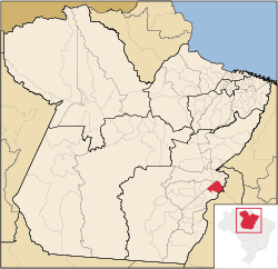 Location in Pará | |
| Country |
|
| Region | Northern |
| State | Pará |
| Mesoregion | Sudeste Paraense |
| Time zone | UTC -3 |
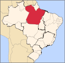
São Geraldo do Araguaia is a municipality in the state of Pará in the Northern region of Brazil.[1][2][3][4]
The municipality contains the 24,897 hectares (61,520 acres) Serra dos Martírios/Andorinhas State Park, created in 1996.[5] It contains the 29,655 hectares (73,280 acres) São Geraldo do Araguaia Environmental Protection Area, created at the same time.[6]
See also
References
- ↑ "Divisão Territorial do Brasil" (in Portuguese). Divisão Territorial do Brasil e Limites Territoriais, Instituto Brasileiro de Geografia e Estatística (IBGE). July 1, 2008. Retrieved December 17, 2009.
- ↑ "Estimativas da população para 1º de julho de 2009" (PDF) (in Portuguese). Estimativas de População, Instituto Brasileiro de Geografia e Estatística (IBGE). August 14, 2009. Retrieved December 17, 2009.
- ↑ "Ranking decrescente do IDH-M dos municípios do Brasil" (in Portuguese). Atlas do Desenvolvimento Humano, Programa das Nações Unidas para o Desenvolvimento (PNUD). 2000. Retrieved December 17, 2009.
- ↑ "Produto Interno Bruto dos Municípios 2002-2005" (PDF) (in Portuguese). Instituto Brasileiro de Geografia e Estatística (IBGE). December 19, 2007. Retrieved December 17, 2009.
- ↑ PES Serra dos Martírios/Andorinhas (in Portuguese), ISA: Instituto Socioambiental, retrieved 2016-12-18
- ↑ APA de São Geraldo do Araguaia (in Portuguese), ISA: Instituto Socioambiental, retrieved 2017-02-08
Capital: Belém | |||||||||||||||
| Mesoregion Baixo Amazonas |
|  | |||||||||||||
| Mesoregion Marajó |
| ||||||||||||||
| Mesoregion Metropolitana de Belém |
| ||||||||||||||
| Mesoregion Nordeste Paraense |
| ||||||||||||||
| Mesoregion Sudeste Paraense |
| ||||||||||||||
| Mesoregion Sudoeste Paraense |
| ||||||||||||||
Coordinates: 6°24′S 48°32′W / 6.400°S 48.533°W
This article is issued from
Wikipedia.
The text is licensed under Creative Commons - Attribution - Sharealike.
Additional terms may apply for the media files.