Allen Park, Michigan
| Allen Park, Michigan | |
|---|---|
| City | |
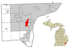 Location in Wayne County and the U.S. state of Michigan | |
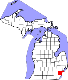
 Allen Park, Michigan Location in the United States | |
| Coordinates: 42°15′17″N 83°12′37″W / 42.25472°N 83.21028°W | |
| Country |
|
| State |
|
| County |
|
| Government | |
| • Mayor | William Matakas |
| Area[1] | |
| • Total | 7.05 sq mi (18.26 km2) |
| • Land | 7.00 sq mi (18.13 km2) |
| • Water | 0.05 sq mi (0.13 km2) |
| Elevation | 594 ft (181 m) |
| Population (2010)[2] | |
| • Total | 28,210 |
| • Estimate (2017)[3] | 27,156 |
| • Density | 4,000/sq mi (1,500/km2) |
| Time zone | UTC-5 (EST) |
| • Summer (DST) | UTC-4 (EDT) |
| ZIP code | 48101, 48122, 48124 |
| Area code(s) | 313 |
| FIPS code | 26-01380 |
| GNIS feature ID | 0619983[4] |
| Website | http://www.cityofallenpark.org/ |
Allen Park is a middle-class suburban city in central Wayne County, Michigan. The city is known for its tree-lined streets, brick houses, and the Fairlane Green Shopping Center that opened in 2006. At the 2010 census, the population was 28,210. The suburb of Detroit was once recognized in Money Magazine's list of America's Best Small Cities.[5] Allen Park is part of the collection of communities known as Downriver. Much like other "Downriver" communities, Allen Park has seen a steady decline in recent years, in terms of property value.[6]
Ford Motor Company is an integral part of the community. Many of the company's offices and facilities lie within the city limits. Since 2002, Allen Park is the practice home of the Detroit Lions football team and is also the site of the team's headquarters.
Geography
According to the United States Census Bureau, the city has a total area of 7.05 square miles (18.26 km2), of which 7.00 square miles (18.13 km2) is land and 0.05 square miles (0.13 km2) is water.[1]
Boundaries
Allen Park borders Southgate to the South, Lincoln Park to the east, Melvindale to the northeast, Dearborn to the north, Dearborn Heights to the northwest, and Taylor to the west.
Major Roads


Fairlane Green and Independence Marketplace
Fairlane Green, also known as "The Hill", is a shopping center located on a large hill between Outer Drive and Oakwood Boulevard. The site is a former clay quarry used to make bricks which was later purchased by Ford to use as a landfill for wastes from the Ford Rouge Plant. After the landfill closed in 2003, construction of retail stores began in 2006 with a focus on green principles.[7] Independence Marketplace is a retail development between the hill and the freeway. It is built on top of the former location of Veterans Administration Hospital. In 1937, Henry and Clara Ford donated 38 acres at the corner of Southfield and Outer Drive for use as a Veterans Administration hospital. Ground-breaking ceremonies for the hospital were held on July 27, 1937, with Henry Ford in attendance. Major additions to the original hospital were made after WWII and during the 1960s. The Allen Park Veterans Administration Medical Center was sometimes referred to as the Dearborn VA Hospital. It was a long time landmark that was both beautiful and interesting in its architecture. The Allen Park VA hospital was deemed eligible for the National Register of Historic Places on Jan. 6, 1981 but in spite of this fact' it was demolished in 2004.
History
Allen Park was incorporated as a village in 1927, and as a city in 1957.[8] It was named after Lewis Allen, a well-to-do lawyer and lumberman whose 276½ acres of land (primarily in Ecorse Township) included holdings in what are now Allen Park and Melvindale.[8] Hubert Champaign (for whom Champaign Park is named) and Edward Pepper were two other early residents of the area.[8]
In 1950 Allen Park did not include the part of the city directly west of Melvindale; that area was still part of Ecorse Township.[9]
Demographics
| Historical population | |||
|---|---|---|---|
| Census | Pop. | %± | |
| 1930 | 944 | — | |
| 1940 | 3,487 | 269.4% | |
| 1950 | 12,329 | 253.6% | |
| 1960 | 37,494 | 204.1% | |
| 1970 | 40,747 | 8.7% | |
| 1980 | 34,196 | −16.1% | |
| 1990 | 31,092 | −9.1% | |
| 2000 | 29,376 | −5.5% | |
| 2010 | 28,210 | −4.0% | |
| Est. 2017 | 27,156 | [3] | −3.7% |
| U.S. Decennial Census[10] 2012 Estimate[11] | |||
2010 census
As of the census[2] of 2010, there were 28,210 people, 11,580 households, and 7,606 families residing in the city. The population density was 4,030.0 inhabitants per square mile (1,556.0/km2). There were 12,206 housing units at an average density of 1,743.7 per square mile (673.2/km2). The racial makeup of the city was 92.9% White, 2.1% African American, 0.5% Native American, 0.8% Asian, 2.0% from other races, and 1.6% from two or more races. Hispanic or Latino of any race were 8.1% of the population.
There were 11,580 households of which 29.1% had children under the age of 18 living with them, 49.1% were married couples living together, 11.6% had a female householder with no husband present, 5.0% had a male householder with no wife present, and 34.3% were non-families. 30.1% of all households were made up of individuals and 14.3% had someone living alone who was 65 years of age or older. The average household size was 2.42 and the average family size was 3.02.
The median age in the city was 41.7 years. 21.7% of residents were under the age of 18; 7.7% were between the ages of 18 and 24; 24.8% were from 25 to 44; 28.5% were from 45 to 64; and 17.2% were 65 years of age or older. The gender makeup of the city was 48.1% male and 51.9% female.
2000 census
As of the census of 2000, there were 29,376 people, 11,974 households, and 8,202 families residing in the city. The population density was 4,189.7 per square mile (1,618.0/km²). There were 12,254 housing units at an average density of 1,747.7 per square mile (674.9/km²). The racial makeup of the city was 95.6% White, 0.7% African American, 0.36% Native American, 0.81% Asian, 0.02% Pacific Islander, 1.21% from other races, and 1.27% from two or more races. Hispanic or Latino of any race were 4.73% of the population. There were 11,974 households out of which 27.5% had children under the age of 18 living with them, 55.0% were married couples living together, 9.9% had a female householder with no husband present, and 31.5% were non-families. 28.2% of all households were made up of individuals and 14.9% had someone living alone who was 65 years of age or older. The average household size was 2.43 and the average family size was 2.99.
In the city, the population was spread out with 22.2% under the age of 18, 6.5% from 18 to 24, 28.2% from 25 to 44, 22.2% from 45 to 64, and 20.9% who were 65 years of age or older. The median age was 41 years. For every 100 females, there were 91.0 males. For every 100 females age 18 and over, there were 88.1 males.
The median income for a household in the city was $51,992, and the median income for a family was $63,350. Males had a median income of $50,143 versus $31,168 for females. The per capita income for the city was $24,980. About 1.9% of families and 3.2% of the population were below the poverty line, including 3.3% of those under age 18 and 4.5% of those age 65 or over.
Politics
Former Mayor Gary Burtka resigned unexpectedly on May 31, 2011 due to a recently diagnosed cancer.[12]
After a state review team recommended an emergency financial manager (under public act 72) for the City, Governor Rick Snyder appointed Joyce Parker to the position. Parker, who was appointed emergency financial manager for the City of Ecorse in 2009 and the Highland Park school district earlier this year, will continue her role with Ecorse as she takes over Allen Park, but she will no longer serve over the Highland Park district.[13] Joyce Parker left in 2014 after the financial crisis was determined over by the state.[14]
Education
Public schools
Most of Allen Park is within the Allen Park School District. The district has three elementary schools: Arno, Lindemann, and Bennie. The district also includes Allen Park Middle School, Allen Park High School, and Allen Park Community School.
Northern Allen Park is within the Melvindale-Northern Allen Park Public Schools. Rogers Early Elementary School is within Allen Park.[15] Residents in Melvindale-Northern Allen Park go on to Melvindale High School.
The Southgate Community School District serves Allen Park south of the Sexton-Kilfoil Drain.[16]
Prior to the construction of Allen Park High School in 1955, education in Allen Park, provided at the Lapham school, ended after the eighth grade. Students in the Allen Park school district had to travel to Detroit Southwestern High School, Lincoln Park High School, and/or Melvindale High School.[17]
Private schools
Private schools in Allen Park include Inter-City Baptist School and St Frances Cabrini Schools (including Cabrini High School).[18] Historically religious private schools in Ecorse, River Rouge, and Taylor served Allen Park residents.[17]
World's largest model tire
42°16′14″N 83°12′33″W / 42.27057°N 83.20907°W
Allen Park is home to the Uniroyal Giant Tire, the largest non-production tire scale model ever built, and one of the world's largest roadside attractions.[19][20] Originally a Ferris wheel at the 1964 New York World's Fair, the structure was moved to Allen Park in 1966.
World Series of Bowling
In 2009, the Professional Bowlers Association (PBA) announced that Thunderbowl Lanes in Allen Park would be the primary site for the inaugural PBA World Series of Bowling. This unique event featured the first seven tournaments of the PBA's 2009-10 season all contested in the same area. One tournament (Motor City Open) was contested in nearby Taylor, MI, while the other six (including the PBA World Championship) took place at Thunderbowl. The 2009 events ran August 2-September 6, with the televised finals being taped by ESPN on September 5–6.[21] Thunderbowl Lanes has hosted additional PBA tournaments since that time, including the five-event PBA Fall Swing in September, 2016[22] and the 2018 PBA Tour Finals.[23] The World Series of Bowling is returning to Thunderbowl Lanes, with WSOB X scheduled for March 11–21, 2019.[24]
References
- Broglin, Sharon. Allen Park. Arcadia Publishing, 2007. ISBN 0738551090, 9780738551098.
Notes
- 1 2 "US Gazetteer files 2010". United States Census Bureau. Archived from the original on January 24, 2012. Retrieved 2012-11-25.
- 1 2 "American FactFinder". United States Census Bureau. Retrieved 2012-11-25.
- 1 2 "American FactFinder". Retrieved June 18, 2018.
- ↑ U.S. Geological Survey Geographic Names Information System: Allen Park, Michigan
- ↑ "Best places to live 2008 - Allen Park, MI". CNNMoney Magazine. Retrieved 2008-11-24.
- ↑ @NHDaveH, Dave HerndonTwitter:. "ALLEN PARK: Property values drop again, but rate of decline falling (VIDEO)".
- ↑ Fairlane Green Case Study - Michigan’s Largest Landfill redevelopment goes green, Michigan Department of Environmental Quality, November 2007
- 1 2 3 Romig, Walter (1986). Michigan Place Names. Detroit: Wayne State University Press, p. 18. ISBN 0-8143-1837-1.
- ↑ 1950 Census. Population Vol. 1. p. 22-32
- ↑ United States Census Bureau. "Census of Population and Housing". Archived from the original on May 12, 2015. Retrieved August 19, 2013.
- ↑ "Annual Estimates of the Resident Population: April 1, 2010 to July 1, 2012". Archived from the original on 2013-11-20. Retrieved August 19, 2013.
- ↑ "ALLEN PARK: Mayor Gary Burtka resigns, citing health reasons". The News Herald. Retrieved 2011-05-24.
- ↑ "Joyce Parker named emergency manager for Allen Park". Detroit Free Press.
- ↑ News-Herald, Jenny KalishThe. "Allen Park council to hold special meeting on the future of the city after emergency manager's departure".
- ↑ "Rogers Early Elementary School Archived 2011-11-27 at the Wayback Machine.." Melvindale-Northern Allen Park Public Schools. Retrieved on November 5, 2011. "5000 Shenandoah *Allen Park, Michigan 48101"
- ↑ "SCHOOL DISTRICT REFERENCE MAP (2010 CENSUS): Wayne County, MI" (Archived 2014-06-15 at WebCite) (1). U.S. Census Bureau. Retrieved on July 7, 2015.
- 1 2 Broglin, p. 41.
- ↑ "Cabrini High School". Cabrini High School.
- ↑ "About the Uniroyal Giant Tire" (PDF). Uniroyal Tires. Archived from the original (PDF) on 2015-06-30. Retrieved 2014-07-16.
- ↑ "World's Largest Tire". RoadsideAmerica.com.
- ↑ "PBA World Series of Bowling". pba.com. Archived from the original on 2009-04-02. Retrieved 2009-06-05.
- ↑ Vint, Bill (August 23, 2016). "PBA Fall Swing Returns to Detroit's Historic Thunderbowl Lanes September 4–11". PBA.com. Retrieved August 24, 2016.
- ↑ "2018 PBA Tour Finals". bowl.com. Retrieved May 4, 2018.
- ↑ Vint, Bill (May 9, 2018). "Tulsa PBA's 10th Anniversary World Series of Bowling Returns to Its Detroit Roots in March 2019". PBA.com. Retrieved May 10, 2018.
External links
Education | |
| Primary and secondary schools | |
Other | |
| Businesses | |
| Landmarks | |
| |
Municipalities and communities of Wayne County, Michigan, United States | ||
|---|---|---|
| Cities |
|  |
| Charter townships | ||
| General law townships | ||
| Unincorporated communities | ||
| Ghost Towns | ||
| Footnotes | ‡This populated place also has portions in an adjacent county or counties | |
| Topics |  | |
|---|---|---|
| Detroit | ||
| Municipalities over 80,000 | ||
| Municipalities 40,000 to 80,000 | ||
| Cultural enclaves | ||
| Satellite cities | ||
| Counties in MSA | ||
| Counties in CSA | ||
Coordinates: 42°15′27″N 83°12′40″W / 42.25750°N 83.21111°W