Regional District of Fraser-Fort George
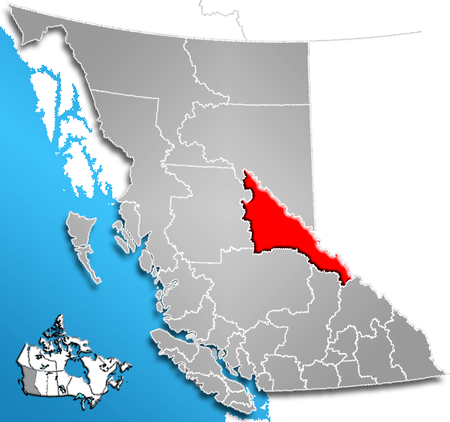
The Regional District of Fraser-Fort George (RDFFG) is a regional district located in the Central Interior of British Columbia. It is bounded by the Alberta border to the east, the Columbia-Shuswap and Thompson-Nicola Regional Districts to the south/southeast, Cariboo Regional District to the southwest, the Regional District of Bulkley-Nechako to the west, and the Peace River Regional District to the north/northeast. As of the Canada 2011 Census, the Regional District had a population of 91,879, and a land area of 51,083.73 km² (19,723.54 sq mi). The offices of the Regional District are located at Prince George.
Communities
Cities
District Municipality
Villages
Regional District Electoral Areas
- Fraser-Fort George A - Salmon River & Lakes
- Fraser-Fort George C - Chilako River-Nechako
- Fraser-Fort George D - Tabor Lake-Stone Creek
- Fraser-Fort George E - Woodpecker-Hixon
- Fraser-Fort George F - Willow River-Upper Fraser
- Fraser-Fort George G - Crooked River-Parsnip
- Fraser-Fort George H - Robson Valley-Canoe
Indian Reserves
NB Indian Reserves are not part of municipal or regional district governance and are outside the regional district's jurisdiction, and also counted separately in the census figures.
- Fort George (Shelley) Indian Reserve No. 2
- McLeod Lake Indian Reserve No. 1
- Parsnip Indian Reserve No. 5
Demographics
(Statistics Canada, 2011)
- Population: 91,879 (39,237 private dwellings)
References
External links
| Subdivisions |  | |
|---|---|---|
| Communities | ||
| Metro areas and agglomerations | ||
| Regional districts |
| |
| ||
Coordinates: 53°54′36″N 122°46′12″W / 53.91000°N 122.77000°W