Aborlan
| Aborlan | |
|---|---|
| Municipality | |
| Municipality of Aborlan | |
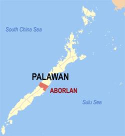 Map of Palawan with Aborlan highlighted | |
.svg.png) Aborlan Location within the Philippines | |
| Coordinates: 9°26′N 118°33′E / 9.43°N 118.55°ECoordinates: 9°26′N 118°33′E / 9.43°N 118.55°E | |
| Country |
|
| Region | Mimaropa (Region IV-B) |
| Province | Palawan |
| District | 3rd district |
| Founded | June 28, 1949 |
| Barangays | 19 (see Barangays) |
| Government [1] | |
| • Type | Sangguniang Bayan |
| • Mayor | Jamie M. Ortega |
| • Electorate | 22,231 voters (2016) |
| Area [2] | |
| • Total | 807.33 km2 (311.71 sq mi) |
| Population (2015 census)[3] | |
| • Total | 35,091 |
| • Density | 43/km2 (110/sq mi) |
| Time zone | UTC+8 (PST) |
| ZIP code | 5302 |
| PSGC | 175301000 |
| IDD : area code | +63 (0)48 |
| Climate type | Tropical climate |
| Income class | 1st municipal income class |
| Revenue (₱) | 173,339,006.79 (2016) |
| Native languages |
Aborlan Tagbanwa language Palawano language Tagalog |
Aborlan, officially the Municipality of Aborlan, is a 1st class municipality in the province of Palawan, Philippines. According to the 2015 census, it has a population of 35,091 people.[3]
It lies in a vast plain between the Sulu Sea and the mountains. It is located 69 kilometres (43 mi) south of Puerto Princesa City.
Aborlan was made into a regular municipality on June 28, 1949, by virtue of Executive Order No. 232.[4] In 1951, it lost the barrios of Berong and Alfonso XII when these were transferred to the then newly created town of Quezon.[5]
It is the only town in the province with an agricultural college, now called the Western Philippines University. It was founded in 1910.[4]
Barangays
Aborlan is politically subdivided into 19 barangays.
- Apo-Aporawan
- Apoc-apoc
- Aporawan
- Barake
- Cabigaan
- Gogognan
- Iraan
- Isaub
- Jose Rizal
- Mabini
- Magbabadil
- Plaridel
- Ramon Magsaysay
- Sagpangan
- San Juan
- Tagpait
- Tigman
- Poblacion
- Culandanum
Demographics
| Population census of Aborlan | ||||||||||||||||||||||||||||||||||||||||||||||
|---|---|---|---|---|---|---|---|---|---|---|---|---|---|---|---|---|---|---|---|---|---|---|---|---|---|---|---|---|---|---|---|---|---|---|---|---|---|---|---|---|---|---|---|---|---|---|
|
| |||||||||||||||||||||||||||||||||||||||||||||
| Source: Philippine Statistics Authority[3] [6] [7] [8] | ||||||||||||||||||||||||||||||||||||||||||||||
In the 2015 census, the population of Aborlan was 35,091 people,[3] with a density of 43 inhabitants per square kilometre or 110 inhabitants per square mile.
References
- ↑ "Municipality". Quezon City, Philippines: Department of the Interior and Local Government. Retrieved 31 May 2013.
- ↑ "Province: Palawan". PSGC Interactive. Quezon City, Philippines: Philippine Statistics Authority. Retrieved 12 November 2016.
- 1 2 3 4 Census of Population (2015). "Region IV-B (Mimaropa)". Total Population by Province, City, Municipality and Barangay. PSA. Retrieved 20 June 2016.
- 1 2 "Aborlan" (PDF). Provincial Government of Palawan. Archived from the original (PDF) on 21 October 2013. Retrieved 22 November 2012.
- ↑ "An act to create the municipality of Quezon in the province of Palawan". LawPH.com. Archived from the original on 2012-07-10. Retrieved 2011-04-09.
- ↑ Census of Population and Housing (2010). "Region IV-B (Mimaropa)". Total Population by Province, City, Municipality and Barangay. NSO. Retrieved 29 June 2016.
- ↑ Censuses of Population (1903–2007). "Region IV-B (Mimaropa)". Table 1. Population Enumerated in Various Censuses by Province/Highly Urbanized City: 1903 to 2007. NSO.
- ↑ "Province of Palawan". Municipality Population Data. Local Water Utilities Administration Research Division. Retrieved 17 December 2016.
External links
- Philippine Standard Geographic Code
- Philippine Census Information
- Local Governance Performance Management System
- Aborlan Palawan Photo Gallery
Places adjacent to Aborlan | |
|---|---|
Puerto Princesa (capital) | |
| Municipalities | |
| Highly urbanized city |
|