847 Damascus earthquake
 Damascus Antioch Mosul→ | |
| Local date | 24 November 847 |
|---|---|
| Magnitude | 7.3 Mw[1] |
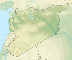
| Epicenter |
34°24′N 36°18′E / 34.4°N 36.3°ECoordinates: 34°24′N 36°18′E / 34.4°N 36.3°E [2] |
| Areas affected | Bilad al-Sham, Abbasid Caliphate (modern Lebanon and Syria) |
| Max. intensity | VI (Strong) [2] |
| Casualties | 20,000 |
The 847 Damascus earthquake occurred (probably on 24 November) in AD 847. Recent scholarship suggests that the earthquake was part of a multiple earthquake stretching from Damascus to the south, to Antioch in the north and to Mosul in the east.[2] There were an estimated 20,000 casualties in Antioch according to the 13th-century historian and writer Al-Dhahabi, and 50,000 in Mosul. It is thought to be one of the most powerful earthquakes along the Dead Sea Transform.[1]

Tectonic setting
The northern Levant lies across the Dead Sea Transform (DST), the mainly strike-slip boundary between the Arabian Plate and the African Plate. In Lebanon the DST has a SW-NE trend that has caused transpression and the formation of the Mount Lebanon range and the Anti-Lebanon range. The main fault strand is the Yammouneh Fault, which has been the location of several major earthquakes, such as the 1202 Syria earthquake and the Near East earthquakes of 1759.[3] The 847 earthquake has also been linked to movement on this fault.[2][4]
Other earthquakes in 847 A.D.
A number of other towns and cities in the Middle East also suffered major destruction in 847 A.D., probably on the same day (24 November).[2] The earthquake in Antioch may have been the same one which destroyed much of Damascus, Syria on 24 November 847. The Damascus earthquake began around dawn, lasting until at least midday; part of the Umayyad (Great) Mosque was destroyed and its minaret fell down. Bridges and houses collapsed, and huge stones were displaced. Other towns near Damascus were destroyed including Darayya.[5]
There was destruction in towns in Homs (Syria), in Lebanon, and also in the region of Al-Jazira, Mesopotamia.[2] There was also a large earthquake in Mosul (now in Iraq), in which up to 50,000 people were killed.[6]
See also
References
- 1 2 Grünthal G.; Hakimhashemi A.; Schelle H.; Bosse C.; Wahlström R. (2009). "The long-term temporal behaviour of the seismicity of the Dead Sea Fault Zone and its implication for time-dependent seismic hazard assessments". Scientific Technical Report STR09/09. Deutsches GeoForschungsZentrum GFZ. p. 18. Retrieved February 16, 2013.
- 1 2 3 4 5 6 Sbeinati, Mohamed Reda; Darawcheh, Ryad; Mouty, Mikhail (June 2005). "The historical earthquakes of Syria: an analysis of large and moderate earthquakes from 1365 B.C. to 1900 A.D." (PDF). Annals of Geophysics. 48 (3): 365. Retrieved 29 January 2012.
- ↑ Daëron, M.; Klinger, Y.; Tapponier, P.; Elias, A.; Jacques, E.; Sursock, A. (2005). "Sources of the large A.D. 1202 and 1759 Near East earthquakes" (PDF). Geology. 33 (7): 529–532. Bibcode:2005Geo....33..529D. doi:10.1130/G21352.1.
- ↑ Jaafar A. (2008). "GPS Measurements of Present day crustal deformation within the Lebanese Restraining Bend along the Dead Sea Transform" (PDF). MSc thesis. p. 7. Retrieved February 17, 2013.
- ↑ Elnashai, Amr S.; El-Khoury, Ramy (2004). Earthquake hazard in Lebanon (illustrated ed.). London: Imperial College Press, 2004. p. 22. ISBN 978-1-86094-461-1.
- ↑ Search page,"Catalog of damaging earthquakes in the world (through 2009)". Retrieved 29 January 2012.