2009 Guerrero earthquake
 | |
| UTC time | ?? |
|---|---|
| ISC event | |
| USGS-ANSS | |
| Date * | 27 April 2009 |
| Local date | |
| Local time | |
| Magnitude | 5.8 Mw |
| Depth | 35 kilometres (22 mi) |
| Epicenter | 17°04′N 99°23′W / 17.07°N 99.39°WCoordinates: 17°04′N 99°23′W / 17.07°N 99.39°W |
| Areas affected | Mexico |
| Max. intensity | V (Moderate) |
| Casualties | 2 |
| * Deprecated | See documentation. |
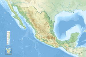
The 2009 Guerrero earthquake struck southeast of Chilpancingo, Guerrero with a moment magnitude of 5.8 on 27 April.[1] The earthquake was at a depth of 30 miles and was felt in other parts of the Mexico's central region, including Mexico City and the states of Hidalgo, Morelos, Puebla and Veracruz. Two women died of heart attacks in the municipality of Acapulco, Guerrero, where four homes also collapsed.[2][3]
See also
References
- ↑ USGS, M5.8 - Guerrero, Mexico, United States Geological Survey
- ↑ http://www.eluniversal.com.mx/notas/594089.html
- ↑ Mexico: Earthquake, Deseret News wire services, April 27, 2009
External links
- The International Seismological Centre has a bibliography and/or authoritative data for this event.
This article is issued from
Wikipedia.
The text is licensed under Creative Commons - Attribution - Sharealike.
Additional terms may apply for the media files.