2009 Honduras earthquake
 Belmopan Tegucigalpa | |
| UTC time | ?? |
|---|---|
| ISC event | |
| USGS-ANSS | |
| Date * | May 28, 2009 |
| Origin time * | 08:24:45 UTC |
| Local date | |
| Local time | |
| Magnitude | 7.3 Mw |
| Depth | 10 kilometres (6 mi) |
| Epicenter | 16°44′N 86°13′W / 16.73°N 86.22°WCoordinates: 16°44′N 86°13′W / 16.73°N 86.22°W |
| Type | Strike-slip |
| Areas affected |
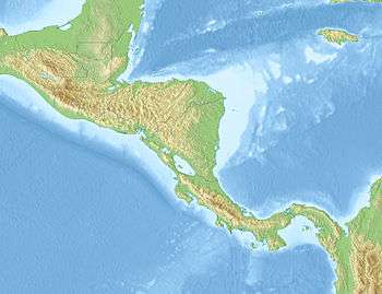
Honduras Guatemala Belize |
| Max. intensity | VII (Very strong) |
| Casualties | 7 killed |
| * Deprecated | See documentation. |
The 2009 Honduras earthquake occurred on May 28 at 02:24:45 AM local time with a moment magnitude of 7.3 and a maximum Mercalli intensity of VII (Very strong). The epicenter was located in the Caribbean Sea, 64 kilometres (40 mi) northeast of the island of Roatán, 19 miles northeast of Port Royal, Isla de Bahias, 15 miles northwest of Isla Barbaretta, and 130 kilometres (81 mi) north-northeast of La Ceiba.[1] Three aftershocks followed the earthquake within magnitude 4 range.[2]
Earthquake
The earthquake occurred at a depth of around 10 kilometres (6.2 mi) in a transform fault zone known as the Swan Islands Transform Fault in the Cayman Trench. It was a result of left-lateral strike slip faulting. The Cayman Trench forms the tectonic boundary between the North American Plate and the Caribbean Plate, and continues onshore as the Motagua Fault and the Chixoy-Polochic Fault.
The 30-second offshore quake was felt in Guatemala, El Salvador, Belize, and as far as Cancún in Mexico. It was also felt in parts of Nicaragua, Costa Rica, Panama, Colombia, Cuba, Jamaica, and the Cayman Islands.[1][3][4]
Damage
The earthquake caused at least seven fatalities, 40 injuries, and more than 130 collapsed or damaged buildings across northern Honduras.[1] Two important bridges and a number of levees and port terminals were also seriously damaged.[5] In the Guatemalan department of Izabal, 35 buildings were destroyed and 80 were damaged. In Belize, at least 5 buildings were also destroyed and 25 were damaged. In Roatan, one home was damaged and one injury occurred.[1][6] The earthquake caused an estimated $37 million worth of damage, and electricity, Internet and telephone connections were cut throughout the majority of Honduras.[7]
A tsunami watch was put into effect by the Pacific Tsunami Warning Center for Honduras, Guatemala, and Belize and was discontinued 90 minutes after the earthquake occurred.[3]
References
- 1 2 3 4 USGS. "Magnitude 7.3 - OFFSHORE HONDURAS". Archived from the original on 31 May 2009. Retrieved 28 May 2009.
- ↑ "7.3-Magnitude Quake off the Honduras Coast : Natural Hazards". earthobservatory.nasa.gov. 2009-05-28. Retrieved 2016-02-09.
- 1 2 BBC (2009-05-28). "Major quake strikes off Honduras". BBC News. Archived from the original on 23 January 2010. Retrieved 2010-01-01.
- ↑ Cuevas, Freddy. "7.1 earthquake topples homes, kills 6 in Honduras". Miami Herald. Retrieved 2009-05-30.
- ↑ "The M7.3 Honduras Earthquake of May 28, 2009. EERI Special Earthquake Report — August 2009" (PDF). EERI. Retrieved 2009-10-07.
- ↑ La Tribuna. "Seísmo destruyó 35 viviendas y dañó otras 80 en el Caribe guatemalteco". Retrieved 2009-05-29.
- ↑ "7.1 Earthquake Hits Honduras, Belize". The Huffington Post. Retrieved 2016-02-15.
External links
| Wikinews has related news: Major 7.3 magnitude earthquake hits Honduras |
- The Magnitude 7.3 Honduras Earthquake May 28, 2009 – ExploringEarth
- "Poster of the Honduras Earthquake of 28 May 2009 - Magnitude 7.3". earthquake.usgs.gov. Retrieved 2016-02-29.
- The International Seismological Centre has a bibliography and/or authoritative data for this event.