'Amanave
| 'Amanave | |
|---|---|
| Village | |
 'Amanave | |
| Coordinates: 14°19′48″S 170°49′46″W / 14.33000°S 170.82944°WCoordinates: 14°19′48″S 170°49′46″W / 14.33000°S 170.82944°W | |
| Country |
|
| Territory |
|
| Area | |
| • Total | 0.342 sq mi (0.885 km2) |
| Population (2000) | |
| • Total | 287 |
| • Density | 840/sq mi (320/km2) |
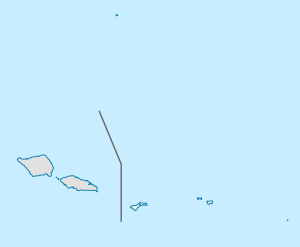
'Amanave is a village on the coast of Tutuila Island, American Samoa. It is located close to the island's western tip, Cape Taputapu, and to the south of the village of Poloa.
‘Amanave was severely damaged by the 2009 tsunami. However, of a population of about 500 residents, no deaths were recorded. When the tsunami approached, emergency information was sent by radio and a bell rang in the village. After the tsunami, some residents followed the advice of the Federal Emergency Management Agency (FEMA) and moved into houses on a higher elevation.[1]
Its mayor Aveao Faausu Fonoti received the Community Resiliency Leadership Award at the National Disaster Preparedness Training Center in 2010, due to his handling of the 2009 tsunami. The Executive Director of the center told reporters: "In spite of the fact that something like eighty percent of his village was destroyed, there were no casualties. And based on our research we found that many lives were saved because of his bravery, his leadership, his knowledge."[2]
Landmarks
- Cape Taputapu National Natural Landmark
- Amanave Village Marine Protected Area
- Palagi Beach
References
- ↑ Esteban, Miguel and Hiroshi Takagi (2015). Handbook of Coastal Disaster Mitigation for Engineers and Planners. Butterworth-Heinemann. Page 81. ISBN 9780128012703.
- ↑ http://www.radionz.co.nz/international/pacific-news/188605/american-samoa-village-mayor-to-receive-leadership-award
| Topics | |
|---|---|
| Geography | |
| Politics | |
| Economy | |
| Culture | |
| Districts | |
| Islands | |
| Villages |
|