Futiga
| Futiga Futiama | |
|---|---|
| Village | |
 Futiga | |
| Coordinates: 14°21′12″S 170°45′15″W / 14.35333°S 170.75417°WCoordinates: 14°21′12″S 170°45′15″W / 14.35333°S 170.75417°W | |
| Country |
|
| Territory |
|
| Area | |
| • Total | 1.67 sq mi (4.33 km2) |
| Population (2012) | |
| • Total | 498 |
| • Density | 300/sq mi (120/km2) |
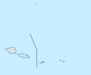
Futiga (pronounced "Futinga") is a village in the southwest of Tutuila Island, American Samoa. It is located inland, seven miles southwest of Pago Pago, between the villages of 'Ili'ili and Leone.
Futiga is home of the Fagatele Bay Site, an archeological site which was added to the U.S. National Register of Historic Places in 1997.
Fagatele Bay Trail is a 1-mile roundtrip hiking trail to the Fagatele Bay National Marine Sactuary from the village of Futiga. Fagatele Bay National Marine Sanctuary is a protected nature area home to animals such as turtles and sharks. When traveling west on Route 1 to Futiga, turn left just before US Mart. Follow the road past the landfill until you reach a locked gate. The trailhead is located here.[1]
Fagatele Bay National Marine Sanctuary
Access to Fagatele Bay National Marine Sanctuary is from the village of Futiga. Fagatele Bay is within National Marine Sanctuary of American Samoa and is one of two designated National Marine Sanctuaries in American Samoa. It is home to various species of animals, including hawksbill and green sea turtles. The nearest village is Taputimu, but the only access to the sanctuary is from Futiga.[2]
References
- ↑ https://www.nps.gov/npsa/planyourvisit/upload/Day_Hikes_SB.pdf
- ↑ World Conservation Monitoring Centre (1991). IUCN Directory of Protected Areas in Oceania. International Union for Conservation of Nature and Natural Resources. Pages 293-294. ISBN 9782831700694.