ʻŌʻōkala, Hawaii
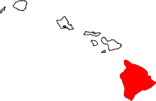
ʻŌʻōkala (also spelled Ookala) is an unincorporated community on the island of Hawaii in Hawaii County, Hawaii, United States. It lies along Hawaii Route 19 north of Hilo, the county seat of Hawaii County.[1] Its elevation is 371 feet (113 m), and it is located at 20°1′3″N 155°17′14″W / 20.01750°N 155.28722°WCoordinates: 20°1′3″N 155°17′14″W / 20.01750°N 155.28722°W (20.0175000, -155.2872222). Because the community has borne multiple names, the Board on Geographic Names officially designated it "ʻŌʻōkala" in 2000.[2] Although it is unincorporated, it has a post office, with the ZIP code of 96774.[3]
The community was in the news after the Hawaii Department of Health warned that the gulch near the community had contaminated water.[4] This was the result of waste from a nearby dairy drained into the water.[5]
References
- ↑ Rand McNally. The Road Atlas '08. Chicago: Rand McNally, 2008, p. 30.
- ↑ Geographic Names Information System Feature Detail Report, Geographic Names Information System, 2003-09-30. Accessed 2008-04-08.
- ↑ Zip Code Lookup
- ↑ http://bigislandnow.com/2018/04/13/warning-contaminated-water-in-gulch-near-ʻoʻokala/
- ↑ http://www.bigislandvideonews.com/2018/04/13/warning-issued-in-ookala-after-dairys-waste-spill-into-gulch/