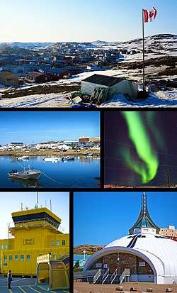
Iqaluit
Iqaluit (/iˈkæluɪt/ ee-KAL-oo-it; Inuktitut: ᐃᖃᓗᐃᑦ [iqaluit] (meaning "place of fish");[9] French: [ikalɥi(t)]) is the capital of the Canadian territory of Nunavut, its largest community, and its only city. It was known as Frobisher Bay from 1942 to 1987, after the large bay on the coast of which the city is situated. In 1987, its traditional Inuktitut name was restored.
Iqaluit ᐃᖃᓗᐃᑦ Frobisher Bay | |
|---|---|
Territorial capital city | |
| City of Iqaluit | |
 | |
 Flag  Seal | |
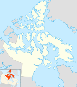 Iqaluit Location of Iqaluit  Iqaluit Iqaluit (Canada) | |
| Coordinates: 63°44′55″N 068°31′11″W | |
| Country | Canada |
| Territory | Nunavut |
| Region | Qikiqtaaluk |
| Electoral districts | Iqaluit-Manirajak Iqaluit-Niaqunnguu Iqaluit-Sinaa Iqaluit-Tasiluk |
| Settled | 1942 |
| Village status | 1974 |
| Town status | 1980 |
| City status | 19 April 2001 |
| Founded by | Nakasuk |
| Government | |
| • Type | Iqaluit City Council |
| • Mayor | Kenny Bell[6] |
| • MLAs | Adam Arreak-Lightstone Pat Angnakak Elisapee Sheutiapik George Hickes |
| Area | |
| • Total | 52.50 km2 (20.27 sq mi) |
| • Population Centre | 9.55 km2 (3.69 sq mi) |
| Population | |
| • Total | 7,740 |
| • Density | 150/km2 (380/sq mi) |
| • Population Centre | 7,082 |
| • Population Centre density | 740/km2 (1,900/sq mi) |
| Demonym(s) | Iqalummiut |
| Time zone | UTC−05:00 (EST) |
| • Summer (DST) | UTC−04:00 (EDT) |
| Canadian Postal code | X0A 0H0, X0A 1H0 |
| Area code(s) | 867 |
| Telephone Exchanges | 222 (mobile), 975, 979 |
| NTS Map | 025N10 |
| GNBC Code | OATRP |
| Website | iqaluit |
In 1999, Iqaluit was designated the capital of Nunavut after the division of the Northwest Territories into two separate territories. Before this event, Iqaluit was a small city and not well known outside the Canadian Arctic or Canada, with population and economic growth highly limited. This is due to the city's isolation and heavy dependence on expensively imported supplies, as the city, like the rest of Nunavut, has no road, rail, or even ship connections for part of the year to the rest of Canada. The city has a polar climate, influenced by the cold deep waters of the Labrador Current just off Baffin Island; this makes the city of Iqaluit cold, although it is well south of the Arctic Circle.
As of the 2016 census, the population was 7,740 (Population Centre: 7,082[8]), an increase of 15.5 percent from the 2011 census. Iqaluit has the lowest population of any capital city in Canada.[7] Inhabitants of Iqaluit are called Iqalummiut (singular: Iqalummiuq).
History
Iqaluit has been a traditional fishing location used by Inuit for thousands of years. Their name, Iqaluit, means place of many fish.[10]
World War II resulted in an influx of non-Inuit to the area, as Canada and the United States cooperated in the defence of Europe. In 1942, the United States built an American air base there, on a long-term lease from the Canadian government, in order to provide a stop-over and refuelling site for the short-range aircraft being ferried to Europe to support the war effort. Iqaluit's first permanent resident was Nakasuk, an Inuk guide who helped US Army Air Force planners to choose a site with a large flat area suitable for a landing strip. The wartime airstrip was known as Crystal Two and was part of the Crimson Route.
It had long been used as a campsite and fishing spot by the Inuit, who called it Iqaluit – "place of many fish" in Inuktitut. The US and Canadian authorities named it Frobisher Bay, after the name of the body of water it borders. For the history of the air base, see Frobisher Bay Air Base.
In 1949, after the war, the Hudson's Bay Company moved its south Baffin operations to the neighbouring valley of Niaqunngut, officially called Apex, in order to use the airfield. In the mid-1950s, the population of Frobisher Bay increased rapidly during the construction of the Distant Early Warning Line (DEW line, a system of defensive radar stations—see North American Aerospace Defense Command (NORAD)). Hundreds of mostly non-Inuit construction workers, military personnel, and administrative staff moved into the community, and several hundred Inuit followed, to take advantage of the access to jobs and medical care provided by the base operations. By 1957, 489 of the town's 1,200 residents were reported to be Inuit. After 1959, the Canadian government established permanent services at Frobisher Bay, including full-time doctors, a school, and social services. The Inuit population grew rapidly in response, as the government encouraged Inuit to settle permanently in communities supported by government services.
Naval Radio Station (NRS) Frobisher Bay, callsign CFI, was established in July 1954 as a result of the closure of NRS Chimo, Quebec. Station CFI was part of the Supplementary Radio network. Because of its remoteness and size, it was very expensive to operate. Advancing technology eventually forced the closure of CFI in 1967.
The American military left Iqaluit in 1963, as their development of the intercontinental ballistic missiles (ICBM) diminished the strategic value of the DEW line and Arctic airbases. Canada continued to operate an administrative and logistical centre for much of the eastern Arctic at Frobisher Bay. In 1964, the first local elections were held for a community council, and in 1979 for the first mayor. The founding of the Gordon Robertson Educational Centre, now Inuksuk High School, in the early 1970s at Iqaluit confirmed the government's commitment to the community as an administrative centre. At the time of its founding, this was the sole high school operating in what constituted more than one-seventh of Canadian territory.
On 1 January 1987, the name of the municipality was changed from "Frobisher Bay" to "Iqaluit" – aligning official usage with the name that the Inuit population had always used. (Many documents were made that referred to Iqaluit as Frobisher Bay for several years after 1987). In December 1995, Iqaluit was selected by a territory-wide referendum to serve as Nunavut's future capital; it was chosen over Rankin Inlet. On 19 April 2001, it was designated a city.
Canada designated Iqaluit as the host city for the 2010 meeting of the G7 finance ministers, held on 5–6 February.[11] The requirements for the international meeting strained the northern communications technology infrastructure and required supplemental investment.[12]
Timeline
- 1576 – Englishman Martin Frobisher sails into Frobisher Bay believing he has found the westward route to China. He held the first Anglican/Episcopalian church service in North America here.
- 1861 – Charles Francis Hall, an American, camps at the Sylvia Grinnell River and explores the waters of Koojesse Inlet, which he names after his Inuit guide.
- 1942 – U.S. Army Air Forces selects this area as the site of a major air base to support war efforts in England and Europe.
- 1949 – The Hudson Bay Company (HBC) moves its trading post from Ward Inlet to nearby Apex.
- 1955 – Frobisher Bay becomes the centre for U.S./Canada DEW Line construction operations. Many Inuit continue to settle here for local services.
- 1958 – Telephone exchange service established by Bell Canada.
- 1963 – US military move out of Iqaluit, resulting in some population loss.
- 1964 – First community council formed; population of Frobisher Bay is 900.
- 1970 – Frobisher Bay officially recognized as a Settlement.
- 1974 – Settlement of Frobisher Bay gains village status.
- 1976 – Inuit present a proposal for a separate Nunavut Territory to the Federal government.
- 1979 – First mayor elected.
- 1980 – Frobisher Bay designated as a town.
- 1982 – Government of Canada agrees in principle to the creation of Nunavut.
- 1987 – Frobisher Bay is renamed as Iqaluit, its original Inuktitut name meaning "place of (many) fish".
- 1993 – The Nunavut Land Claims Agreement is signed in Iqaluit.
- 1995 – Nunavut residents select Iqaluit as capital of the new territory[13]
- 1 April 1999 – The Territory of Nunavut is established.
- 19 April 2001 – Iqaluit is chartered as a city.
- 2002 – Iqaluit, along with Nuuk, Greenland, co-host the first jointly hosted Arctic Winter Games; the Arctic Winter Games Arena was constructed in Iqaluit for the event.
- 5 February 2010 – Canada designates Iqaluit to host the finance meeting as part of the 2010 G7 summit.[14]
Geography
.jpg)
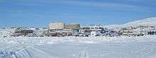
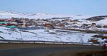
Iqaluit is located in the Everett Mountains rising from Koojesse (Kuujussi) Inlet, an inlet of Frobisher Bay, on the southeast part of Baffin Island. It is well to the east of Nunavut's mainland, and northeast of Hudson Bay.
Climate
.jpg)
Iqaluit has a tundra climate (Köppen: ET) typical of the Arctic region, although it is well outside the Arctic Circle. The city features very long, cold winters and brief summers that are too cool to permit the growth of trees. Although it is north of the tree line, there are still shrubs, which are woody plants. These include the Arctic willow (Salix arctica), which is hard to recognize as a tree because of its low height. The permafrost does not allow the taproot to get deeper than 150 mm (6 in), disallowing vertical growth. The Arctic willow may be up to around 7.6 m (25 ft) horizontally, but only 150 mm (6 in) tall. Average monthly temperatures are below freezing for eight months of the year.[15] Iqaluit averages just over 400 mm (16 in) of precipitation annually, much wetter than many other localities in the Arctic Archipelago, with the summer being the wettest season. Temperatures of the winter months are comparable to other northern communities further west on the continent such as Yellowknife and to some extent even Fairbanks, even though Iqaluit is a few degrees colder than the latter. Summer temperatures are, however, much colder due to its easterly maritime position affected by the waters of the cold Baffin Island Current. This means that the tree line is much further south in the eastern part of Canada, being as southbound, in spite of low elevation, as northern Labrador.[16]
In comparison, the climate of Iqaluit is severely cold compared to Gulf Stream locations on the same latitude. For example, the Norwegian city of Trondheim has an annual mean temperature that is 16 °C (29 °F) milder.
The highest temperature ever recorded in Iqaluit was 26.7 °C (80 °F) on 21 July 2008.[17] The lowest temperature ever recorded was −45.6 °C (−50 °F) on 10 February 1967.[18]
| Climate data for Iqaluit Airport, 1981–2010 normals, extremes 1946–present | |||||||||||||
|---|---|---|---|---|---|---|---|---|---|---|---|---|---|
| Month | Jan | Feb | Mar | Apr | May | Jun | Jul | Aug | Sep | Oct | Nov | Dec | Year |
| Record high humidex | 3.3 | 5.2 | 4.3 | 5.1 | 13.3 | 21.7 | 27.8 | 27.6 | 18.8 | 8.6 | 4.8 | 3.4 | 27.8 |
| Record high °C (°F) | 3.9 (39.0) |
5.7 (42.3) |
4.2 (39.6) |
7.2 (45.0) |
13.3 (55.9) |
22.7 (72.9) |
26.7 (80.1) |
25.5 (77.9) |
18.3 (64.9) |
9.1 (48.4) |
5.6 (42.1) |
3.7 (38.7) |
26.7 (80.1) |
| Average high °C (°F) | −22.8 (−9.0) |
−23.3 (−9.9) |
−18.3 (−0.9) |
−9.4 (15.1) |
−1.2 (29.8) |
6.8 (44.2) |
12.3 (54.1) |
10.5 (50.9) |
5.2 (41.4) |
−1.0 (30.2) |
−8.3 (17.1) |
−17.0 (1.4) |
−5.6 (21.9) |
| Daily mean °C (°F) | −26.9 (−16.4) |
−27.5 (−17.5) |
−23.2 (−9.8) |
−14.2 (6.4) |
−4.4 (24.1) |
3.6 (38.5) |
8.2 (46.8) |
7.1 (44.8) |
2.6 (36.7) |
−3.7 (25.3) |
−12.0 (10.4) |
−21.3 (−6.3) |
−9.3 (15.3) |
| Average low °C (°F) | −30.9 (−23.6) |
−31.7 (−25.1) |
−28.1 (−18.6) |
−18.9 (−2.0) |
−7.6 (18.3) |
0.5 (32.9) |
4.1 (39.4) |
3.6 (38.5) |
−0.1 (31.8) |
−6.4 (20.5) |
−15.8 (3.6) |
−25.5 (−13.9) |
−13.1 (8.4) |
| Record low °C (°F) | −45.0 (−49.0) |
−45.6 (−50.1) |
−44.7 (−48.5) |
−34.2 (−29.6) |
−26.1 (−15.0) |
−10.2 (13.6) |
−2.8 (27.0) |
−2.5 (27.5) |
−12.8 (9.0) |
−27.1 (−16.8) |
−36.2 (−33.2) |
−43.4 (−46.1) |
−45.6 (−50.1) |
| Record low wind chill | −64.0 | −65.6 | −62.1 | −53.1 | −36.0 | −18.8 | −7.2 | −8.6 | −18.6 | −42.9 | −56.8 | −60.1 | −65.6 |
| Average precipitation mm (inches) | 19.7 (0.78) |
18.7 (0.74) |
18.7 (0.74) |
27.5 (1.08) |
29.2 (1.15) |
33.0 (1.30) |
51.9 (2.04) |
69.5 (2.74) |
55.2 (2.17) |
33.3 (1.31) |
27.2 (1.07) |
19.9 (0.78) |
403.7 (15.89) |
| Average rainfall mm (inches) | 0.0 (0.0) |
0.0 (0.0) |
0.0 (0.0) |
0.2 (0.01) |
3.1 (0.12) |
23.8 (0.94) |
51.9 (2.04) |
68.6 (2.70) |
42.2 (1.66) |
6.8 (0.27) |
0.6 (0.02) |
0.0 (0.0) |
197.2 (7.76) |
| Average snowfall cm (inches) | 21.7 (8.5) |
21.0 (8.3) |
21.6 (8.5) |
31.5 (12.4) |
27.6 (10.9) |
9.3 (3.7) |
0.0 (0.0) |
0.9 (0.4) |
13.2 (5.2) |
29.4 (11.6) |
29.7 (11.7) |
23.4 (9.2) |
229.3 (90.3) |
| Average precipitation days (≥ 0.2 mm) | 11.4 | 11.1 | 11.8 | 13.1 | 12.0 | 10.9 | 12.5 | 15.3 | 15.0 | 14.0 | 13.2 | 12.2 | 152.2 |
| Average rainy days (≥ 0.2 mm) | 0.0 | 0.1 | 0.0 | 0.3 | 1.4 | 7.4 | 12.7 | 16.7 | 10.6 | 2.2 | 0.3 | 0.0 | 51.6 |
| Average snowy days (≥ 0.2 cm) | 12.2 | 11.6 | 12.7 | 13.4 | 12.0 | 3.9 | 0.1 | 0.5 | 7.2 | 13.7 | 13.8 | 12.3 | 113.5 |
| Average relative humidity (%) | 65.3 | 64.6 | 65.4 | 72.8 | 76.4 | 72.6 | 69.4 | 72.6 | 75.6 | 78.1 | 76.6 | 71.5 | 71.7 |
| Mean monthly sunshine hours | 32.4 | 94.0 | 172.2 | 216.5 | 180.5 | 200.2 | 236.8 | 156.8 | 87.9 | 51.4 | 35.6 | 12.6 | 1,476.8 |
| Percent possible sunshine | 18.5 | 39.0 | 47.4 | 48.2 | 31.9 | 32.5 | 39.3 | 31.0 | 22.4 | 16.8 | 17.7 | 8.9 | 29.5 |
| Average ultraviolet index | 0 | 0 | 1 | 2 | 4 | 4 | 4 | 3 | 2 | 1 | 0 | 0 | 2 |
| Source: Environment Canada[17][18][19][20][21][22] and Weather Atlas[23] | |||||||||||||
Cityscape
Neighbourhoods
- Downtown (central)
- Happy Valley (north)
- Lake Subdivision (north) – residential area
- Lower Base (south)
- Lower Iqaluit (southeast)
- North 40 (northwest) – located on the north side of the airport
- Plateau Subdivision (northwest) – residential area
- Road To Nowhere (north)
- Tundra Valley (west)
- Tundra Ridge (west) – home to two of the city's schools and youth centre
- West 40 (southwest) – commercial area
Suburbs
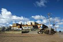
Apex, officially and functionally part of the City of Iqaluit, is a small community about 5 km (3.1 mi) southeast (63°43′47″N 068°26′48″W) from Iqaluit's centre and is known in Inuktitut as Niaqunngut. It is located on a small peninsula separating Koojesse Inlet from Tarr Inlet. There is a women's shelter, a church, a primary school (Nanook Elementary School), a design shop and a bed-and-breakfast in the community. Apex was where most Inuit lived when Iqaluit was a military site, and as such the suburb was off-limits to anyone not working at the base.
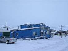
Architecture and attractions
Much of Iqaluit's architecture is functional – designed to minimize material costs, while retaining heat and withstanding the climate. Early architecture runs from the 1950s military barracks of the original DEW line installation, through the 1970s white hyper-modernist fibreglass block of the Nakasuk School and Municipal Offices and Arena, to the lines of the steel-reinforced concrete high-rise complex on the hill above it. A number of older Hudson's Bay Company and early 1950s buildings have been retained and restored in Apex (the former nursing station has been revived as the Rannva Bed and Breakfast, the HBC buildings as an art gallery). The newer buildings are more colourful and diverse, and closer to the norms of southern architecture.
The principal exception is the Nunavut Legislative Assembly Building, which is remarkable for its colourful interior, adorned with some of the very best in Inuit art. A new legislative building is in planning to be developed and built outside the city on the Apex Road.
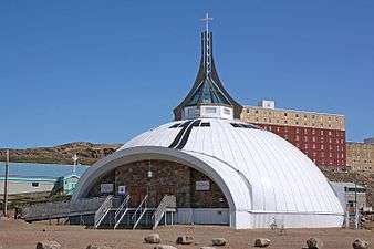
Another distinctive building was St. Jude's Anglican Cathedral, see of the Anglican Diocese of The Arctic, which was a white building shaped like an igloo. The altar was built by the parishioners, under the guidance of Markoosie Peter, a traditional master carpenter. It was shaped like a traditional Inuit sled, and the cross composed of two crossed narwhal tusks. An incident of arson severely affected the Cathedral structure and interior on 5 November 2005,[25] and it was demolished on 1 June 2006. The cathedral is slowly being rebuilt (foundation 2008 superstructure 2010) and fund-raising continues locally and internationally. In December 2010, the exterior of a similarly shaped replacement cathedral was completed, and interior work was planned for 2011 with a potential opening for Christmas 2011. The current building, informally referred to as the Igloo Cathedral, was opened on June 3, 2012. The unique building, in the shape of an igloo, has traditionally been a landmark and tourist attraction in Iqaluit, besides its important spiritual role for Iqalummiut (people of Iqaluit).
On a ridge overlooking the city is the distinctive blue and white Inuksuk High School. The school is made up of four square sections joined together that give a cloverleaf shape when viewed from the air.
The city is also the location of the Nunatta Sunakkutaangit Museum, which houses a large collection of Inuit and Arctic objects. The museum is housed in a restored and extended Hudson's Bay Company building, clad in the HBC signature red and white, transported to Iqaluit from its original site on the Apex Beach.
Just west of Iqaluit is the Sylvia Grinnell Territorial Park Reserve. This park is dominated by the valley of the Sylvia Grinnell River. A small visitor's centre with viewing platform is located on top of a hill overlooking scenic waterfalls, tidal flats and traditional fishing sites.
Nearby on an island near Peterhead Inlet, is the Qaummaarviit Territorial Historic Park. It is a site with a long Inuit history and numerous artifacts have been recovered, including the remains of 11 semi-buried sod houses.
A little farther, across Frobisher Bay, are the Katannilik Territorial Park Reserve and the Soper Heritage River Park forming a park corridor linking Iqaluit along traditional overland travel routes with Kimmirut (formerly Lake Harbour). Frobisher Bay extends for almost 110 kilometres (70 mi) to the east, with moderate hills, glaciers and traditional and summer camp sites, opening into the Davis Straits which divide Nunavut from Greenland.
Iqaluit, like many Nunavut communities, has a volunteer-run annual spring festival. Called Toonik Tyme it involves a combination of traditional Inuit activities combined with more modern events, while the Alianait Music and Arts Festival is held for a week each June 21.
Demographics
| Historical populations | ||
|---|---|---|
| Year | Pop. | ±% |
| 1971 | 2,014 | — |
| 1981 | 2,333 | +15.8% |
| 1991 | 3,552 | +52.3% |
| 1996 | 4,220 | +18.8% |
| 2001 | 5,236 | +24.1% |
| 2006 | 6,184 | +18.1% |
| 2011 | 6,699 | +8.3% |
| 2016 | 7,740 | +15.5% |
The 2016 census reported that there were 7,740, people living in Iqaluit, a 15.5% increase from 2011 census. The land area of the city is 52.50 km2 (20.27 sq mi), therefore a population density of 147.4 inhabitants per square kilometre (382/sq mi). Iqaluit has 3,419 private dwellings, 2,749 of which are occupied by usual residents.[7] The median value of these dwellings is $376,639, quite a bit higher than the national median at $280,552. The average household has about 2.8 people living in it, and the average family has 1.4 children living at home with them. The median (after-tax) household income in Iqaluit is quite high, $98,921, almost double the national rate at $54,089. The median income for an individual in the city, is also high, $60,688. 5.9% of people (over 15 years old) are either divorced or separated, which is quite a bit lower than the national rate at 8.6%. Also, 53.3% of the population is either married or living with a common law partner.
Iqaluit has quite a young population, the median age of the population is more than 10 years younger than the national rate, 30.1 years old compared to 40.6 years old.
Iqaluit has the most Inuit people in both numbers (3,900) and percentages (59.1%), of all Canadian cities with populations greater than 5,000. The racial make up is:[26]
- 59.4% Indigenous; 1.4% First Nations, 1.2% Metis, 56.3% Inuit
- 34.3% White
- 3.0% Black
- 2.2% Southeast Asian; 2.0% Filipino
- 0.9% East Asian; 0.7% Chinese, 0.2% Korean
- 0.9% South Asian
- 0.4% Arab
- 0.3% Latin American
- 0.2% Multiracial; 16.2% with Inuit and Non-Aboriginal mixed [27]
There is no "majority mother tongue" in Iqaluit, as 45.4% reported their mother tongue as being English, and 45.4% also reported their mother tongue as Inuktitut. 97.2% of Iqalummiuts can speak English, however, whereas only 53.1% can speak Inuktitut. French was the mother tongue of 4.8% of the population, which is the same figure of the population who can speak the language. As of 2012, "Pirurvik, Iqaluit’s Inuktitut language training centre, has a new goal: to train instructors from Nunavut communities to teach Inuktitut in different ways and in their own dialects when they return home."[28]
74.9% of the population practise some form of Christianity (Anglican is the most popular at 42.6%), and 22.9% of the population identify as having no religious affiliation. There are other religions practised in the city, just not in large numbers.
For those over the age of 25:
- 75.7% are high school educated (15.9% as their highest level of education)
- 59.8% are post-secondary school educated
- 24.3% have no certificate, diploma or degree
Education
The Qikiqtani School Operations based in Pond Inlet operates five schools in the area. Nanook Elementary School, located in Apex, Nakasuk School and Joamie Ilinniarvik School offer kindergarten to grade 5. Aqsarniit Ilinniarvik School offers grades 6 to 8 and Inuksuk High School offers grades 9 to 12.[29]
The Commission scolaire francophone du Nunavut runs École des Trois-Soleils and offers kindergarten to grade 8.[30]
At the post-secondary level there are two, Nunavut Arctic College (Nunatta Campus) and Akitsiraq Law School.
Infrastructure
Emergency services
Emergency services (fire and ambulance) are provided by city from a single station on Niaqunngusiariaq.[31]
The emergency services fleet consists of:
- Engine 1: Spartan Diamond/Smeal pumper
- Ladder 1: Spartan Metro Star/Smeal 75' aerial
- Command 1: Ford SUV
- Command 2: Ford F250 4×4 pickup
- Medic 1 and 2: Ford F450 Type II ambulances
Iqaluit Airport Emergency Services is responsible for fire services at the airport. Following a fire at the airport in 1998, the Government of Nunavut re-opened the fire station at the airport.[32] Their fleet consists of:
- Waltek C-5500 ARFF
- Oshkosh T3000 ARFF
Policing in Iqaluit, as with the rest of Nunavut is contracted to the Royal Canadian Mounted Police (RCMP) V Division.[33]
Medical services
Qikiqtani General Hospital is the primary care facility in the city. There is also a Family Practice Clinic providing primary care services by Nurse Practitioners. There are two dental clinics in the city.
Sports facilities
Iqaluit features two arenas (AWG and Arnaitok), the Iqaluit Aquaplex, a curling rink, the Timmianut Pikiuqarvik disc golf course, the Frobisher Inn Fitness Centre, a golf course, outdoor basketball courts, soccer nets, seasonal outdoor ice rinks, a shooting range, a skatepark, and more.[34]
Transportation
Iqaluit is the smallest Canadian capital in terms of population, and the only capital that is not connected to other settlements by a highway. Located on an island remote from the Canadian highway system, Iqaluit is generally only accessible by aircraft and, subject to ice conditions, by boat.
.jpg)
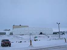
Iqaluit Airport is a modern facility with a runway long enough for most modern jet aircraft. A new, larger passenger terminal building north of the old terminal was completed in 2018.
Canadian North serves Iqaluit from Ottawa, Yellowknife, and several communities in Nunavut. Locally based airlines Air Nunavut, Canadian Helicopters, Nunasi Helicopters, and Unaalik Aviation provide air charters, and Air Nunavut and Kivalliq Air provide MEDIVAC/air ambulance service. Air Canada Jazz provided daily service to Iqaluit from Ottawa in 2010 and 2011, but cancelled service due to rising fuel costs, which prevented the route from being profitable.[35][36]
Iqaluit shared its runway with the Royal Canadian Air Force until the Canadian Forces stopped using Iqaluit as a Forward Operating Location (FOL). The barracks and CF-18 hangars are maintained. The airport was a centre for cold-weather testing of new aircraft, such as the Airbus A380 in February 2006.
Rumours that Iqaluit was an emergency landing site for the Space Shuttle are false.[37]
In the middle of summer, a few ships—generally no larger than a Liberty-class vessel—transport bulk and heavy goods to the city. Cargo is currently off-loaded onto barges as the harbour is not deep enough, however the city is currently constructing a deepwater port which is expected to open in 2020. The port, which will cost approximately $72 million dollars, will provide all-tide access to ships and will have space for one ship to dock and unload, with the ability to offload a second using a barge-and-ramp method.[38][39] Initial plans for the port included facilities for a vehicle ferry connection to Happy Valley-Goose Bay, Newfoundland and Labrador, however these plans were dropped due to high cost. [40] Experienced locals also cross the Hudson Strait from the Canadian mainland when it freezes over, either on foot or by dog sled or snowmobile, a distance of over 100 km (62 mi).
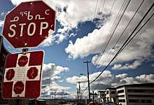
Iqaluit has a local road system only stretching from the nearby community of Apex to the Sylvia Grinnell Territorial Park, 1 km (0.62 mi) west of town. Iqaluit has no public transportation, although there is citywide taxi service. There used to be bus service in the city, but the service was cancelled due to low ridership. Motor cars are increasing in number, to the extent of causing occasional traffic jams known locally as "the rush minute". However, the cost of shipping automobiles and the wear-and-tear of the harsh Arctic climate combined with its notoriously rough roadways mean that snowmobiles remain the preferred form of personal transportation. All-terrain vehicles are also increasingly common in most of the Canadian Arctic. Snowmobiles are used to travel within the city and in the surrounding area. In winter, dog sleds are still used, but primarily for recreation. In winter, the nearby Qaummaarviit Territorial Historic Park and the more remote Katannilik Territorial Park Reserve are only accessible by snowmobile, dog sled or foot. In the summer, both are accessible by boat. Most major roads within Iqaluit are paved with asphalt, but local and smaller roads are gravel. Roads do not have traffic signals, but use stop signs to control intersections.
Residents and businesses identify their locations mostly by building number, and occasionally by the name of a prominent structure. Residents know where in the city certain series of building numbers are located; numbers tend to be aggregated in blocks, so someone might say that they live in the 2600s. Around 2003, street names were developed, although there were delays in finalizing them and posting the signs. Street numbers have not been assigned, and building numbers continue to be used. Iqaluit is the only Canadian capital city not to have traffic signals.[41]
Waste and water treatment
The city's infrastructure is stressed by growth and lack of means to upgrade. Waste from the city is disposed of into an open air dump on Akilliq Drive (West 40) located south of the city.[42]
Although the city has water treatment facilities, raw sewage from the city is often dumped untreated into nearby Frobisher Bay.[42]
As the dump has reached capacity, the city plans to open a second dump 9 kilometres (5.6 mi) north of the city.[43] Iqaluit does not have a recycling program in place; all recyclable materials are sent into the waste stream.
Media
Communications
- Meshnet Community WiFi—free community WiFi and paid service available in most areas of city. Free services include access to Isuma.tv, and many other resources.
Press
- Nunatsiaq News
- News/North
Radio
| Frequency | Call sign | Branding | Format | Owner | Notes |
|---|---|---|---|---|---|
| AM 1230 & FM 91.1 | CFFB | CBC Radio One | Talk radio, public radio | Canadian Broadcasting Corporation | Part of CBC North; broadcasts English and Inuktitut programming |
| FM 88.3 | CBM-FM-3 | CBC Music | Assorted music, public radio | Canadian Broadcasting Corporation | Rebroadcaster of CBM-FM (Montreal) |
| FM 93.3 | CIQA-FM | Weatheradio Canada | Weather radio | Meteorological Service of Canada | Rebroadcaster of VEV284 (Iqaluit Airport) |
| FM 99.9 | CKIQ-FM | Ice FM | Adult contemporary | Northern Lights Entertainment | |
| FM 103.5 | CKGC-FM | Capital FM | Oldies | Northern Lights Entertainment | |
| FM 107.3 | CFRT-FM | 107.3 CFRT | Community radio | Association des Francophones du Nunavut | French language community radio |
Television
| OTA channel | Call sign | Network | Notes |
|---|---|---|---|
| 10 (VHF) | CH4161 | Aboriginal Peoples Television Network | Eastern time zone feed |
| 12 (VHF) | CH2260 | Ici Radio-Canada Télé | Community-owned rebroadcaster of CBFT-DT (Montreal) |
Iqaluit was served by CFFB-TV channel 8, a CBC Television/CBC North repeater of CFYK-DT (Yellowknife) until July 31, 2012 when it was closed because of budget cuts at the CBC.[44][45]
Notable people
- Eva Aariak, politician, former MLA and second Premier of Nunavut
- Paul-André Brasseur, child actor
- Ann Meekitjuk Hanson, former Commissioner of Nunavut
- Kenn Harper, grocer, amateur historian, and entrepreneur
- Lucie Idlout, rock singer, songwriter
- Matty McNair, US-born explorer
- Mosha Michael, filmmaker[46]
- Simonie Michael, first Inuk to be elected to what is now the Legislative Assembly of the Northwest Territories in 1966[47]
- Nakasuk, founder of Iqaluit
- Paul Okalik, lawyer, politician, member of the Legislative Assembly of Nunavut, first Premier of Nunavut and former Speaker of the Legislative Assembly of Nunavut. Unsuccessful federal Liberal candidate for Nunavut
- Abe Okpik, politician, worked on Project Surname to obtain family names for Inuit rather than disc numbers and first Inuk to sit (appointed) on what is now the NWT Legislative Assembly[47][48]
- Dennis Patterson, politician, former MLA and Premier of the NWT (prior to division), current Canadian Senator for Nunavut
- Bryan Pearson, politician, former MLA, first mayor of Iqaluit, businessman
- Aqpik Peter, Nunavut speed skater, contestant in 2010 Winter Olympics[49]
- Ed Picco, politician, former MLA in NWT and Nunavut
- Annabella Piugattuk, actress
- Elisapee Sheutiapik, ex-politician & mayor
- Hunter Tootoo, territorial and federal politician, and former speaker of the Nunavut Legislative Assembly[50]
- Sheila Watt-Cloutier, politician, environmental activist, Nobel nominee
See also
References
- "Council Members". City.iqaluit.nu.ca. Archived from the original on 10 May 2011. Retrieved 2 March 2011.
- Results for the constituency of Iqaluit-Manirajak Archived 2013-11-13 at the Wayback Machine at Elections Nunavut
- Results for the constituency of Iqaluit-Niaqunnguu Archived 2013-11-14 at the Wayback Machine at Elections Nunavut
- Results for the constituency of Iqaluit-Sinaa Archived 2013-11-13 at the Wayback Machine at Elections Nunavut
- Results for the constituency of Iqaluit-Tasiluk Archived 2013-11-14 at the Wayback Machine
- Brown, Beth (28 October 2019). "Kenny Bell is Iqaluit's new mayor as municipal elections held across Nunavut". CBC News. Retrieved 23 April 2020.
- "Census Profile, 2016 Census". Statistics Canada. Archived from the original on 4 March 2017. Retrieved 2 March 2017.
- "Census Profile, 2016 Census Iqaluit [Population centre]". Statistics Canada. 2016. Archived from the original on 4 March 2017. Retrieved 3 March 2016.
- "Iqaluit | Nunavut, Canada". Encyclopedia Britannica. Archived from the original on 18 September 2017. Retrieved 17 September 2017.
- "About Iqaluit: History & Milestones - City of Iqaluit". www.city.iqaluit.nu.ca. Archived from the original on 2 May 2018. Retrieved 2 May 2018.
- "Iqaluit G7 talks serious business: Aglukkaq". Cbc.ca. 2 February 2010. Archived from the original on 22 September 2012. Retrieved 12 December 2013.
- "G7 tests Nunavut data networks". Cbc.ca. 4 February 2010. Archived from the original on 4 January 2012. Retrieved 12 December 2013.
- "Iqaluit Wins the Capital Plebiscite". Nunatisaq News. 15 December 1995. Archived from the original on 11 March 2007. Retrieved 30 July 2006.
- "Iqaluit to host G7 finance meeting". CBC News. 18 November 2009. Archived from the original on 14 November 2012. Retrieved 25 August 2012.
- "Iqaluit A". Canadian Climate Normals 1981−2010. Environment Canada. Retrieved 6 September 2013.
- "The Treeline in Canada" (PDF). NWT Department of Education, Culture and Employment. Archived (PDF) from the original on 10 February 2015. Retrieved 10 February 2015.
- "July 2008". Canadian Climate Data. Environment Canada. 31 October 2011. Climate ID: 2402592. Archived from the original on 10 June 2016. Retrieved 14 May 2016.
- "Iqaluit A". Canadian Climate Normals 1981–2010. Environment Canada. 31 October 2011. Climate ID: 2402590. Archived from the original on 16 May 2017. Retrieved 24 February 2014.
- "March 1999". Canadian Climate Data. Environment Canada. 31 October 2011. Climate ID: 2402590. Archived from the original on 10 June 2016. Retrieved 14 May 2016.
- "September 2010". Canadian Climate Data. Environment Canada. 31 October 2011. Climate ID: 2402592. Archived from the original on 10 June 2016. Retrieved 14 May 2016.
- "October 2015". Canadian Climate Data. Environment Canada. 31 October 2011. Climate ID: 2402592. Archived from the original on 10 June 2016. Retrieved 14 May 2016.
- "December 2010". Canadian Climate Data. Environment Canada. 1 November 2019. Climate ID: 2402592. Archived from the original on 10 June 2016. Retrieved 14 May 2016.
- d.o.o, Yu Media Group. "Iqaluit, Canada - Detailed climate information and monthly weather forecast". Weather Atlas. Retrieved 6 July 2019.
- "June 2019". Canadian Climate Data. Environment Canada. 1 November 2019. Climate ID: 2402592. Retrieved 1 November 2019.
- "Iqaluit officials confirm cathedral fire was deliberately set". CBC News. 10 November 2005.
- Canada, Government of Canada, Statistics (8 February 2017). "Census Profile, 2016 Census - Iqaluit, City [Census subdivision], Nunavut and Baffin, Region [Census division], Nunavut". www12.statcan.gc.ca. Archived from the original on 17 March 2017. Retrieved 2 May 2018.
- Canada, Government of Canada, Statistics (8 February 2017). "Census Profile, 2016 Census - Iqaluit, City [Census subdivision], Nunavut and Baffin, Region [Census division], Nunavut". www12.statcan.gc.ca. Archived from the original on 17 March 2017. Retrieved 2 May 2018.
- Dawson, Samantha (17 January 2013). "A new way to nurture the Inuit language: train the instructors". NunatsiaqOnline. Archived from the original on 8 February 2013. Retrieved 24 January 2013.
- Nunavut Schools Contact List Archived 2016-01-01 at the Wayback Machine
- "Nunatsiaq News 2011-06-16: NEWS: Iqaluit's French-language school spreads its wings". www.nunatsiaqonline.ca. Archived from the original on 13 February 2018. Retrieved 2 May 2018.
- "Welcome to the City of Iqaluit". City.iqaluit.nu.ca. Archived from the original on 22 September 2013. Retrieved 8 August 2013.
- "Transportation Safety Board of Canada - Aviation Investigation Report A98Q0192". Bst.gc.ca. Archived from the original on 2 December 2013. Retrieved 8 August 2013.
- Police, Government of Canada, Royal Canadian Mounted. "Nunavut - Royal Canadian Mounted Police". www.rcmp.gc.ca. Archived from the original on 6 August 2014. Retrieved 2 May 2018.
- "What We Have - Our Community Assets" (PDF). Sustainable Iqaluit. 2012.
- "Air Canada expands its network north to Iqaluit". Micro.newswire.ca. 28 March 2010. Archived from the original on 3 September 2015. Retrieved 2 March 2011.
- "Air Canada discontinues Iqaluit flights". www.cbc.ca. 4 July 2011. Archived from the original on 10 August 2011. Retrieved 2 August 2011.
- John Pike (27 April 2005). "List of Space Shuttle emergency landing sites at". Globalsecurity.org. Archived from the original on 31 March 2016. Retrieved 2 March 2011.
- "Long road ahead for transportation needs". Nunavut News. 15 December 2019. Retrieved 6 April 2020.
- "Public gets first look at plans for Iqaluit's deep sea port". CBC News. 27 March 2017. Retrieved 6 April 2020.
- "High costs killed Iqaluit-Labrador vehicle ferry dream, Nunavut minister says". Nunatsiaq News.
- "Iqaluit's infrastructure struggles to keep up with growth - North - CBC News". Cbc.ca. 22 November 2011. Archived from the original on 7 August 2013. Retrieved 8 August 2013.
- "As Iqaluit landfill overflows, residents propose incinerator - News - MSN CA". News.ca.msn.com. 22 July 2013. Retrieved 8 August 2013.
- "April 4 • CBC/Radio-Canada". cbc.radio-canada.ca. Archived from the original on 1 January 2015. Retrieved 2 May 2018.
- (CRTC), Government of Canada, Canadian Radio-television and Telecommunications Commission (17 July 2012). "ARCHIVED - Revocation of licences for the rebroadcasting stations CBIT Sydney and CBKST Saskatoon and licence amendment to remove analog transmitters for 23 English- and French-language television stations". www.crtc.gc.ca. Archived from the original on 28 July 2012. Retrieved 2 May 2018.
- "Inuk filmmaker mourned" Archived 2017-02-02 at the Wayback Machine. CBC News, November 20, 2009.
- The road to Nunavut: the progress of the eastern Arctic Inuit since the Second World War by Ronald Quinn Duffy
- "Fact Sheet" (in French). Civilization.ca. Archived from the original on 5 June 2009. Retrieved 2 March 2011.
- "Chasing his dreams – Aqpik Peter leads way for Inuit youth". Vancouver2010.com. Retrieved 2 March 2011.
- "Nunavut MLAs choose Tootoo as new Speaker". cbc.ca/news. 31 May 2011. Archived from the original on 5 May 2012. Retrieved 31 July 2011.
Further reading
- Baffin Regional Health Board (Nunavut), and Health Needs Assessment Project (Nunavut). Iqaluit Community Profile. Iqaluit, Nunavut?: Health Needs Assessment Project, Baffin Regional Health Board?, 1994.
- Eno, Robert V. Crystal Two: The Origin of Iqaluit. Arctic. 2003.
- Hodgson, D. A. Quaternary geology of western Meta Incognita Peninsula and Iqaluit area, Baffin Island, Nunavut. Ottawa: Geological Survey of Canada, 2005. ISBN 0-660-19405-8
- Keen, Jared. Iqaluit Gateway to the Arctic. Calgary: Weigl Educational Publishers Limited, 2000. ISBN 1-896990-55-X
- Kublu, Alexina, and Mélanie Gagnon. Inuit Recollections on the Military Presence in Iqaluit. Memory and history in Nunavut, v. 2. Iqaluit, N.W.T.: Nunavut Arctic College, 2002. ISBN 1-896204-54-6
- Newbery, Nick. Iqaluit gateway to Baffin. Iqaluit, NT: Published for the Royal Canadian Legion Branch No. 4, Iqaluit by Nortext Pub. Co, 1995. ISBN 1-55036-452-9
External links
| Wikimedia Commons has media related to Iqaluit. |
| Look up Iqaluit in Wiktionary, the free dictionary. |
| Wikivoyage has a travel guide for Iqaluit. |
- Official website{{Dead link|date=April 2020 |bot=InternetArchiveBot |fix-attempted=yes }}
Places adjacent to Iqaluit | ||||||||||
|---|---|---|---|---|---|---|---|---|---|---|
| ||||||||||
| |||||||||||||||||||||||||||||||||||||||||||||||||||||||||||||||||||||

| Authority control |
|
|---|