Yongning District
Yongning District (simplified Chinese: 邕宁区; traditional Chinese: 邕寧區; pinyin: Yōngníng Qū; Standard Zhuang: Yunghningz Gih) is one of 7 districts of the prefecture-level city of Nanning, the capital of Guangxi Zhuang Autonomous Region, South China. The district was approved to build from the dissolution of the former Yongning County (邕宁县) by the Chinese State Council on September 15, 2004.[4] The district's total area is 1295 square kilometers, and its population in 2004 was 316,000 people.
Yongning 邕宁区 · Yunghningz Gih Yungning | |
|---|---|
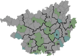 Yongning Location in Guangxi | |
| Coordinates: 22°44′56″N 108°29′41″E[1] | |
| Country | People's Republic of China |
| Autonomous region | Guangxi |
| Prefecture-level city | Nanning |
| Area | |
| • Total | 1,255 km2 (485 sq mi) |
| Population (2010)[3] | |
| • Total | 259,721 |
| • Density | 210/km2 (540/sq mi) |
| Time zone | UTC+8 (China Standard) |
| Website | yongning |
Administrative divisions
Yongning District administers three towns and two villages. The towns are Pumiao, Xinjiang, and Nalou; the villages are Baiji and Zhonghe.
References
- Google (2014-07-02). "Pumiaozhen" (Map). Google Maps. Google. Retrieved 2014-07-02.
- Nanning City Land Use Plan (2006–20)/《南宁市土地利用总体规划(2006-2020年)》.(in Chinese) Accessed 8 July 2014.
- 《中国2010年人口普查分县资料》 (in Chinese). 中国统计出版社. December 2012. ISBN 978-7-5037-6659-6.
- 邕宁区历史沿革 (in Chinese). xzqh.org. 2013-11-05. Retrieved 2019-07-19.
This article is issued from Wikipedia. The text is licensed under Creative Commons - Attribution - Sharealike. Additional terms may apply for the media files.