Chiconamel (municipality)
Chiconamel Municipality is one of the 212 municipalities of the Mexican state of Veracruz. It is located in the state's Huasteca Alta region. The municipal seat is the village of Chiconamel, Veracruz.
Chiconamel | |
|---|---|
Municipality | |
Chiconamel Location in Mexico 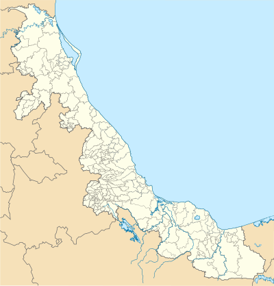 Chiconamel Chiconamel (Veracruz) | |
| Coordinates: 21°14′0″N 98°27′0″W | |
| Country | |
| State | Veracruz |
| Municipal seat | Chiconamel |
| Government | |
| • Municipal President | Aldegundo Barragán Flores (AFV), 2009-10 |
| Area | |
| • Total | 133.25 km2 (51.45 sq mi) |
| Elevation | 140 m (460 ft) |
| Population (2005) | |
| • Total | 6,811 |
| • Density | 51/km2 (130/sq mi) |
In the 2005 INEGI Census, the municipality reported a total population of 6,811, of whom 1,517 lived in the municipal seat.[1] Of the municipality's inhabitants, 3,902 (62%) spoke an indigenous language, primarily Nahuatl.
The municipality of Chiconamel covers a total surface area of 133.25 km². Unusually, however, the municipality is divided into two by an intervening portion of the municipality of Chalma, with the eastern portion of its territory an exclave.[2]
Settlements in the municipality
- Chiconamel (municipal seat; 2005 population 1,517)
- Motoltepec (population 750)
- Tancazahuela (1,550)
- Los Venados (450)
References
- "Chiconamel". Enciclopedia de los Municipios de México. Instituto Nacional para el Federalismo y el Desarrollo Municipal. Archived from the original on 17 June 2011. Retrieved 2 November 2008.
- "Map of Chiconamel". Veracruz State Govt. Archived from the original on 22 July 2011. Retrieved 4 November 2008.
External links
- Chiconamel Web page of the Veracruz State Govt. Accessed 4 November 2008.
- (in Spanish) Municipal Official Information
This article is issued from Wikipedia. The text is licensed under Creative Commons - Attribution - Sharealike. Additional terms may apply for the media files.