Chilpancingo
Chilpancingo de los Bravo (commonly shortened to Chilpancingo; Spanish pronunciation: [tʃilpanˈsiŋɡo] (![]()
Chilpancingo de los Bravo | |
|---|---|
 Above, from left to right: Downtown, Chilpancingo Francisco Assisi Church, Tehuacalco archaeological site, The Civic Plaza "First Congress of Anahuac", Chilpancingo Saint Mary Cathedral, Museo de Regional de Guerrero (Regional Museum of Guerrero), Chilpancingo City Hall and the judiciary. | |
 Seal | |
| Nickname(s): Ciudad Bravo | |
Chilpancingo de los Bravo | |
| Coordinates: 17°33′N 99°30′W | |
| Country | Mexico |
| State | Guerrero |
| Municipality | Chilpancingo de los Bravo |
| Founded | November 1, 1591 |
| Government | |
| • Mayor | Mario Moreno Arce (2012-2015, PRI) |
| Area | |
| • Municipality | 2,338.4 km2 (902.86 sq mi) |
| Elevation | 1,253 m (4,111 ft) |
| Population (2010) | |
| • Total | 187,251 |
| • Municipality | 214,219 |
| • Demonym | Chilpancingueño |
| Time zone | UTC−6 (CST) |
| • Summer (DST) | UTC−5 (CDT) |
| Postal code | 39000 |
| Area code(s) | 747 |
| Website | chilpancingo.gob.mx |
History
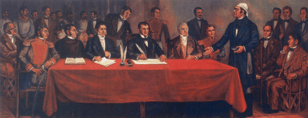
In pre-Columbian times, the area was occupied by the Olmecs, who built an extensive tunnel network through the mountains, and left the cave paintings in the caverns of Juxtlahuaca.[1] The city of Chilpancingo was founded on November 1, 1591 by the Spanish conquistadores, its name meaning “Place of Wasps” in Nahuatl.[1] During the War of Independence, Chilpancingo was crucial to the insurgent cause as its population participated actively and decisively in their favor, and became a strategic point for military action in the south. Chilpancingo was very important to Mexican history because it was here where the National Congress met under José María Morelos y Pavón in 1813 during the Mexican War of Independence.[2]
General Nicolás Catalán, husband of the independence war heroine Antonia Nava de Catalán, was made commander of the state of Guerrero on 24 January 1828. The family settled in Chilpancingo, where both Nicolás and Antonia later died.[3] In 1853, Chilpancingo was declared the provisional capital of the state, due to an epidemic that struck the then capital of Tixtla, and regional ecclesiastical organizational changes were made at the same time.[4] In 1870 it was again declared capital by Governor Francisco O. Arce, due to the opposition led by General Jimenez, who was in possession of the official seat of government at Tixtla. It was not until 1871, when the state legislature agreed to a change of venue, that the capital was moved again from Chilpancingo.[5]
During the Mexican Revolution, Chilpancingo was deeply troubled, and had political and administrative importance as a strategic place for the sides in the debate. Battles took place in the vicinity in the 1910s, in which Emiliano Zapata defeated federal forces of Porfirio Diaz, Francisco I. Madero, Victoriano Huerta and Venustiano Carranza. A major defeat of Huerta's southern forces took place here in March April 1914;[6] the Zapatistas took the town until after the Constitutional Convention.
In 1960, the city entered a severe social crisis with the start of a student popular movement at the Autonomous University of Guerrero, protests which led to a general strike at the institution and later swarmed to various forces and social sectors of the city and the state.[7] The main objective was to diminish the power of the state government and seek autonomy for the college. On April 27, 2009 an earthquake with a magnitude of 5.6 was centered near Chilpancingo.[8]
Geography
Climate
| Climate data for Chilpancingo (1951–2010) | |||||||||||||
|---|---|---|---|---|---|---|---|---|---|---|---|---|---|
| Month | Jan | Feb | Mar | Apr | May | Jun | Jul | Aug | Sep | Oct | Nov | Dec | Year |
| Record high °C (°F) | 35.0 (95.0) |
35.0 (95.0) |
37.0 (98.6) |
38.2 (100.8) |
39.0 (102.2) |
37.5 (99.5) |
37.0 (98.6) |
35.5 (95.9) |
34.0 (93.2) |
34.0 (93.2) |
34.0 (93.2) |
32.5 (90.5) |
39.0 (102.2) |
| Average high °C (°F) | 27.9 (82.2) |
28.6 (83.5) |
30.2 (86.4) |
31.2 (88.2) |
31.3 (88.3) |
28.9 (84.0) |
27.9 (82.2) |
28.3 (82.9) |
27.6 (81.7) |
28.1 (82.6) |
28.3 (82.9) |
27.7 (81.9) |
28.8 (83.8) |
| Daily mean °C (°F) | 19.5 (67.1) |
20.2 (68.4) |
21.5 (70.7) |
23.1 (73.6) |
24.0 (75.2) |
23.2 (73.8) |
22.5 (72.5) |
22.7 (72.9) |
22.3 (72.1) |
22.1 (71.8) |
21.2 (70.2) |
19.8 (67.6) |
21.8 (71.2) |
| Average low °C (°F) | 11.1 (52.0) |
11.8 (53.2) |
12.9 (55.2) |
14.9 (58.8) |
16.6 (61.9) |
17.5 (63.5) |
17.0 (62.6) |
17.0 (62.6) |
16.9 (62.4) |
16.0 (60.8) |
14.0 (57.2) |
11.9 (53.4) |
14.8 (58.6) |
| Record low °C (°F) | 2.0 (35.6) |
2.0 (35.6) |
1.5 (34.7) |
9.0 (48.2) |
8.5 (47.3) |
10.5 (50.9) |
11.0 (51.8) |
12.0 (53.6) |
10.0 (50.0) |
9.0 (48.2) |
5.5 (41.9) |
4.0 (39.2) |
1.5 (34.7) |
| Average precipitation mm (inches) | 17.8 (0.70) |
3.1 (0.12) |
2.8 (0.11) |
17.2 (0.68) |
63.1 (2.48) |
162.4 (6.39) |
191.1 (7.52) |
152.7 (6.01) |
165.8 (6.53) |
78.1 (3.07) |
16.9 (0.67) |
2.8 (0.11) |
873.8 (34.40) |
| Average precipitation days (≥ 0.1 mm) | 1.4 | 0.9 | 0.6 | 1.9 | 6.6 | 16.1 | 21.1 | 19.1 | 18.2 | 9.1 | 2.0 | 0.8 | 97.8 |
| Average relative humidity (%) | 75 | 73 | 70 | 69 | 73 | 82 | 84 | 84 | 87 | 82 | 78 | 76 | 77 |
| Mean monthly sunshine hours | 213.9 | 211.9 | 232.5 | 195.0 | 176.7 | 147.0 | 164.3 | 170.5 | 135.0 | 179.8 | 198.0 | 201.5 | 2,226.1 |
| Source 1: Servicio Meteorológico Nacional[9][10] | |||||||||||||
| Source 2: Deutscher Wetterdienst (sun and humidity 1941–1970)[11] | |||||||||||||
Economy
In 1869, the Autonomous University of Guerrero was established in Chilpancingo; it still plays a considerable role in the local economy. The city is a producer of processed foods and alcoholic beverages, and is a market for maize, sugarcane, bananas, livestock, and lumber produced in the region.[1]
Archaeology
"Pezuapan" is an archaeological site located in Chilpancingo city.[12] It sits on the eastern slope of the Chilpancingo valley. The archaeological vestiges found at the site cover the total area of 4000 m2. The dates are from 650 AD to 1150 AD.
Other archaeological sites found in this area of Guerrero are:
Twin towns – sister cities


References
- "Chilpancingo". Encyclopædia Britannica. Retrieved 18 September 2014.
- Mills, Kenneth R.; Taylor, William B.; Graham, Sandra Lauderdale (1 January 2002). Colonial Latin America: A Documentary History. Rowman & Littlefield. p. 397. ISBN 978-0-8420-2997-1.
- Acuña Cepeda, Mirtea Elizabeth (19 November 2017), "Antonia Nava de Catalán, la Generala", Ecos de la Costa (in Spanish), archived from the original on 1 December 2017, retrieved 2017-11-28
- Transactions of the American Philosophical Society. American Philosophical Society. 1966. p. 7. ISSN 0065-9746.
- "Chilpancingo de los Bravo" (in Spanish). Enciclopedia de los Municipios de México. Archived from the original on 5 November 2013. Retrieved 18 September 2014.
- O'Kane, Rosemary H. T. (2000). Revolution: Critical Concepts in Political Science. Taylor & Francis. p. 127. ISBN 978-0-415-20135-3.
- Selee, Andrew D. (2011). Decentralization, Democratization, and Informal Power in Mexico. Penn State Press. p. 83. ISBN 0-271-04843-3.
- "Mexico Earthquake: Felt In Mexico City, Centered Near Chilpancingo". Huffington Post. 28 May 2009. Retrieved 18 September 2014.
- "Estado de Guerrero–Estacion: Chilpancingo (DGE)". NORMALES CLIMATOLÓGICAS 1951–2010 (in Spanish). Servicio Meteorológico Nacional. Retrieved January 30, 2016.
- "Extreme Temperatures and Precipitation for Chilpancingo (DGE) 1953-1991" (in Spanish). Servicio Meteorológico Nacional. Retrieved January 30, 2016.
- "Klimatafel von Chilpancingo Los Bravos, Guerrero / Mexiko" (PDF). Baseline climate means (1961-1990) from stations all over the world (in German). Deutscher Wetterdienst. Retrieved January 30, 2016.
- Reyna Beatríz SOLÍS CIRIACO, Hervé Victor MONTERROSA DESRUELLES, Malacological Material from Pezuapan's Archaeological site, Chilpancingo, Guerrero, Mexico. 2010
External links
| Wikimedia Commons has media related to Chilpancingo de los Bravo. |
- Ayuntamiento de Chilpancingo de los Bravo Official website
|
Chilpancingo (capital) | |
| Municipalities/ (seats) |
|

| Authority control |
|
|---|