Wilson County, Tennessee
Wilson County is a county in the U.S. state of Tennessee. It is located in Middle Tennessee. As of the 2010 census, the population was 113,993.[2] Its county seat is Lebanon.[3] The largest city is Mt. Juliet.[4]
Wilson County | |
|---|---|
 Wilson County Courthouse in Lebanon | |
 Seal | |
 Location within the U.S. state of Tennessee | |
 Tennessee's location within the U.S. | |
| Coordinates: 36°10′N 86°18′W | |
| Country | |
| State | |
| Founded | October 26, 1799 |
| Named for | David Wilson, early statesman[1] |
| Seat | Lebanon |
| Largest city | Mt. Juliet |
| Area | |
| • Total | 583 sq mi (1,510 km2) |
| • Land | 571 sq mi (1,480 km2) |
| • Water | 12 sq mi (30 km2) 2.1%% |
| Population | |
| • Estimate (2019) | 144,657 |
| • Density | 232/sq mi (90/km2) |
| Time zone | UTC−6 (Central) |
| • Summer (DST) | UTC−5 (CDT) |
| Congressional district | 6th |
| Website | www |
Wilson County is part of the Nashville-Davidson–Murfreesboro–Franklin, TN Metropolitan Statistical Area.
History
Wilson County was created in 1799 from a portion of Sumner County, and named for Major David Wilson, a Revolutionary War veteran and statesman.[1] The county remained predominantly agrarian throughout the 19th century. The arrival of the railroad after the Civil War boosted the county's timber sector, and several large factories were constructed in the county during the early 20th century.[1]
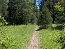
Wilson County was the site of an important saltpeter mine. Saltpeter is the main ingredient of gunpowder and was obtained by leaching the earth from Valley Cave. Valley Cave is located near Statesville. Numerous saltpeter hoppers still inside the cave indicate that this was a relatively large mining operation. These saltpeter vats may date from either the War of 1812 mining era or the Civil War mining era, or perhaps both. Further research is needed to determine when this mine was active.[5]
Geography
According to the U.S. Census Bureau, the county has a total area of 583 square miles (1,510 km2), of which 571 square miles (1,480 km2) is land and 12 square miles (31 km2) (2.1%) is water.[6] The Cumberland River flows along the county's northern border with Trousdale and Sumner counties. This section of the river is part of Old Hickory Lake. Several streams in the western part of the county are part of the Stones River basin.
Wilson County is home to a large concentration of cedar glades, a unique ecosystem where the soil is too rocky or shallow for trees to grow. Many of these glades are found in Cedars of Lebanon State Park.
Adjacent counties
- Trousdale County (north)
- Smith County (northeast)
- DeKalb County (east)
- Cannon County (southeast)
- Rutherford County (south)
- Davidson County (west)
- Sumner County (northwest)
State protected areas
- Cedars of Lebanon State Forest
- Cedars of Lebanon State Park
- Couchville Cedar Glade State Natural Area (part)
- Gattinger's Cedar Glade and Barrens State Natural Area (part)
- John and Hester Land Cedar Glades State Natural Area
- Old Hickory Wildlife Management Area (part)
- Percy Priest Wildlife Management Area (part)
- Vesta Cedar Glade State Natural Area
- Vine Cedar Glade State Natural Area
Demographics
| Historical population | |||
|---|---|---|---|
| Census | Pop. | %± | |
| 1800 | 3,261 | — | |
| 1820 | 18,730 | — | |
| 1830 | 25,472 | 36.0% | |
| 1840 | 24,460 | −4.0% | |
| 1850 | 27,443 | 12.2% | |
| 1860 | 26,072 | −5.0% | |
| 1870 | 25,881 | −0.7% | |
| 1880 | 28,747 | 11.1% | |
| 1890 | 27,148 | −5.6% | |
| 1900 | 27,078 | −0.3% | |
| 1910 | 25,394 | −6.2% | |
| 1920 | 26,241 | 3.3% | |
| 1930 | 23,929 | −8.8% | |
| 1940 | 25,267 | 5.6% | |
| 1950 | 26,318 | 4.2% | |
| 1960 | 27,668 | 5.1% | |
| 1970 | 36,999 | 33.7% | |
| 1980 | 56,064 | 51.5% | |
| 1990 | 67,675 | 20.7% | |
| 2000 | 88,809 | 31.2% | |
| 2010 | 113,993 | 28.4% | |
| Est. 2019 | 144,657 | [7] | 26.9% |
| U.S. Decennial Census[8] 1790-1960[9] 1900-1990[10] 1990-2000[11] 2010-2019[2] | |||

2010 census
As of the census of 2010,[13] there were 113,993 people, 42,563 households, and 32,177 families living in the county. The population density was 199.64 persons per square mile. The housing unit density was 74.54 units per square mile. The racial makeup of the county was 89.30% White, 6.40% African American, 1.12% Asian, 0.35% Native American, 0.04% Pacific Islander, and 1.46% from two or more races. Those of Hispanic or Latino origins constituted 3.24% of the population.
Of all of the households, 33.22% had children under the age of 18 living in them, 60.08% were married couples living together, 4.33% had a male householder with no wife present, 11.19% had a female householder with no husband present, and 24.40% were non-families. 19.86% of households were one person and 7.29% were one person aged 65 or older. The average household size was 2.65 and the average family size was 3.03.
The age distribution was 25.06% under the age of 18, 62.78% ages 18 to 64, and 12.17% age 65 and older. The median age was 39.3 years. 51.02% of the population were females and 48.98% were males.
The median household income was $60,678, and the median family income was $70,092. Males had a median income of $49,293 versus $36,419 for females. The per capita income for the county was $27,814. About 5.6% of families and 7.6% of the population were below the poverty line, including 9.1% of those under the age of 18 and 8.1% of those age 65 and older.
2000 census
At the 2000 census there were 88,809 people, 32,798 households, and 25,582 families living in the county. The population density was 156 people per square mile (60/km²).[14] There were 34,921 housing units at an average density of 61 per square mile (24/km²). The racial makeup of the county was 91.50% White, 6.26% Black or African American, 0.32% Native American, 0.48% Asian, 0.03% Pacific Islander, 0.48% from other races, and 0.92% from two or more races. 1.27% of the population were Hispanic or Latino of any race.
Of the 32,798 households 37.20% had children under the age of 18 living with them, 64.20% were married couples living together, 10.10% had a female householder with no husband present, and 22.00% were non-families. 18.10% of households were one person and 6.10% were one person aged 65 or older. The average household size was 2.67 and the average family size was 3.03.
The age distribution was 26.20% under the age of 18, 7.70% from 18 to 24, 31.70% from 25 to 44, 24.70% from 45 to 64, and 9.70% 65 or older. The median age was 36 years. For every 100 females, there were 97.40 males. For every 100 females age 18 and over, there were 94.80 males.
The median household income was $50,140 and the median family income was $56,650. Males had a median income of $39,848 versus $26,794 for females. The per capita income for the county was $22,739. About 4.60% of families and 6.70% of the population were below the poverty line, including 7.80% of those under age 18 and 11.50% of those age 65 or over.
Education
Wilson County Schools oversees 22 public schools, including 2 adult education centers and a technical education center. The county has four high schools: Mount Juliet High School, Lebanon High School, Wilson Central High School, and Watertown High School.
Cumberland University is located in Lebanon.
Communities
Town
Census-designated places
Other unincorporated communities
- Cainsville
- Carroll
- Cherry Valley
- Commerce
- Couchville
- Doaks Crossroads
- Egan
- Gladeville
- Hunter's Point
- Hurricane
- LaGuardo
- Leeville
- Martha
- Norene
- Oakland
- Possum Town
- Prosperity
- Shop Springs
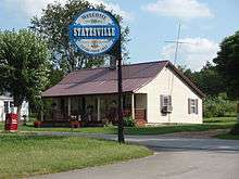
- Statesville
- Suggs Creek
- Tuckers Crossroads
- Vesta
- Vine
Former community
Notable people
- Jordan Anderson (1825–1907) – author of Letter from a Freedman to His Old Master (1865)
- Casey Atwood (b. 1980) – NASCAR driver
- Adrian Belew (b. 1949) – musical artist
- Charlie Daniels (b. 1936) – musical artist
- Dan Evins (1935–2012) – businessman and founder of the Cracker Barrel Old Country Store
- Bobby Hamilton (1957–2007) – NASCAR driver
- Erika Jo (b. 1986) – musical artist
- John J. Pettus (1813–1867) – 20th and 23rd Governor of Mississippi
- John S. Roane (1817–1867) – 4th Governor of Arkansas
- David P. Sartor (b. 1956) – classical composer
- Gretchen Wilson (b. 1973) – musical artist
- Ross Winn (1871–1912) – writer
Politics
In the 2004 U.S. presidential election, 65 percent of voters supported the reelection of President of the United States George W. Bush. In the 2008 U.S. presidential election, 68 percent of voters favored Republican Senator John McCain.
| Year | Republican | Democratic | Third Parties |
|---|---|---|---|
| 2016 | 69.5% 39,406 | 25.4% 14,385 | 5.2% 2,943 |
| 2012 | 70.0% 36,109 | 28.5% 14,695 | 1.5% 793 |
| 2008 | 67.6% 34,595 | 31.1% 15,886 | 1.3% 678 |
| 2004 | 65.1% 28,924 | 34.4% 15,277 | 0.6% 251 |
| 2000 | 52.5% 18,844 | 46.1% 16,561 | 1.4% 511 |
| 1996 | 46.8% 13,817 | 46.2% 13,655 | 7.0% 2,071 |
| 1992 | 40.3% 12,061 | 46.4% 13,861 | 13.3% 3,981 |
| 1988 | 61.1% 13,317 | 38.4% 8,360 | 0.5% 116 |
| 1984 | 60.0% 12,858 | 39.3% 8,433 | 0.7% 158 |
| 1980 | 39.1% 7,535 | 58.4% 11,248 | 2.6% 491 |
| 1976 | 30.6% 4,696 | 68.6% 10,537 | 0.8% 129 |
| 1972 | 65.8% 6,486 | 31.4% 3,096 | 2.8% 279 |
| 1968 | 24.2% 2,736 | 25.8% 2,916 | 50.0% 5,648 |
| 1964 | 30.2% 2,707 | 69.8% 6,267 | |
| 1960 | 40.8% 3,383 | 58.5% 4,857 | 0.7% 57 |
| 1956 | 30.0% 2,266 | 69.2% 5,221 | 0.8% 57 |
| 1952 | 32.6% 2,449 | 67.4% 5,070 | |
| 1948 | 18.2% 854 | 66.7% 3,133 | 15.2% 712 |
| 1944 | 23.0% 942 | 77.0% 3,148 | |
| 1940 | 17.8% 655 | 82.0% 3,020 | 0.2% 6 |
| 1936 | 14.7% 534 | 85.3% 3,108 | 0.1% 3 |
| 1932 | 17.2% 567 | 82.3% 2,713 | 0.6% 18 |
| 1928 | 39.1% 1,049 | 60.7% 1,629 | 0.3% 7 |
| 1924 | 21.9% 580 | 77.0% 2,043 | 1.2% 32 |
| 1920 | 41.5% 1,532 | 58.4% 2,160 | 0.1% 4 |
| 1916 | 24.9% 841 | 75.1% 2,535 | |
| 1912 | 20.6% 682 | 70.4% 2,325 | 9.0% 298 |
References
- Frank Burns, "Wilson County," Tennessee Encyclopedia of History and Culture. Retrieved: 24 April 2013.
- "State & County QuickFacts". United States Census Bureau. Retrieved December 7, 2013.
- "Find a County". National Association of Counties. Retrieved 2011-06-07.
- "Mt. Juliet Tennessee". Census.gov. Census.gov. Retrieved 12 October 2018.
- Thomas C. Barr, Jr., "Caves of Tennessee", Bulletin 64 of the Tennessee Division of Geology, 1961, 568 pages.
- "2010 Census Gazetteer Files". United States Census Bureau. August 22, 2012. Retrieved April 14, 2015.
- "Population and Housing Unit Estimates". Retrieved May 21, 2020.
- "U.S. Decennial Census". United States Census Bureau. Retrieved April 14, 2015.
- "Historical Census Browser". University of Virginia Library. Retrieved April 14, 2015.
- Forstall, Richard L., ed. (March 27, 1995). "Population of Counties by Decennial Census: 1900 to 1990". United States Census Bureau. Retrieved April 14, 2015.
- "Census 2000 PHC-T-4. Ranking Tables for Counties: 1990 and 2000" (PDF). United States Census Bureau. April 2, 2001. Retrieved April 14, 2015.
- Based on 2000 census data
- "U.S. Census website". United States Census Bureau. Retrieved 2019-10-05.
- "U.S. Census website". United States Census Bureau. Retrieved 2008-01-31.
- Leip, David. "Dave Leip's Atlas of U.S. Presidential Elections". uselectionatlas.org. Retrieved 2018-03-13.
External links
| Wikimedia Commons has media related to Wilson County, Tennessee. |
- Official site
- Mt. Juliet Chamber of Commerce
- Lebanon-Wilson County Chamber of Commerce
- Wilson County Schools
- Wilson County Convention and Visitors Bureau
- Tennessee Central Economic Alliance for Wilson County
- Wilson County at TNGenWeb
- Wilson County at Curlie
Places adjacent to Wilson County, Tennessee | ||||||||||
|---|---|---|---|---|---|---|---|---|---|---|
| ||||||||||
Municipalities and communities of Wilson County, Tennessee, United States | ||
|---|---|---|
| Cities | ||
| Town | ||
| CDPs | ||
| Unincorporated communities | ||
| Ghost towns | ||
| Principal City | ||
|---|---|---|
| Other Major Cities | ||
| Counties | ||

| Authority control |
|
|---|