Westville, New Jersey
Westville is a borough in Gloucester County, New Jersey, United States. As of the 2010 United States Census, the borough's population was 4,288,[8][9][10] reflecting a decline of 212 (-4.7%) from the 4,500 counted in the 2000 Census, which had in turn declined by 73 (-1.6%) from the 4,573 counted in the 1990 Census.[19] The Borough of Westville is known as "The Gateway to South Jersey!"[20]
Westville, New Jersey | |
|---|---|
| Borough of Westville | |
 Thomas West House, built ca. 1746 | |
| Motto(s): "The Gateway to South Jersey"[1] | |
 Map of Westville highlighted within Gloucester County. Inset: Location of Gloucester County in New Jersey. | |
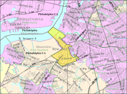 Census Bureau map of Westville, New Jersey | |
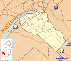 Westville Location in Gloucester County 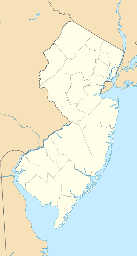 Westville Location in New Jersey  Westville Location in the United States | |
| Coordinates: 39.868922°N 75.131584°W[2][3] | |
| Country | |
| State | |
| County | |
| Incorporated | April 28, 1914 |
| Government | |
| • Type | Borough |
| • Body | Borough Council |
| • Mayor | Russell W. Welsh Jr. (D, term ends December 31, 2022)[5] |
| • Administrator | Ryan J. Giles[6] |
| • Municipal clerk | Ryan J. Giles[6] |
| Area | |
| • Total | 1.378 sq mi (3.568 km2) |
| • Land | 1.024 sq mi (2.652 km2) |
| • Water | 0.354 sq mi (0.916 km2) 25.66% |
| Area rank | 463rd of 566 in state 21st of 24 in county[2] |
| Elevation | 23 ft (7 m) |
| Population | |
| • Total | 4,288 |
| • Estimate (2019)[11] | 4,144 |
| • Rank | 400th of 566 in state 17th of 24 in county[12] |
| • Density | 4,187.0/sq mi (1,616.6/km2) |
| • Density rank | 143rd of 566 in state 2nd of 24 in county[12] |
| Time zone | UTC−05:00 (Eastern (EST)) |
| • Summer (DST) | UTC−04:00 (Eastern (EDT)) |
| ZIP Code | |
| Area code | 856[15] |
| FIPS code | 3401580120[2][16][17] |
| GNIS feature ID | 0885440[2][18] |
| Website | www |
Westville was formed as a borough by an act of the New Jersey Legislature on April 7, 1914, from portions of Deptford Township and West Deptford Township, based on the results of a referendum held on April 28, 1914. The borough was reincorporated on March 8, 1924.[21][22] Legislation had been passed in 1900 to create Westville, but it had to have a majority vote in favor of the new municipality in both Deptford and West Deptford.[23] The borough was named for Thomas West, who built a home in the area in 1775 that still stands.[24][25][26]
Geography
According to the United States Census Bureau, the borough had a total area of 1.378 square miles (3.568 km2), including 1.024 square miles (2.652 km2) of land and 0.354 square miles (0.916 km2) of water (25.66%).[2][3]
Unincorporated communities, localities and place names located partially or completely within the borough include Newbold, South Westville, Business District, Victoria, and Gardner Tract. .[27]
The borough borders the municipalities of Deptford Township and West Deptford Township in Gloucester County; Bellmawr, Brooklawn and Gloucester City in Camden County; and Philadelphia, across the Delaware River in Pennsylvania.[28][29]
Demographics
| Historical population | |||
|---|---|---|---|
| Census | Pop. | %± | |
| 1920 | 2,380 | — | |
| 1930 | 3,462 | 45.5% | |
| 1940 | 3,585 | 3.6% | |
| 1950 | 4,731 | 32.0% | |
| 1960 | 4,951 | 4.7% | |
| 1970 | 5,170 | 4.4% | |
| 1980 | 4,786 | −7.4% | |
| 1990 | 4,573 | −4.5% | |
| 2000 | 4,500 | −1.6% | |
| 2010 | 4,288 | −4.7% | |
| Est. 2019 | 4,144 | [11][30] | −3.4% |
| Population sources: 1920–2000[31] 1920[32] 1920–1930[33] 1930–1990[34] 2000[35][36] 2010[8][9][10] | |||
Census 2010
The 2010 United States Census counted 4,288 people, 1,755 households, and 1,095.120 families in the borough. The population density was 4,187.0 per square mile (1,616.6/km2). There were 1,912 housing units at an average density of 1,867.0 per square mile (720.9/km2). The racial makeup of the borough was 89.53% (3,839) White, 4.90% (210) Black or African American, 0.16% (7) Native American, 1.49% (64) Asian, 0.05% (2) Pacific Islander, 2.31% (99) from other races, and 1.56% (67) from two or more races. Hispanic or Latino of any race were 6.02% (258) of the population.[8]
The 1,755 households accounted 26.2% with children under the age of 18 living with them; 40.9% were married couples living together; 14.5% had a female householder with no husband present, and 37.6% were non-families. Of all households, 31.3% were made up of individuals, and 9.1% had someone living alone who was 65 years of age or older. The average household size was 2.44 and the average family size was 3.06.[8]
In the borough, the population age was spread out with 20.4% under the age of 18, 10.1% from 18 to 24, 28.7% from 25 to 44, 29.1% from 45 to 64, and 11.6% who were 65 years of age or older. The median age was 38.8 years. For every 100 females, the population had 96.1 males. For every 100 females ages 18 and older there were 94.1 males.[8]
The Census Bureau's 2006–2010 American Community Survey showed that (in 2010 inflation-adjusted dollars) median household income was $49,854 (with a margin of error of +/- $4,131) and the median family income was $65,089 (+/- $13,208). Males had a median income of $45,294 (+/- $5,957) versus $39,732 (+/- $7,921) for females. The per capita income for the borough was $26,908 (+/- $3,575). About 13.7% of families and 15.1% of the population were below the poverty line, including 22.7% of those under age 18 and 24.2% of those age 65 or over.[37]
Census 2000
As of the 2000 United States Census[16] there were 4,500 people, 1,812 households, and 1,125 families residing in the borough. The population density was 4,666.1 people per square mile (1,809.9/km2). There were 1,938 housing units at an average density of 2,009.5 per square mile (779.4/km2). The racial makeup of the borough was 93.47% White, 2.71% Black, 0.13% Native American, 1.00% Asian, 0.02% Pacific Islander, 1.29% from other races, and 1.38% from two or more races. Hispanic or Latino of any race were 2.96% of the population.[35][36]
There were 1,812 households out of which 29.5% had children under the age of 18 living with them, 45.4% were married couples living together, 12.2% had a female householder with no husband present, and 37.9% were non-families. 31.8% of all households were made up of individuals and 11.9% had someone living alone who was 65 years of age or older. The average household size was 2.48 and the average family size was 3.15.[35][36]
In the borough the age distribution of the population shows 24.5% under the age of 18, 8.0% from 18 to 24, 32.0% from 25 to 44, 21.5% from 45 to 64, and 14.1% who were 65 years of age or older. The median age was 37 years. For every 100 females, there were 94.2 males. For every 100 females age 18 and over, there were 91.4 males.[35][36]
The median income for a household in the borough was $39,570, and the median income for a family was $49,005. Males had a median income of $35,909 versus $27,220 for females. The per capita income for the borough was $18,747. About 7.4% of families and 8.7% of the population were below the poverty line, including 13.9% of those under age 18 and 5.9% of those age 65 or over.[35][36]
Government
Local government
Westville is governed under the Borough form of New Jersey municipal government, which is used in 218 of 565 municipalities statewide, making it the most common form of government in New Jersey.[38] The governing body is comprised of a Mayor and a Borough Council, with all positions elected at-large on a partisan basis as part of the November general election. A Mayor is elected directly by the voters to a four-year term of office. The Borough Council is comprised of six members elected to serve three-year terms on a staggered basis, with two seats coming up for election each year in a three-year cycle.[4] The Borough form of government used by Westville is a "weak mayor / strong council" government in which council members act as the legislative body with the mayor presiding at meetings and voting only in the event of a tie. The mayor can veto ordinances subject to an override by a two-thirds majority vote of the council. The mayor makes committee and liaison assignments for council members, and most appointments are made by the mayor with the advice and consent of the council.[39][40]
As of 2020, the Mayor of Westville is Democrat Russell W. Welsh Jr., whose term of office ends December 31, 2022. Members of the Westville Borough Council are Council President Michael O. Ledrich (D, 2021), Travis Lawrence (D, 2022), Paul C. Mailley (D, 2022), Charles D. Murtaugh (D, 2020), Bruce Nordaby (D, 2021) and Fritz H. Sims Jr. (D, 2020).[41][42][43][44][45][46]
Federal, state and county representation
Westville is located in the 1st Congressional District[47] and is part of New Jersey's 5th state legislative district.[9][48][49]
For the 116th United States Congress, New Jersey's First Congressional District is represented by Donald Norcross (D, Camden).[50][51] New Jersey is represented in the United States Senate by Democrats Cory Booker (Newark, term ends 2021)[52] and Bob Menendez (Paramus, term ends 2025).[53][54]
For the 2018–2019 session (Senate, General Assembly), the 5th Legislative District of the New Jersey Legislature is represented in the State Senate by Nilsa Cruz-Perez (D, Barrington) and in the General Assembly by Patricia Egan Jones (D, Barrington) and William Spearman (D, Camden).[55][56] Spearman took office in June 2018 followingh the resignation of Arthur Barclay.[57]
Gloucester County is governed by a Board of Chosen Freeholders, whose seven members are elected at-large to three-year terms of office on a staggered basis in partisan elections, with two or three seats coming up for election each year. At a reorganization meeting held each January, the Board selects a Freeholder Director and a Deputy Freeholder Director from among its members. As of 2020, Gloucester County's Freeholders are Freeholder Director Robert M. Damminger (D, West Deptford Township; 2021),[58] Deputy Freeholder Director Frank J. DiMarco (D, Deptford Township; 2022),[59] Lyman J. Barnes (D, Logan Township; 2020),[60] Daniel Christy (D, Washington Township; 2022),[61] Jim Jefferson (D, Woodbury; 2020),[62] Jim Lavender (D, Woolwich Township; 2021),[63] and Heather Simmons (D, Glassboro; 2020).[64][65]
Constitutional officers elected countywide are: County Clerk James N. Hogan (D, Franklinville in Franklin Township; 5-year term ends 2022),[66][67][68] Sheriff Carmel Morina (D, Greenwich Township; 3-year term ends 2021)[69][70][71] and Surrogate Giuseppe "Joe" Chila (D, Woolwich Township; 5-year term ends 2022).[72][73][74][68][75][71]
Politics
As of March 23, 2011, there were a total of 2,636 registered voters in Westville, of which 898 (34.1%) were registered as Democrats, 481 (18.2%) were registered as Republicans and 1,256 (47.6%) were registered as Unaffiliated. There was one voter registered to another party.[76]
In the 2012 presidential election, Democrat Barack Obama received 57.2% of the vote (967 cast), ahead of Republican Mitt Romney with 40.5% (685 votes), and other candidates with 2.4% (40 votes), among the 1,711 ballots cast by the borough's 2,715 registered voters (19 ballots were spoiled), for a turnout of 63.0%.[77][78] In the 2008 presidential election, Democrat Barack Obama received 57.0% of the vote (1,133 cast), ahead of Republican John McCain with 38.8% (770 votes) and other candidates with 2.5% (50 votes), among the 1,987 ballots cast by the borough's 2,854 registered voters, for a turnout of 69.6%.[79] In the 2004 presidential election, Democrat John Kerry received 55.5% of the vote (1,044 ballots cast), outpolling Republican George W. Bush with 43.1% (812 votes) and other candidates with 0.7% (19 votes), among the 1,882 ballots cast by the borough's 2,623 registered voters, for a turnout percentage of 71.7.[80]
In the 2013 gubernatorial election, Republican Chris Christie received 64.2% of the vote (602 cast), ahead of Democrat Barbara Buono with 32.4% (304 votes), and other candidates with 3.4% (32 votes), among the 961 ballots cast by the borough's 2,666 registered voters (23 ballots were spoiled), for a turnout of 36.0%.[81][82] In the 2009 gubernatorial election, Republican Chris Christie received 45.0% of the vote (514 ballots cast), ahead of Democrat Jon Corzine with 41.5% (473 votes), Independent Chris Daggett with 10.2% (116 votes) and other candidates with 0.9% (10 votes), among the 1,141 ballots cast by the borough's 2,759 registered voters, yielding a 41.4% turnout.[83]
Education
The Westville School District is a community public school district that serves students in pre-kindergarten through sixth grade at Parkview Elementary School.[84] As of the 2017–18 school year, the district, comprising one school, had an enrollment of 368 students and 29.1 classroom teachers (on an FTE basis), for a student–teacher ratio of 12.6:1.[85]
For seventh through twelfth grade, students attend Gateway Regional High School, a regional public high school serving students from the boroughs of National Park, Wenonah, Westville and Woodbury Heights, as part of the Gateway Regional High School District.[86][87] As of the 2017–18 school year, the school had an enrollment of 914 students and 81.3 classroom teachers (on an FTE basis), for a student–teacher ratio of 11.2:1.[88]
Students from across the county are eligible to apply to attend Gloucester County Institute of Technology, a four-year high school in Deptford Township that provides technical and vocational education. As a public school, students do not pay tuition to attend the school.[89]
Transportation

Roads and highways
As of May 2010, the borough had a total of 18.05 miles (29.05 km) of roadways, of which 12.72 miles (20.47 km) were maintained by the municipality, 1.66 miles (2.67 km) by Gloucester County and 3.67 miles (5.91 km) by the New Jersey Department of Transportation.[90]
Major roads that pass through include County Route 551,[91] Route 45,[92] Route 47,[93] U.S. Route 130[94] and Interstate 295.[95]
Public transportation
NJ Transit bus service on the 401 route between Salem and Philadelphia, the 402 between Pennsville Township and Philadelphia, the 408 between Millville and Philadelphia, the 410 between Bridgeton and Philadelphia, the 412 route between Sewell and Philadelphia, the 455 between Cherry Hill Mall and Paulsboro, and the 463 route between Woodbury and the Avandale Park-and-Ride in Sicklerville.[96][97]
Conrai's Penns Grove Secondary freight rail line passes through the town. The planned diesel multiple unit light rail system, the Glassboro-Camden Line, would use the same right-of-way with a stop in Westville at Crown Point Road.[98]
Notable people
People who were born in, residents of, or otherwise closely associated with Westville include:
- George Anastasia (born 1947), author and journalist who has been a long-time writer for The Philadelphia Inquirer.[99]
- Stephen Decatur (1779–1820), naval officer notable for his heroism in the First Barbary War and the Second Barbary War and in the War of 1812.[100]
- Malcolm Fox (born 1906), racecar driver.[101]
- Harold W. Hannold (1911-1995), politician who served in the New Jersey Senate from 1945 to 1959, serving as Senate President in 1952.[102]
- James Hunter III (1916–1989), judge of the United States Court of Appeals for the Third Circuit.[103]
- Maria Pallante (born 1964), United States Register of Copyrights.[104]
- Milt Plum (born 1935), NFL quarterback with the Cleveland Browns (1957–1961), Detroit Lions (1962–1967), Los Angeles Rams (1968) and the New York Giants (1969).[105]
- Antwine Perez (born 1988) was an American, college football player.[106]
- Larry Sharpe (1951-2017), professional wrestler.[107]
References
- Transportation, Westville, New Jersey. Accessed November 1, 2014. "Westville was called the Gateway to South Jersey because Delsea Drive, Broadway and Crown Point Road all lead to important spots in South Jersey."
- 2010 Census Gazetteer Files: New Jersey County Subdivisions, United States Census Bureau. Accessed May 21, 2015.
- US Gazetteer files: 2010, 2000, and 1990, United States Census Bureau. Accessed September 4, 2014.
- 2012 New Jersey Legislative District Data Book, Rutgers University Edward J. Bloustein School of Planning and Public Policy, March 2013, p. 28.
- 2020 New Jersey Mayors Directory, New Jersey Department of Community Affairs. Accessed February 1, 2020.
- Borough Department Directory, Borough of Westville. Accessed November 11, 2019.
- U.S. Geological Survey Geographic Names Information System: Borough of Westville, Geographic Names Information System. Accessed March 14, 2013.
- DP-1 - Profile of General Population and Housing Characteristics: 2010 for Westville borough, Gloucester County, New Jersey Archived February 12, 2020, at Archive.today, United States Census Bureau. Accessed November 8, 2012.
- Municipalities Sorted by 2011-2020 Legislative District, New Jersey Department of State. Accessed February 1, 2020.
- Profile of General Demographic Characteristics: 2010 for Westville borough Archived August 27, 2014, at the Wayback Machine, New Jersey Department of Labor and Workforce Development. Accessed November 8, 2012.
- Annual Estimates of the Resident Population for Minor Civil Divisions in New Jersey: April 1, 2010 to July 1, 2019, United States Census Bureau. Accessed May 21, 2020.
- GCT-PH1 Population, Housing Units, Area, and Density: 2010 - State -- County Subdivision from the 2010 Census Summary File 1 for New Jersey Archived February 12, 2020, at Archive.today, United States Census Bureau. Accessed November 8, 2012.
- Look Up a ZIP Code for Westville, NJ, United States Postal Service. Accessed November 8, 2012.
- Zip Codes, State of New Jersey. Accessed September 1, 2013.
- Area Code Lookup - NPA NXX for Westville, NJ, Area-Codes.com. Accessed September 1, 2013.
- U.S. Census website , United States Census Bureau. Accessed September 4, 2014.
- Geographic codes for New Jersey, Missouri Census Data Center. Accessed September 1, 2019.
- US Board on Geographic Names, United States Geological Survey. Accessed September 4, 2014.
- Table 7. Population for the Counties and Municipalities in New Jersey: 1990, 2000 and 2010, New Jersey Department of Labor and Workforce Development, February 2011. Accessed November 8, 2012.
- Westville Borough History: Transportation, Borough of Westville. Accessed June 18, 2007.
- Snyder, John P. The Story of New Jersey's Civil Boundaries: 1606-1968, Bureau of Geology and Topography; Trenton, New Jersey; 1969. p. 140. Accessed October 25, 2012.
- Boro Incorporated, Borough of Westville. Accessed June 18, 2007.
- Honeyman, Abraham Van Doren. Index-analysis of the Statutes of New Jersey, 1896-1909: Together with References to All Acts, and Parts of Acts, in the 'General Statutes' and Pamphlet Laws Expressly Repealed: and the Statutory Crimes of New Jersey During the Same Period, p. 314. New Jersey Law Journal Publishing Company, 1910. Accessed October 26, 2015.
- Hutchinson, Viola L. The Origin of New Jersey Place Names, New Jersey Public Library Commission, May 1945. Accessed October 26, 2015.
- The Thomas West Home, Gloucester County, New Jersey. Accessed October 26, 2015. "This old brick house was built ca. 1775 by Thomas West, for whom Westville is named."
- Early History, Westville, New Jersey. Accessed October 26, 2015. "Thomas West and his wife built the old 'West' house located on River Drive and raised a family of three children."
- Locality Search, State of New Jersey. Accessed May 21, 2015.
- Municipalities within Gloucester County, NJ, Delaware Valley Regional Planning Commission. Accessed November 7, 2019.
- New Jersey Municipal Boundaries, New Jersey Department of Transportation. Accessed November 7, 2019.
- Census Estimates for New Jersey April 1, 2010 to July 1, 2019, United States Census Bureau. Accessed May 21, 2020.
- Barnett, Bob. "Population Data for Gloucester County Municipalities, 1800 - 2000, WestJersey.org, January 6, 2011. Accessed November 8, 2012.
- Compendium of censuses 1726-1905: together with the tabulated returns of 1905, New Jersey Department of State, 1906. Accessed September 1, 2013.
- Fifteenth Census of the United States : 1930 - Population Volume I, United States Census Bureau, p. 716. Accessed November 8, 2012.
- Table 6. New Jersey Resident Population by Municipality: 1930 - 1990, New Jersey Department of Labor and Workforce Development. Accessed June 28, 2015.
- Census 2000 Profiles of Demographic / Social / Economic / Housing Characteristics for Westville borough, New Jersey Archived January 13, 2016, at the Wayback Machine, United States Census Bureau. Accessed November 8, 2012.
- DP-1: Profile of General Demographic Characteristics: 2000 - Census 2000 Summary File 1 (SF 1) 100-Percent Data for Westville borough, Gloucester County, New Jersey Archived February 12, 2020, at Archive.today, United States Census Bureau. Accessed November 8, 2012.
- DP03: Selected Economic Characteristics from the 2006-2010 American Community Survey 5-Year Estimates for Westville borough, Gloucester County, New Jersey Archived February 12, 2020, at Archive.today, United States Census Bureau. Accessed November 8, 2012.
- Inventory of Municipal Forms of Government in New Jersey, Rutgers University Center for Government Studies, July 1, 2011. Accessed November 18, 2019.
- Cerra, Michael F. "Forms of Government: Everything You've Always Wanted to Know, But Were Afraid to Ask" Archived September 24, 2014, at the Wayback Machine, New Jersey State League of Municipalities. Accessed November 30, 2014.
- "Forms of Municipal Government in New Jersey", p. 6. Rutgers University Center for Government Studies. Accessed June 3, 2015.
- Elected Officials, Borough of Westville. Accessed March 9, 2020.
- 2019 Municipal Data Sheet, Borough of Westville. Accessed November 11, 2019.
- Gloucester County 2020 Official Directory, Gloucester County, New Jersey. Accessed March 9, 2020.
- General Election November 5, 2019 Summary Report Unofficial Results, Gloucester County, New Jersey Clerk, November 12, 2019. Accessed January 1, 2020.
- General Election November 6, 2018 Summary Report Unofficial Results, Gloucester County, New Jersey Clerk, November 12, 2018. Accessed January 1, 2019.
- General Election November 7, 2017 Summary Report Unofficial Results, Gloucester County, New Jersey Clerk, November 14, 2017. Accessed January 1, 2018.
- Plan Components Report, New Jersey Redistricting Commission, December 23, 2011. Accessed February 1, 2020.
- 2019 New Jersey Citizen's Guide to Government, New Jersey League of Women Voters. Accessed October 30, 2019.
- Districts by Number for 2011-2020, New Jersey Legislature. Accessed January 6, 2013.
- Directory of Representatives: New Jersey, United States House of Representatives. Accessed January 3, 2019.
- Full Biography, Congressman Donald Norcross. Accessed January 3, 2019. "Donald and his wife Andrea live in Camden City and are the proud parents of three grown children and grandparents of two."
- About Cory Booker, United States Senate. Accessed January 26, 2015. "He now owns a home and lives in Newark's Central Ward community."
- Biography of Bob Menendez, United States Senate, January 26, 2015. "He currently lives in Paramus and has two children, Alicia and Robert."
- Senators of the 116th Congress from New Jersey. United States Senate. Accessed April 17, 2019. "Booker, Cory A. - (D - NJ) Class II; Menendez, Robert - (D - NJ) Class I"
- Legislative Roster 2018-2019 Session, New Jersey Legislature. Accessed July 3, 2018.
- District 5 Legislators, New Jersey Legislature. Accessed July 3, 2018.
- Johnson, Brent. "Yet another new lawmaker takes office in N.J.", NJ Advance Media for NJ.com, July 2, 2018. Accessed July 3, 2018. "Former Camden councilman William Spearman was sworn in Saturday as the newest member of the state Assembly, replacing Arthur Barclay, who resigned last month amid assault charges stemming from a domestic violence incident."
- Robert M. Damminger, Gloucester County, New Jersey. Accessed February 11, 2020.
- Frank J. DiMarco, Gloucester County, New Jersey. Accessed February 11, 2020.
- Lyman Barnes, Gloucester County, New Jersey. Accessed February 11, 2020.
- Daniel Christy, Gloucester County, New Jersey. Accessed February 11, 2020.
- Jim Jefferson, Gloucester County, New Jersey. Accessed February 11, 2020.
- Jim Lavender, Gloucester County, New Jersey. Accessed February 11, 2020.
- Heather Simmons, Gloucester County, New Jersey. Accessed February 11, 2020.
- Board of Freeholders, Gloucester County, New Jersey. Accessed February 11, 2020.
- James N. Hogan, Gloucester County. Accessed February 11, 2020.
- Members List: Clerks, Constitutional Officers Association of New Jersey. Accessed February 11, 2020.
- 2017 Gloucester County Election Results, Office of the Gloucester County Clerk. Accessed February 11, 2020.
- Sheriff Carmel M. Morina, Gloucester County. Accessed February 11, 2020.
- Members List: Sheriffs, Constitutional Officers Association of New Jersey. Accessed February 11, 2020.
- 2018 Gloucester County Election Results, Office of the Gloucester County Clerk. Accessed February 11, 2020.
- Surrogate Giuseppe Chila, Gloucester County. Accessed February 11, 2020.
- Members List: Surrogates, Constitutional Officers Association of New Jersey. Accessed February 11, 2020.
- Row Officers, Gloucester County, New Jersey. Accessed February 11, 2020.
- Helene Reed Dies, New Jersey Globe, April 28, 2018. Accessed February 11, 2020.
- Voter Registration Summary - Gloucester, New Jersey Department of State Division of Elections, March 23, 2011. Accessed November 8, 2012.
- "Presidential General Election Results - November 6, 2012 - Gloucester County" (PDF). New Jersey Department of Elections. March 15, 2013. Retrieved December 24, 2014.
- "Number of Registered Voters and Ballots Cast - November 6, 2012 - General Election Results - Gloucester County" (PDF). New Jersey Department of Elections. March 15, 2013. Retrieved December 24, 2014.
- 2008 Presidential General Election Results: Gloucester County, New Jersey Department of State Division of Elections, December 23, 2008. Accessed November 8, 2012.
- 2004 Presidential Election: Gloucester County, New Jersey Department of State Division of Elections, December 13, 2004. Accessed November 8, 2012.
- "Governor – Gloucester County" (PDF). New Jersey Department of Elections. January 29, 2014. Retrieved December 24, 2014.
- "Number of Registered Voters and Ballots Cast - November 5, 2013 - General Election Results - Gloucester County" (PDF). New Jersey Department of Elections. January 29, 2014. Retrieved December 24, 2014.
- 2009 Governor: Gloucester County Archived October 17, 2012, at the Wayback Machine, New Jersey Department of State Division of Elections, December 31, 2009. Accessed November 8, 2012.
- New Jersey School Directory for the Westville Boro Public School District, New Jersey Department of Education. Accessed December 29, 2016.
- District information for Westville Boro Public School District, National Center for Education Statistics. Accessed November 11, 2019.
- Gateway Regional High School District 2015 School Report Card Narrative, New Jersey Department of Education. Accessed June 8, 2016. "Gateway Regional High School is a one school district located in Woodbury Heights, NJ. It serves students in grades 7-12 from the municipalities of National Park, Wenonah, Westville, and Woodbury Heights."
- Shryock, Bob. "Plans are in the works for Gateway's 50th anniversary", Gloucester County Times, March 22, 2012. Accessed June 8, 2016. "The 50-year milestone is based on Gateway opening in the fall of 2014 when four sending districts (Woodbury Heights, Westville, National Park and Wenonah) split from Woodbury and sent seventh, eighth and ninth graders to the new school on Egg Harbor Road in Woodbury Heights."
- School data for Gateway Regional High School, National Center for Education Statistics. Accessed November 10, 2019.
- Admissions, Gloucester County Institute of Technology. Accessed November 7, 2019. "There is no charge to attend. GCIT is a public school.... GCIT is the vocational-technical school for Gloucester County residents. You must live in Gloucester County to apply and attend."
- Gloucester County Mileage by Municipality and Jurisdiction, New Jersey Department of Transportation, May 2010. Accessed July 18, 2014.
- County Route 551 Straight Line Diagram, New Jersey Department of Transportation, updated June 2012. Accessed November 11, 2019.
- Route 45 Straight Line Diagram, New Jersey Department of Transportation, updated March 2017. Accessed November 11, 2019.
- Route 47 Straight Line Diagram, New Jersey Department of Transportation, updated March 2014. Accessed November 11, 2019.
- U.S> Route 130 Straight Line Diagram, New Jersey Department of Transportation, updated March 2018. Accessed November 11, 2019.
- Interstate 295 Straight Line Diagram, New Jersey Department of Transportation, updated May 2017. Accessed November 11, 2019.
- Gloucester County Bus / Rail Connections, NJ Transit, backed up by the Internet Archive as of July 26, 2010. Accessed September 1, 2013.
- Gloucester County's Transit Guide, Gloucester County, New Jersey. Accessed November 7, 2019.
- Glassboro-Camden Line Fact Sheet 2013, Delaware River Port Authority and PATCO. Accessed September 1, 2013. "The new line proposed under the Light Rail Alternative would traverse the communities of Glassboro, Pitman, Sewell, Mantua Township, Deptford Township, Wenonah, Woodbury Heights, Woodbury, Westville, Brooklawn, Gloucester City, and Camden."
- Manzella, Joseph C. The Struggle to Revitalize American Newspapers, p. 165. E. Mellen Press, 2002. ISBN 9780773472594. Accessed June 11, 2015. "George Anastasia came from South Jersey near Westville."
- Woodbury Public Schools History, Woodbury Public Schools. Accessed May 11, 2009. "Captain James Laurence, of 'Don't Give Up the Ship' fame, was educated at the Woodbury Academy, as was Commodore Stephen Decatur, who then lived in Westville."
- Reed, Terry. Indy: The Race and Ritual of the Indianapolis 500, p. 57. Potomac Books, 2005. ISBN 9781574889079. Accessed August 15, 2016. "While Louis Meyer enjoyed his somewhat unanticipated second Indianapolis win in 1933, one of the forty-one other cars chasing him was a Studebaker-powered Universal Service Special driven by Westville, New Jersey's Malcolm Fox, who slowed momentarily behind another car in the southwest turn on Fox's 123rd lap."
- Fitzgerald's Legislative Manual, State of New Jersey, 1971, p. 359. J.A. Fitzgerald, 1971. Accessed November 20, 2017. "Harold W. Hannold (Rep., Westville) Mr. Hannold was born December 20, 1911, in Westville, New Jersey. He is the son of Chaikley C. Hannold and Bertha T. Hannold."
- James Hunter III, Biographical Directory of Federal Judges. Accessed March 1, 2011.
- Staff. "Copyright chief eyes web conflict", Seattle Post-Intelligencer, June 6, 2011. Accessed October 26, 2015. "A native of Westville, N.J., Pallante, who has two children, has spent most of her career hopping back and forth between New York and Washington."
- "Westville: Once a part of two other townships", Courier-Post, October 19, 2006. Accessed June 18, 2007. "Milt Plum, who played quarterback for the Cleveland Browns, Detroit Lions, Los Angeles Rams and New York Giants during a 13-year NFL career that lasted from 1957 to 1969, was born in Westville on Jan. 20, 1935."
- Dinich, Heather A. "Terps, Rutgers rivals on recruiting trail: Schools frequent foes on recruiting trail in N.J.", The Baltimore Sun, September 29, 2007. Accessed October 26, 2015. "A large outline of the state of New Jersey is tattooed on the right biceps of Maryland senior defensive tackle Carlos Feliciano, a native of Elizabeth, N.J. The same tattoo is etched into the arm of his teammate, defensive back Antwine Perez, of Westville Grove, N.J. And linebacker Jeff Clement, from Westville, plans to get one soon."
- Shyrock, Bob. "Bob Shryock: What Gloucester County people are doing", Gloucester County Times, September 24, 2009, updated January 19, 2019. Accessed November 11, 20119. "Former long-time professional wrestler 'Pretty Boy' Larry Sharpe of Westville will participate in a Friday, 7 p.m. fund-raiser at Dover Downs Raceway & Casino, shooting pool (9-ball) against Miss America, Katie Stam, of Indiana, and NASCAR drivers K.C. Kane, Ryan Newman, Benny Hamlin and K.C. Mears, who are in town for the big race."
External links
| Wikimedia Commons has media related to Westville, New Jersey. |
- Westville Borough website
- Parkview Elementary School
- Parkview Elementary School's 2015–16 School Report Card from the New Jersey Department of Education
- School Data for the Parkview Elementary School, National Center for Education Statistics
- Gateway Regional High School
| Preceded by Brooklawn Camden County |
Bordering communities of Philadelphia |
Succeeded by West Deptford Township |
Municipalities and communities of Gloucester County, New Jersey, United States | ||
|---|---|---|
| City | 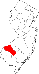 Map of New Jersey highlighting Gloucester County | |
| Boroughs | ||
| Townships | ||
| CDPs | ||
| Other unincorporated communities |
| |