Gibbstown, New Jersey
Gibbstown is an unincorporated community and census-designated place (CDP) located within Greenwich Township, in Gloucester County, New Jersey, United States.[7][8] At the 2010 census, the CDP's population was 3,739.[3] Gibbstown is the location of C. A. Nothnagle Log House, purportedly the oldest house in New Jersey and the oldest surviving log house in the U.S., dating to around 1638.
Gibbstown, New Jersey | |
|---|---|
 | |
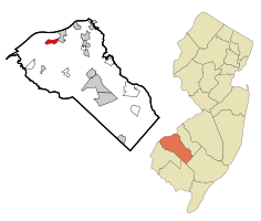 Map of Gibbstown highlighted within Gloucester County. Right: Location of Gloucester County in New Jersey. | |
| Coordinates: 39.82454°N 75.278082°W | |
| Country | |
| State | |
| County | Gloucester |
| Township | Greenwich |
| Area | |
| • Total | 1.642 sq mi (4.253 km2) |
| • Land | 1.642 sq mi (4.253 km2) |
| • Water | 0.000 sq mi (0.000 km2) 0.00% |
| Elevation | 13 ft (4 m) |
| Population | |
| • Total | 3,739 |
| • Density | 2,277.0/sq mi (879.2/km2) |
| Time zone | UTC-5 (Eastern (EST)) |
| • Summer (DST) | UTC-4 (EDT) |
| ZIP code | 08027[4] |
| Area code(s) | 856 |
| FIPS code | 3426100[1][5] |
| GNIS feature ID | 02389839[1][6] |
Geography
According to the United States Census Bureau, Gibbstown had a total area of 1.642 square miles (4.253 km2), all of which was land.[1][9]
The Port of Paulsboro is located on the Delaware River and Mantua Creek in and around Paulsboro. Traditionally one of the nation's busiest for marine transfer operations of petroleum products, including the Paulsboro Refinery, which is mostly located in Gibbstown. The port is being redeveloped as an adaptable omniport able to handle a diversity of bulk, break bulk cargo and shipping containers. Studies completed in 2012[10][11] concluded that the port is well suited to become a center for the manufacture, assembly, and transport of wind turbines and platforms the development of Atlantic Wind Connection[12][13][14][15][16][17]
Demographics
| Historical population | |||
|---|---|---|---|
| Census | Pop. | %± | |
| 1990 | 3,902 | — | |
| 2000 | 3,758 | −3.7% | |
| 2010 | 3,739 | −0.5% | |
| Population sources: 2000[18] 2010[3] | |||
Census 2010
The 2010 United States Census counted 3,739 people, 1,472 households, and 1,039.232 families in the CDP. The population density was 2,277.0 per square mile (879.2/km2). There were 1,551 housing units at an average density of 944.5 per square mile (364.7/km2). The racial makeup of the CDP was 95.91% (3,586) White, 1.77% (66) Black or African American, 0.05% (2) Native American, 0.43% (16) Asian, 0.00% (0) Pacific Islander, 0.32% (12) from other races, and 1.52% (57) from two or more races. Hispanic or Latino of any race were 2.01% (75) of the population.[3]
The 1,472 households accounted 26.9% with children under the age of 18 living with them; 54.1% were married couples living together; 11.5% had a female householder with no husband present, and 29.4% were non-families. Of all households, 23.5% were made up of individuals, and 10.8% had someone living alone who was 65 years of age or older. The average household size was 2.54 and the average family size was 3.00.[3]
In the CDP, the population age was spread out with 21.3% under the age of 18, 6.4% from 18 to 24, 25.8% from 25 to 44, 30.0% from 45 to 64, and 16.6% who were 65 years of age or older. The median age was 42.9 years. For every 100 females, the population had 98.9 males. For every 100 females ages 18 and older there were 94.8 males.[3]
Census 2000
At the 2000 census[5] there were 3,758 people, 1,453 households, and 1,060 families living in the CDP. The population density was 890.2/km2 (2,302.4/mi2). There were 1,513 housing units at an average density of 358.4/km2 (927.0/mi2). The racial makeup of the CDP was 96.65% White, 1.09% African American, 0.11% Native American, 0.69% Asian, 0.03% Pacific Islander, 0.32% from other races, and 1.12% from two or more races. Hispanic or Latino of any race were 1.52% of the population.[18]
Of the 1,453 households 31.7% had children under the age of 18 living with them, 57.1% were married couples living together, 11.2% had a female householder with no husband present, and 27.0% were non-families. 23.3% of households were one person and 13.3% were one person aged 65 or older. The average household size was 2.58 and the average family size was 3.05.[18]
The age distribution was 23.0% under the age of 18, 7.6% from 18 to 24, 28.1% from 25 to 44, 23.6% from 45 to 64, and 17.7% 65 or older. The median age was 40 years. For every 100 females, there were 95.9 males. For every 100 females age 18 and over, there were 92.2 males.[18]
The median household income was $50,444 and the median family income was $59,833. Males had a median income of $41,200 versus $31,225 for females. The per capita income for the CDP was $23,931. About 1.2% of families and 3.2% of the population were below the poverty line, including 3.4% of those under age 18 and 4.9% of those age 65 or over.[18]
Education
Guardian Angels Regional School is a K-8 elementary school that operates under the auspices of the Roman Catholic Diocese of Camden.[19]
Notable people
People who were born in, residents of, or otherwise closely associated with Gibbstown include:
- Alex Silvestro (born 1988), former football tight end / defensive end who played in the NFL for the Baltimore Ravens and New England Patriots.[20]
References
- Gazetteer of New Jersey Places, United States Census Bureau. Accessed July 21, 2016.
- U.S. Geological Survey Geographic Names Information System: Gibbstown Census Designated Place, Geographic Names Information System. Accessed November 10, 2012.
- DP-1 - Profile of General Population and Housing Characteristics: 2010 Demographic Profile Data for Gibbstown CDP, New Jersey Archived 2020-02-12 at Archive.today, United States Census Bureau. Accessed November 10, 2012.
- Look Up a ZIP Code for Gibbstown, NJ, United States Postal Service. Accessed November 10, 2012.
- U.S. Census website , United States Census Bureau. Accessed September 4, 2014.
- US Board on Geographic Names, United States Geological Survey. Accessed September 4, 2014.
- New Jersey: 2010 - Population and Housing Unit Counts - 2010 Census of Population and Housing (CPH-2-32), United States Census Bureau, August 2012. Accessed November 10, 2012.
- Locality Search, State of New Jersey. Accessed April 18, 2015.
- US Gazetteer files: 2010, 2000, and 1990, United States Census Bureau. Accessed September 4, 2014.
- Laday, Jason. "Paulsboro port site vetted by wind energy firm", South Jersey Times, December 11, 2012. Accessed September 5, 2014.
- "AWC Study Confirms Feasibility Of Paulsboro Marine Terminal Site". North American Wind Power. April 25, 2013. Retrieved July 17, 2013.
- "AWC to Build Manufacturing Facility in Paulsboro, USA". Off shore Wind Biz. December 6, 2012. Retrieved 2013-07-27.
- Merritt, Athena D. (January 19, 2009). "$250M port will be built in Paulsboro". Philadelphia Business Journal. Retrieved 2013-07-08.
- Forand, Rebecca (April 23, 2013). "Port of Paulsboro could be construction site for off-shore wind structures". South Jersey Times. Retrieved July 8, 2013.
- Belier, Carolyn. "Companies Betting Big on New Jersey's Offshore Wind", WCAU, April 24, 2013. Accessed September 5, 2014.
- Paciolla, Christina (February 2012). "The Port of Paulsboro". South Jersey Biz. Retrieved July 8, 2013.
- Loyd , Linda "Construction under way at new Paulsboro port", The Philadelphia Inquirer, April 13, 2012 . Accessed September 5, 2014.
- DP-1 - Profile of General Demographic Characteristics: 2000 from the Census 2000 Summary File 1 (SF 1) 100-Percent Data for Gibbstown CDP, New Jersey Archived 2020-02-12 at Archive.today, United States Census Bureau. Accessed November 10, 2012.
- Catholic Schools Directory, Roman Catholic Diocese of Camden. Accessed October 20, 2016.
- Duggan, Dan. "Rutgers alums Tiquan Underwood and Alex Silvestro recall when Super Bowl fates intersected", NJ Advance Media for NJ.com, February 1, 2015. Accessed July 6, 2015. "Signed by the Patriots as an undrafted free agent out of Rutgers in 2011, Silvestro was released in the final round of preseason roster cuts. The defensive end from Gibbstown was re-signed to the Patriots' practice squad three weeks into the season."
Municipalities and communities of Gloucester County, New Jersey, United States | ||
|---|---|---|
| City | 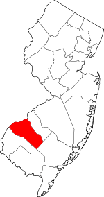 Map of New Jersey highlighting Gloucester County | |
| Boroughs | ||
| Townships | ||
| CDPs | ||
| Other unincorporated communities |
| |