West End Brook
West End Brook is a small stream in southern England. It rises near the Hampshire village of Tadley. Its name is probably related to the parish, and village, it passes through for some of its course: Mortimer West End.
| West End Brook | |
|---|---|
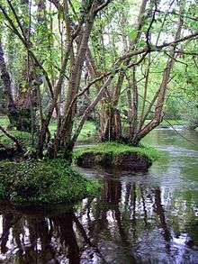
 West End Brook at Kiln Pond, Benyon's Inclosure, Hampshire. | |
| Location | |
| Country | England |
| Counties | , Hampshire |
| Towns | Tadley, Mortimer West End |
| Physical characteristics | |
| Source | Tadley |
| ⁃ location | Hampshire, United Kingdom |
| ⁃ coordinates | 51.359924°N 1.145153°W |
| ⁃ elevation | 103 m (338 ft) |
| Mouth | Foudry Brook |
⁃ location | Hampshire, United Kingdom |
⁃ coordinates | 51.362296°N 1.053164°W |
⁃ elevation | 59 m (194 ft) |
| Discharge | |
| ⁃ location | Foudry Brook, south of Mortimer Common, Berkshire |
The source is very close to West's Meadow, Aldermaston SSSI, from where the stream travels East, passing through Upper Moor's Gulley to the South off AWE Aldermaston. A tributary joins the stream here, arriving from Decoy Pond, within the AWE site. This particular area, identified on maps as Roundwood Copse is also an SSSI Decoy Pit, Pools and Woods.
Further East the stream travels through the woodland of Benyon's Inclosure, and the watercourse is ponded here, at Kiln Pond. Just to the south of the pond is The Frith, an Iron Age Hill fort. Also in the area, further to the South, is Silchester Roman Town. After flowing further East and to the South, the stream joins the Foudry Brook.
| Main rivers |
|  |
|---|---|---|
| Canals and Navigations | ||
| Ordinary watercourses | ||
| Lakes, ponds and wetlands | ||
| Coast | ||
Categories: Rivers, Canals | ||