Lymington River
The Lymington River is a small river in Hampshire, England, flowing through the New Forest into the Solent at the town of Lymington. The river has a total length of 22 kilometres (14 mi), although the initial part, north of Brockenhurst, is known as Highland Water.
| the river Lymington Highland Water | |
|---|---|
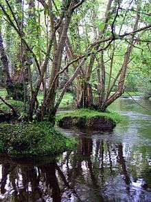
 New Forest ponies grazing next to the Lymington River near Brockenhurst | |
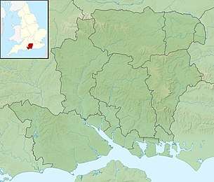 Location of the mouth within Hampshire | |
| Location | |
| Country | England |
| Region | Hampshire |
| District | New Forest |
| Physical characteristics | |
| Source | |
| ⁃ location | Ocknell Plain |
| Mouth | |
⁃ location | Lymington |
⁃ coordinates | 50.75°N 1.533°W |
| Length | 22 km (14 mi) |
| Basin features | |
| Tributaries | |
| ⁃ left | Long Brook, Bagshot Gutter, Etherise Gutter |
| ⁃ right | Warwickslade Cutting, Fletchers Water, Ober Water, Passford Water |
Highland Water rises north of the Ocknell Inclosure (SU243125) and flows for 10 kilometres (6 mi) to Bolderford Bridge (SU291041) where it meets Ober Water. From then on it is known as the Lymington River and flows for a further 12 kilometres (7 mi) until it enters the Solent (SZ3493).
History
In 1731 a merchant navy captain, Captain Cross, constructed a causeway across the river to the north of Lymington.[1] He built toll houses and charged travellers using his causeway, more than a mile south of the existing bridge at Boldre.[2] The dam had the effect of impeding the river and contributed to the silting-up of Lymington harbour.[2] Lymington Corporation complained about the matter in court, but lost their case.[2] In 1795 it was noted that the mud building up in the channel "has rendered it already very narrow; and will probably in a few years, so completely choke it up, as to make it unnavigable by any ships of considerable burden."[3] The causeway was taken over by the railway company who continued to collect tolls until they were bought out by Hampshire County Council in 1955, and they discontinued the tolls a few years later.[2] Even today silting in the harbour as a result of the dam still occurs, although it is ameliorated by the scouring effects of the Isle of Wight ferries.[1] Before the causeway was built it is said that the river was tidal as far as Brockenhurst.[4]
Reedbeds
The river's extensive reedbeds are an important Site of Special Scientific Interest.
References
- Peter Bruce (2001) Solent Hazards, page 63 ISBN 187168031X
- Jude James (2013) Lymington Through Time ISBN 1445629364
- D. Y. (1795) Collections for the history of Hampshire, and the bishopric of Winchester: Including the Isles of Wight, Jersey, Guernsey, and Sarke, Volume 1, Section 2, page 24
- David William Garrow (1825) The history of Lymington, and its immediate vicinity, page 29
External links
![]()
| Main rivers |
|  |
|---|---|---|
| Canals and Navigations | ||
| Ordinary watercourses | ||
| Lakes, ponds and wetlands | ||
| Coast | ||
Categories: Rivers, Canals | ||