U.S. Route 34 in Illinois
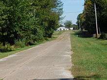
U.S. Route 34 (US 34) is an east–west highway In the state of Illinois that runs from the Iowa state line at Gulfport, west of Galesburg, to Illinois Route 43 (IL 43) and Historic U.S. Route 66 at Harlem Avenue in Berwyn. The entire highway in Illinois is named the Walter Payton Memorial Highway after Pro Football Hall of Famer Walter Payton, who wore #34 for the Chicago Bears. The highway is 211.37 miles (340.17 km) long within the state.[2]
| |||||||
|---|---|---|---|---|---|---|---|
| Walter Payton Memorial Highway[1] | |||||||

US 34 highlighted in red | |||||||
| Route information | |||||||
| Maintained by IDOT | |||||||
| Length | 211.37 mi[2] (340.17 km) | ||||||
| Existed | 1926–present | ||||||
| Major junctions | |||||||
| West end | |||||||
| |||||||
| East end | |||||||
| Location | |||||||
| Counties | Henderson, Warren, Knox, Henry, Bureau, LaSalle, DeKalb, Kendall, Kane, DuPage, Cook | ||||||
| Highway system | |||||||
| |||||||

The bridge into Iowa over the Mississippi River is called the Great River Bridge. Between Monmouth and Galesburg, the highway is up to Interstate Highway standards with exits at Main Street, Henderson Street, and Seminary Street in Galesburg.
History
Up until 1935, Illinois Route 28 roughly followed US 34 from Galesburg to Sheffield.[3] In 1935, US 34 absorbed what had been the last remaining section of US 32.[4] In 1935, IL 28 was entirely decommissioned.[5]
US 34 formerly overlapped US 66 all the way to its endpoint in downtown Chicago, but was truncated to its intersection with US 66 and IL 43 in Berwyn in 1970. When US 66 was subsequently eliminated, the endpoint of US 34 was left at that location—the intersection of Ogden and Harlem Avenues in Berwyn. Due to the elimination of US 66, it is one of the few US Numbered Highways that ends at a state highway.[6] With the re-signing of much of Historic US 66, the history of US 34's eastern endpoint is becoming much more clear.[7]
Proposals
The now cancelled Prairie Parkway limited-access highway would have had an interchange with US 34, between Needham Road and Waubonsee Drive in the city of Plano.
A bypass of the town of Biggsville has finished construction. It created a diamond interchange between US 34 and IL 94/IL 116 as well as bypass West Central High School. It was complete by the fall of 2014.[8][9]
Major intersections
All exits are unnumbered.
| County | Location | mi[10] | km | Destinations | Notes | |||
|---|---|---|---|---|---|---|---|---|
| Mississippi River | 0.00 | 0.00 | Continuation into Iowa | |||||
| Great River Bridge | ||||||||
| Henderson | Gulfport | 0.6 | 0.97 | Gulfport | ||||
| | 2.2 | 3.5 | West end of Great River Road overlap; east end of freeway section | |||||
| Gladstone | 8.4 | 13.5 | East end of Great River Road overlap | |||||
| Biggsville | 11.5 | 18.5 | Interchange Completed in 2014 | |||||
| Warren | | 25.9 | 41.7 | West end of US 67/IL 110 overlap; interchange | ||||
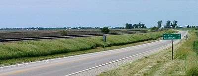
| Monmouth | 27.8 | 44.7 | West end of IL 164 overlap | |||||
| 29.3 | 47.2 | East end of US 67 overlap | ||||||
| | 31.4 | 50.5 | East end of IL 164 overlap | |||||
| | 36.2 | 58.3 | Cameron Road | West end of freeway section | ||||
| Knox | Galesburg | 42.9 | 69.0 | |||||
| 45.7 | 73.5 | |||||||
| 46.8 | 75.3 | Seminary Street | ||||||
| | 48.2 | 77.6 | East end of IL 110 overlap; east end of freeway section; I-74 exit 46 | |||||
| Wataga | 53.2 | 85.6 | ||||||
| Henry | | 64.8 | 104.3 | West end of IL 17 overlap | ||||
| Galva | 70.8 | 113.9 | East end of IL 17 overlap | |||||
| | 77.0 | 123.9 | West end of IL 78 overlap | |||||
| | 77.5 | 124.7 | ||||||
| Kewanee | 82.2 | 132.3 | East end of IL 78 overlap | |||||
| Bureau | | 96.0 | 154.5 | West end of US 6 overlap | ||||
| | 99.8 | 160.6 | ||||||
| Princeton | 111.4 | 179.3 | West end of IL 26 overlap; east end of US 6 overlap | |||||
| 112.2 | 180.6 | East end of IL 26 overlap | ||||||
| La Moille | 126.7 | 203.9 | ||||||
| 127.7 | 205.5 | |||||||
| LaSalle | Mendota | 135.7 | 218.4 | |||||
| | 139.5 | 224.5 | I-39 exit 72 | |||||
| | 153.6 | 247.2 | West end of IL 23 overlap | |||||
| | 157.7 | 253.8 | East end of IL 23 overlap | |||||
| DeKalb |
No major junctions | |||||||
| Kendall | Yorkville | 174.3 | 280.5 | |||||
| Oswego | 179.3 | 288.6 | ||||||
| 179.8 | 289.4 | |||||||
| 180.4 | 290.3 | |||||||
| Montgomery | 183.7 | 295.6 | West end of US 30 overlap | |||||
| 184.1 | 296.3 | East end of US 30 overlap | ||||||
| Kane |
No major junctions | |||||||
| DuPage | Aurora–Naperville city line | 188.7 | 303.7 | |||||
| Lisle | 197.1 | 317.2 | Interchange | |||||
| Lisle–Downers Grove village line | 198.3 | 319.1 | I-355 exits 19 & 20B; I-88 exit 131 | |||||
| Westmont–Hinsdale village line | 203.9 | 328.1 | Interchange | |||||
| Cook | Western Springs | 205.7 | 331.0 | I-294 exit 27 | ||||
| La Grange | 208.0 | 334.7 | ||||||
| Lyons | 209.9 | 337.8 | ||||||
| Berwyn | 211.37 | 340.17 | National eastern terminus | |||||
| Continuation beyond IL 43 | ||||||||
1.000 mi = 1.609 km; 1.000 km = 0.621 mi
| ||||||||
References
| Wikimedia Commons has media related to U.S. Route 34 in Illinois. |
- State of Illinois (April 15, 2000). "91st General Assembly Summary of HJR0071". Retrieved November 26, 2006.
- Illinois Technology Transfer Center (2006). "T2 GIS Data". Retrieved November 8, 2007.
- Illinois Secretary of State; Rand McNally (1934). Official Road Map Illinois (Map). [c. 1:950,000 and c. 1:1,110,000]. Springfield: Illinois Secretary of State. OCLC 183709045 – via Illinois Digital Archives.
- End of US highway 32. usends.com.
- Illinois Secretary of State; H.M. Gousha (1935). Official Road Map Illinois (Map). [c. 1:950,000 and c. 1:1,110,000]. Springfield: Illinois Secretary of State – via Illinois Digital Archives.
- End of US highway 34. usends.com.
- East end of US highway 34 in Berwyn IL. usends.com.
- "Construction of four-lane section of US-34 approved". WQAD-TV. June 21, 2013. Retrieved July 18, 2014.
- "New Biggsville Bypass Promotes Safety Initiative". KWQC-TV. June 28, 2013. Retrieved July 18, 2014.
- Google (March 16, 2017). "Overview Map of US 34" (Map). Google Maps. Google. Retrieved March 16, 2017.
| Previous state: Iowa |
Illinois | Next state: Terminus |