La Moille, Illinois
La Moille is a village in Bureau County, Illinois, United States. The population was 726 at the 2010 census.[3] It is part of the Ottawa Micropolitan Statistical Area.
La Moille, Illinois | |
|---|---|
Village | |
 Historic school in La Moille | |
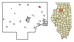 Location of La Moille in Bureau County, Illinois. | |
.svg.png) Location of Illinois in the United States | |
| Coordinates: 41°31′45″N 89°16′52″W | |
| Country | United States |
| State | Illinois |
| County | Bureau |
| Townships | Lamoille, Clarion |
| Area | |
| • Total | 1.20 sq mi (3.1 km2) |
| • Land | 1.20 sq mi (3.1 km2) |
| • Water | 0.0 sq mi (0 km2) 0% |
| Population (2010) | |
| • Total | 726 |
| • Estimate (2018)[2] | 686 |
| • Density | 610/sq mi (230/km2) |
| Time zone | UTC-6 (CST) |
| • Summer (DST) | UTC-5 (CDT) |
| ZIP Code(s) | 61330 |
| Area code(s) | 815 |
| FIPS code | 17-41794 |
| Wikimedia Commons | La Moille, Illinois |
La Moille was named after the Lamoille River valley, in Vermont.[4]
History
La Moille was established in 1836.[5]
Geography
La Moille is located at 41°31′45″N 89°16′52″W (41.529204, -89.281187).[6]
According to the 2010 census, La Moille has a total area of 1.2 square miles (3.11 km2), all land.[7]
The village is at the junction of State Highway 92 and U.S. Route 34.
Demographics
| Historical population | |||
|---|---|---|---|
| Census | Pop. | %± | |
| 1880 | 488 | — | |
| 1890 | 516 | 5.7% | |
| 1900 | 576 | 11.6% | |
| 1910 | 555 | −3.6% | |
| 1920 | 547 | −1.4% | |
| 1930 | 504 | −7.9% | |
| 1940 | 509 | 1.0% | |
| 1950 | 505 | −0.8% | |
| 1960 | 655 | 29.7% | |
| 1970 | 669 | 2.1% | |
| 1980 | 734 | 9.7% | |
| 1990 | 654 | −10.9% | |
| 2000 | 773 | 18.2% | |
| 2010 | 726 | −6.1% | |
| Est. 2018 | 686 | [2] | −5.5% |
| U.S. Decennial Census[8] | |||
At the 2000 census there were 773 people, 305 households, and 215 families in the village. The population density was 641.5 people per square mile (246.7/km²). There were 321 housing units at an average density of 266.4 per square mile (102.4/km²). The racial makeup of the village was 97.67% White, 0.13% African American, 1.42% from other races, and 0.78% from two or more races. Hispanic or Latino of any race were 4.14%.[9]
Of the 305 households 36.1% had children under the age of 18 living with them, 57.7% were married couples living together, 8.9% had a female householder with no husband present, and 29.5% were non-families. 26.6% of households were one person and 12.1% were one person aged 65 or older. The average household size was 2.53 and the average family size was 3.08.
The age distribution was 29.0% under the age of 18, 7.4% from 18 to 24, 28.8% from 25 to 44, 20.8% from 45 to 64, and 14.0% 65 or older. The median age was 35 years. For every 100 females, there were 97.2 males. For every 100 females age 18 and over, there were 94.0 males.
The median household income was $37,212 and the median family income was $46,563. Males had a median income of $32,083 versus $21,944 for females. The per capita income for the village was $17,008. About 4.4% of families and 6.5% of the population were below the poverty line, including 11.7% of those under age 18 and 1.9% of those age 65 or over.
References
- "2016 U.S. Gazetteer Files". United States Census Bureau. Retrieved Jun 29, 2017.
- "Population and Housing Unit Estimates". Retrieved November 8, 2019.
- "Geographic Identifiers: 2010 Demographic Profile Data (G001): La Moille village, Illinois". U.S. Census Bureau, American Factfinder. Archived from the original on February 12, 2020. Retrieved November 15, 2013.
- Gannett, Henry (1905). The Origin of Certain Place Names in the United States. Government Printing Office. pp. 180.
- History of Bureau County, Illinois
- "US Gazetteer files: 2010, 2000, and 1990". United States Census Bureau. 2011-02-12. Retrieved 2011-04-23.
- "G001 - Geographic Identifiers - 2010 Census Summary File 1". United States Census Bureau. Archived from the original on 2020-02-13. Retrieved 2015-08-04.
- "Census of Population and Housing". Census.gov. Retrieved June 4, 2015.
- "U.S. Census website". United States Census Bureau. Retrieved 2008-01-31.
| Wikimedia Commons has media related to La Moille, Illinois. |
Municipalities and communities of Bureau County, Illinois, United States | ||
|---|---|---|
| Cities | Map of Illinois highlighting Bureau County | |
| Villages | ||
| Townships | ||
| Unincorporated communities | ||
| Ghost town | ||
| Footnotes | ‡This populated place also has portions in an adjacent county or counties | |