Tolosa, Leyte
Tolosa, officially the Municipality of Tolosa, is a 5th class municipality in the province of Leyte, Philippines. According to the 2015 census, it has a population of 20,978 people.[3]
Tolosa | |
|---|---|
| Municipality of Tolosa | |
 Map of Leyte with Tolosa highlighted | |
| |
.svg.png) Tolosa Location within the Philippines | |
| Coordinates: 11°02′N 125°01′E | |
| Country | |
| Region | Eastern Visayas (Region VIII) |
| Province | Leyte |
| District | 1st district of Leyte |
| Barangays | 15 (see Barangays) |
| Government | |
| • Type | Sangguniang Bayan |
| • Mayor | Maria Ofelia O. Alcantara |
| • Vice Mayor | Rodolfo B. Legaspi |
| • Congressman | Ferdinand Martin G. Romualdez |
| • Municipal Council | Councilors
|
| • Electorate | 15,001 voters (2019) |
| Area | |
| • Total | 22.54 km2 (8.70 sq mi) |
| Elevation | 7.7 m (25.3 ft) |
| Population (2015 census)[3] | |
| • Total | 20,978 |
| • Density | 930/km2 (2,400/sq mi) |
| • Households | 5,032 |
| Economy | |
| • Income class | 5th municipal income class |
| • Poverty incidence | 28.24% (2015)[4] |
| • Revenue (₱) | 55,379,615.66 (2016) |
| Time zone | UTC+8 (PST) |
| ZIP code | 6503 |
| PSGC | |
| IDD : area code | +63 (0)53 |
| Climate type | tropical rainforest climate |
| Native languages | Waray Tagalog |
| Website | elgu |
It is located 24 kilometres (15 mi) south of Tacloban City.
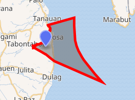
The cities closest to Tolosa are Tacloban, Ormoc, Baybay, Borongan, Catbalogan, and Maasin. The nearest municipalities are Tanauan, Tabontabon, Dulag, Palo, Julita, and Dagami. Its distance from the national capital is 588.52 kilometers (365.69 miles).[5]
Barangays
Tolosa is politically subdivided into 15 barangays. [2]
- Burak
- Canmogsay
- Cantariwis
- Capangihan
- Doña Brigida
- Imelda
- Malbog
- Olot
- Opong
- Poblacion
- Quilao
- San Roque
- San Vicente
- Tanghas
- Telegrafo
Climate
| Climate data for Tolosa, Leyte | |||||||||||||
|---|---|---|---|---|---|---|---|---|---|---|---|---|---|
| Month | Jan | Feb | Mar | Apr | May | Jun | Jul | Aug | Sep | Oct | Nov | Dec | Year |
| Average high °C (°F) | 28 (82) |
28 (82) |
29 (84) |
30 (86) |
30 (86) |
30 (86) |
29 (84) |
30 (86) |
30 (86) |
29 (84) |
29 (84) |
28 (82) |
29 (84) |
| Average low °C (°F) | 22 (72) |
22 (72) |
22 (72) |
23 (73) |
24 (75) |
24 (75) |
24 (75) |
24 (75) |
24 (75) |
24 (75) |
23 (73) |
23 (73) |
23 (74) |
| Average precipitation mm (inches) | 90 (3.5) |
67 (2.6) |
82 (3.2) |
70 (2.8) |
97 (3.8) |
145 (5.7) |
142 (5.6) |
127 (5.0) |
132 (5.2) |
152 (6.0) |
169 (6.7) |
144 (5.7) |
1,417 (55.8) |
| Average rainy days | 17.0 | 13.5 | 16.0 | 16.5 | 20.6 | 24.3 | 26.0 | 25.4 | 25.2 | 26.4 | 23.0 | 21.0 | 254.9 |
| Source: Meteoblue [6] | |||||||||||||
History
According to popular beliefs, Tolosa derived its name from a legend about three chieftains (datus) who united their chiefdoms. According to the legend, the area that is now Tolosa was ruled by three great datus: the datu of fishing, the datu of harvest and the datu of hunting. Typical of chiefdoms in those times, the three datus regard each other with hostility. One time a great battle broke out among the three of them. Their people fought valiantly in defense of each datu. But the three datus were strong they could not defeat each other. Accidentally they were hit by their own swords and they died. Their blood spilt everywhere. Then came a great earthquake followed by a tsunami. When the floodwaters subsided, three promontories rose on three sides of the three datus' lands, as if acting as defensive walls of the contiguous land. Survivors of the great battle realized that the three hills were their great datus who were now united in protecting them from outside dangers. From three (tolo) they became one (usa).
Tolosa was once part of the nearby municipality of Tanauan. Magdaleno Vivero and Domingo Camacho petitioned the Spanish Government to grant Tolosa autonomy from Tanauan. The petition was approved in 1852, resulting in great jubilation among the new town's inhabitants. The town's residents, however, continued to call a nearby promontory Inapusong after the town's old name. Spanish officials named the town in honor of Tolosa, a town in the Basque Country, Spain. The town was formally founded in 1861 and became a parish on February 12, 1863. Its first parish priest was Padre Geronimo Asenjo, a Spaniard. The first Filipino priest of the parish was Father Quintin Bautista. In 1910, a plan to abolish the municipality worried its inhabitants. Owing to the efforts of Captain Daniel Romualdez, grandfather of the late Speaker Daniel Z. Romualdez, the plan to return Tolosa to the care of Tanauan was averted.
During the liberation of the Philippines in 1944, Tolosa and its north eastern neighboring towns were spared from bombardment by the United States and Philippine Commonwealth forces when Eagle Scout Valeriano Abello of barangay San Roque, including two other identified scouts braved Japanese sniper fire and directed US and Filipino fire to the exact location of Japanese batteries along Leyte's north-eastern coast. Abello's act saved the lives of thousands of Leytenos and allowed the Filipino Soldiers and Allied Forces unhampered landing on the coast. This unhampered attack dealt the blow that broke the back of the Japanese resistance in Leyte, and ultimately The Philippines.
A few days after the return of General Douglas MacArthur and the forces of liberation in Leyte, Tolosa became the base of the U.S Navy, as well as the 6th and 13th Air Force. It was in Tanghas, a barangay in Tolosa, where the famous American composer Irving Berlin first presented his renowned composition "Heaven Watch The Philippines" together with his Filipino audience including then President Sergio Osmeña and Carlos P. Romulo.
About 4 decades ago, Tolosa suffered its worst environmental disaster. The sand in the beaches of Tolosa were black until the 1970s because of the abundance of the mineral called magnetite, a naturally magnetized iron, which was a prime raw material for high quality steel. INCO (Iron, Nickel & Copper Ore), a mining company based in nearby barangay Opong, stripped the town's beaches of vegetation to get the mineral, destroying much of the wide beaches and rendering the town's coastal defenses bare against the onslaught of tidal erosion.
Then First Lady Imelda Marcos developed the area between the sea and Mt. Inapusong and built a large compound where she entertained Miss Universe candidates during the pageant held in Manila.
Demographics
| Population census of Tolosa | |||||||||||||||||||||||||||||||||||||||||||||||||
|---|---|---|---|---|---|---|---|---|---|---|---|---|---|---|---|---|---|---|---|---|---|---|---|---|---|---|---|---|---|---|---|---|---|---|---|---|---|---|---|---|---|---|---|---|---|---|---|---|---|
|
| ||||||||||||||||||||||||||||||||||||||||||||||||
| Source: Philippine Statistics Authority [3][7][8][9] | |||||||||||||||||||||||||||||||||||||||||||||||||
In the 2015 census, the population of Tolosa, Leyte, was 20,978 people,[3] with a density of 930 inhabitants per square kilometre or 2,400 inhabitants per square mile.
Tourist attractions
- Karisyuhan Festival & Tribu Bungkaras of San Roque,Tolosa Leyte (A week-long Celebration of Patron Senior San Roque, Every last Saturday of August, Founded by Mr. Florentino Adap Legaspi
- Kalipayan or Olot Mansion
- Romualdez Mausoleum
- Sacred Heart Shrine on top of the bulwark of Mt. Inapusong
- Miramar Beach, former U.S Navy base
- Bil-At Beach Resort
- St. Michael Parish Church
- Statue of late Speaker Daniel Z. Romualdez
- Monument of Eagle Scout Valeriano Abello, one of the three hero scouts of the Philippines during World War II.
- The steep rocky slopes of Mt. Inapusong
- Pacific-borne waves for surfing
References
- "Municipality". Quezon City, Philippines: Department of the Interior and Local Government. Retrieved 31 May 2013.
- "Province: Leyte". PSGC Interactive. Quezon City, Philippines: Philippine Statistics Authority. Retrieved 12 November 2016.
- Census of Population (2015). "Region VIII (Eastern Visayas)". Total Population by Province, City, Municipality and Barangay. PSA. Retrieved 20 June 2016.
- "PSA releases the 2015 Municipal and City Level Poverty Estimates". Quezon City, Philippines. Retrieved 12 October 2019.
- "Distances". "https://www.philatlas.com". Retrieved January 28, 2019.
- "Tolosa: Average Temperatures and Rainfall". Meteoblue. Retrieved 29 February 2020.
- Census of Population and Housing (2010). "Region VIII (Eastern Visayas)". Total Population by Province, City, Municipality and Barangay. NSO. Retrieved 29 June 2016.
- Censuses of Population (1903–2007). "Region VIII (Eastern Visayas)". Table 1. Population Enumerated in Various Censuses by Province/Highly Urbanized City: 1903 to 2007. NSO.
- "Province of Leyte". Municipality Population Data. Local Water Utilities Administration Research Division. Retrieved 17 December 2016.
External links
- Tolosa Profile at PhilAtlas.com
- Philippine Standard Geographic Code
- Philippine Census Information
- Local Governance Performance Management System
- DORELCO-Don Orestes Romualdez Electric Cooperative
Places adjacent to Tolosa, Leyte | ||||||||||
|---|---|---|---|---|---|---|---|---|---|---|
| ||||||||||
Tacloban (capital) | |
| Municipalities |
|
| Component city | |
| Independent component city |
|
| Highly urbanized city |
|