The Summit, Queensland
The Summit is a town and locality in the Southern Downs Region, Queensland, Australia.[2][3] It borders New South Wales.[4]
| The Summit Queensland | |||||||||||||||
|---|---|---|---|---|---|---|---|---|---|---|---|---|---|---|---|
%2C_The_Summit%2C_2015_02.JPG) Granite Belt Drive (main street), The Summit, 2015 | |||||||||||||||
 The Summit | |||||||||||||||
| Coordinates | 28°34′25″S 151°56′56″E | ||||||||||||||
| Population | 409 (2016 census)[1] | ||||||||||||||
| Postcode(s) | 4377 | ||||||||||||||
| Elevation | 923.5 m (3,030 ft) | ||||||||||||||
| Location |
| ||||||||||||||
| LGA(s) | Southern Downs Region | ||||||||||||||
| State electorate(s) | Southern Downs | ||||||||||||||
| Federal Division(s) | Maranoa | ||||||||||||||
| |||||||||||||||
History
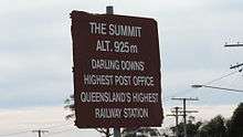
The town takes its name from The Summit railway station, which was so named because it was the highest point (923.5 metres (3,030 ft)) on the Southern railway line from Warwick to Wallangarra.[5][6]
The Summit State School opened on 29 August 1921.[7][8]
In the 2011 census, The Summit had a population of 484 people.[9]
Geography
The Summit is predominantly farmland with some urban development surrounding the railway station. The New England Highway passes north-south through the town, running close to and parallel with the Southern railway line. Originally the highway was the main street of the town, but now the highway bypasses the town to the east. Cannon Creek forms the south-western border of the locality.[10]
Amenities
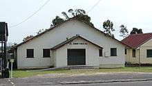
The Summit Public Hall is on Granite Belt Drive opposite the railway station.
References
- Australian Bureau of Statistics (27 June 2017). "The Summit (State Suburb)". 2016 Census QuickStats. Retrieved 19 March 2018.

- "The Summit - town (entry 34150)". Queensland Place Names. Queensland Government. Retrieved 11 June 2015.
- "The Summit - locality (entry 45992)". Queensland Place Names. Queensland Government. Retrieved 11 June 2015.
- "Queensland Globe". State of Queensland. Retrieved 6 May 2020.
- "Queensland place names search". Department of Natural Resources and Mines. QLD Govt.
- "The Summit (railway station) (entry 34151)". Queensland Place Names. Queensland Government.
- "Opening and closing dates of Queensland Schools". Queensland Government. Retrieved 10 June 2015.
- "Agency ID11258, The Summit State School". Queensland State Archives. Retrieved 11 June 2015.
- Australian Bureau of Statistics (31 October 2012). "The Summit (SSC)". 2011 Census QuickStats. Retrieved 11 June 2015.
- "Queensland Globe". State of Queensland. Retrieved 10 June 2015.
Further reading
External links
- "Amiens, Thulimbah, Applethorpe District". Queensland Places. Centre for the Government of Queensland, University of Queensland.
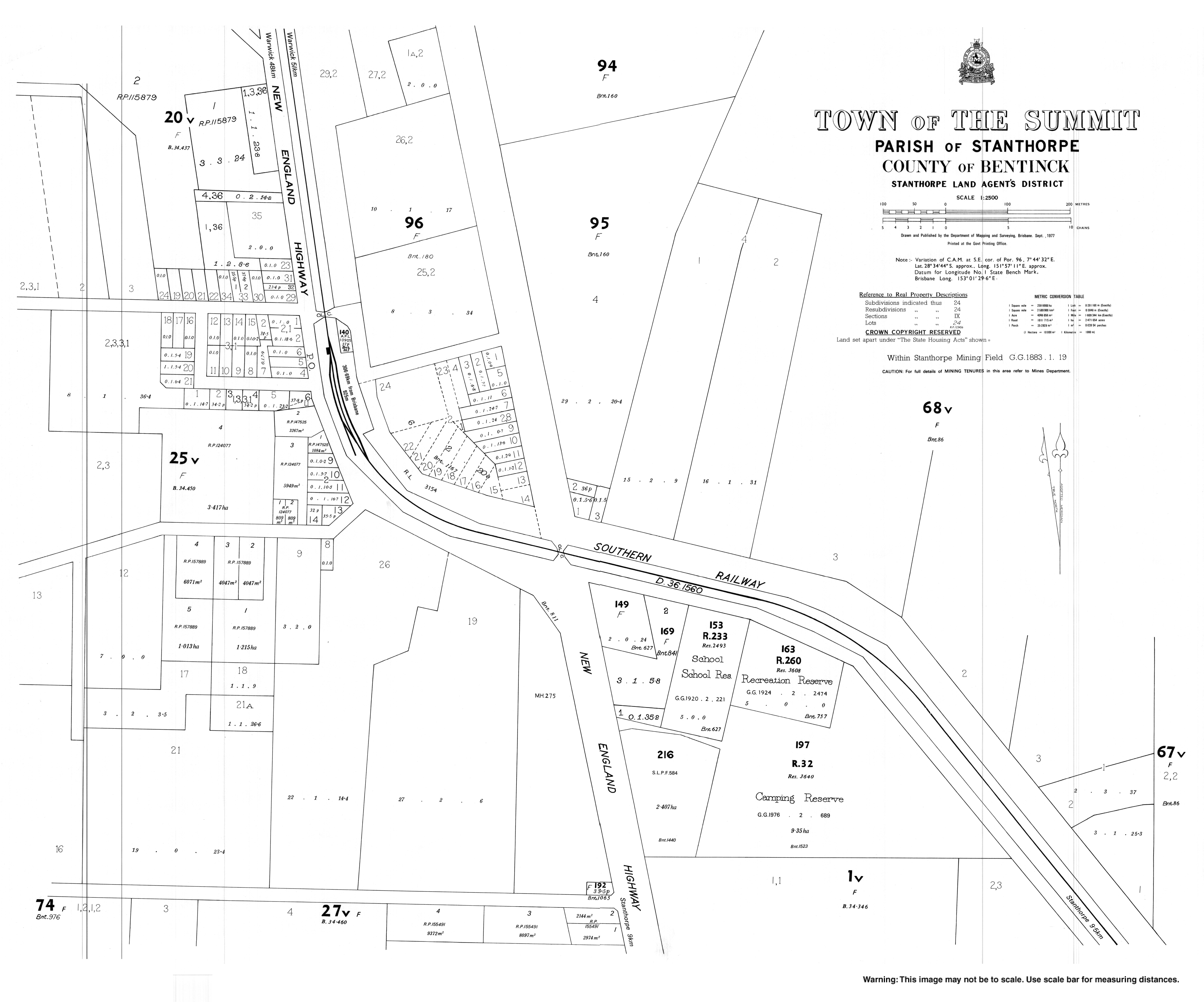
- Town map of The Summit, 1977