Surnadal
Surnadal (![]()
Surnadal kommune | |
|---|---|
.jpg) View of Skei in Surnadal | |
 Coat of arms 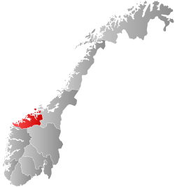 Møre og Romsdal within Norway | |
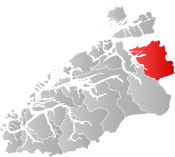 Surnadal within Møre og Romsdal | |
| Coordinates: 62°56′51″N 08°46′12″E | |
| Country | Norway |
| County | Møre og Romsdal |
| District | Nordmøre |
| Established | 1 Jan 1838 |
| Administrative centre | Skei |
| Government | |
| • Mayor (2019) | Margrethe Svinvik (Sp) |
| Area | |
| • Total | 1,366.05 km2 (527.43 sq mi) |
| • Land | 1,315.01 km2 (507.73 sq mi) |
| • Water | 51.03 km2 (19.70 sq mi) 3.7% |
| Area rank | 68 in Norway |
| Population (2020) | |
| • Total | 5,920 |
| • Rank | 161 in Norway |
| • Density | 4.5/km2 (12/sq mi) |
| • Change (10 years) | -0.6% |
| Demonym(s) | Surndaling[1] |
| Time zone | UTC+01:00 (CET) |
| • Summer (DST) | UTC+02:00 (CEST) |
| ISO 3166 code | NO-1566 |
| Official language form | Nynorsk[2] |
| Website | surnadal |
A mild climate and rich soil make Surnadal well suited for agriculture. The local economy is based on agriculture, forestry, and industrial production, in addition to services.[3]
The 1,366-square-kilometre (527 sq mi) municipality is the 68th largest by area out of the 356 municipalities in Norway. Surnadal is the 161st most populous municipality in Norway with a population of 5,920. The municipality's population density is 4.5 inhabitants per square kilometre (12/sq mi) and its population has decreased by 0.6% over the previous 10-year period.[4][5]
General information
The parish of Surnadal was established as a municipality on 1 January 1838 (see formannskapsdistrikt). In 1858, the eastern district (population: 2,684) was separated from Surnadal to form the new Rindal Municipality. This left Surnadal with 3,105 residents. On 1 January 1877, part of Stangvik Municipality (population: 50) was transferred to Surnadal. In 1879, part of Surnadal (population: 83) was transferred to the neighboring Stangvik Municipality. On 1 January 1886, the Møklegjerdet farm (population: 29), just west of the village of Glærem, was transferred from Stangvik to Surnadal. On 1 January 1897, the Sjøflot farm (population: 27) was also transferred from Stangvik to Surnadal. During the 1960s, there were many municipal mergers across Norway due to the work of the Schei Committee. On 1 January 1965, all of Åsskard Municipality (population: 1,014) and most of Stangvik Municipality (population: 1,386) were merged with Surnadal Municipality (population: 3,534) to create a new, larger municipality of Surnadal with a total population of 5,934.[6]
Name
The Old Norse form of the name was Súrnardalr. The first element is the genitive case of the river name Surna and the last element is dalr which means "valley" or "dale". The meaning of the river name is unknown. Before 1918, the name was written Surendalen.[7]
Coat of arms
The coat of arms was granted in 1989. It shows two silver or white wavy lines on a green background. The wavy lines represent the many rivers in the municipality, the most notable one being the Surna.[3][8]
Churches
The Church of Norway has five parishes (sokn) within the municipality of Surnadal. It is part of the Indre Nordmøre prosti (deanery) in the Diocese of Møre.
| Parish (sokn) | Church name | Location of the church | Year built |
|---|---|---|---|
| Mo | Mo Church | Mo | 1728 |
| Stangvik | Stangvik Church | Stangvik | 1896 |
| Todalen | Todalen Church | Todalsøra | 1861 |
| Øye og Ranes | Ranes Church | Ranes | 1869 |
| Øye Church | Skei | 1871 | |
| Åsskard | Åsskard Church | Åsskard | 1876 |
Geography
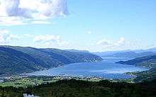
The municipality is made up by the main valley, Surnadalen through which the river Surna runs. There are also many smaller side valleys including Stor-Bæverdalen, Settemsdalen, Øvstbødalen, Todalen, and Vinddøldalen. The municipality is bordered by the Trollheimen mountain range and Sunndal Municipality to the south, the neighboring Rindal Municipality to the east, Halsa Municipality to the north, and several fjords to the west: Trongfjorden, Stangvikfjorden, and Todalsfjorden. There are three main fjords that cut into the municipality: Åsskardfjorden, Hamnesfjorden, and Surnadalsfjorden.
The landscape is a combination of forests, fjords, and mountains. The highest mountain peak is Snota at 1,668 metres (5,472 ft) above sea level. Other mountains include Vassnebba, Indre Sula and Ytre Sula, Neådalssnota, and Trollhetta. The river Surna runs through the valley from the east to the west, and forms a large delta where it enters the fjord near Surnadalsøra and Skei. This river is rich in salmon, which attract tourists from the rest of the country and abroad. The lakes Foldsjøen and Gråsjøen lie along the border with the municipality of Rindal in the east. The Grønkjølen Nature Reserve lies in the extreme northeast of the municipality.[9]
Government
All municipalities in Norway, including Surnadal, are responsible for primary education (through 10th grade), outpatient health services, senior citizen services, unemployment and other social services, zoning, economic development, and municipal roads. The municipality is governed by a municipal council of elected representatives, which in turn elect a mayor.[10] The municipality falls under the Nordmøre District Court and the Frostating Court of Appeal.
Municipal council
The municipal council (Kommunestyre) of Surnadal is made up of 27 representatives that are elected to four year terms. The party breakdown of the council is as follows:
| Party Name (in Nynorsk) | Number of representatives | |
|---|---|---|
| Labour Party (Arbeidarpartiet) | 8 | |
| Progress Party (Framstegspartiet) | 2 | |
| Green Party (Miljøpartiet Dei Grøne) | 1 | |
| Conservative Party (Høgre) | 2 | |
| Centre Party (Senterpartiet) | 13 | |
| Socialist Left Party (Sosialistisk Venstreparti) | 1 | |
| Total number of members: | 27 | |
| Party Name (in Nynorsk) | Number of representatives | |
|---|---|---|
| Labour Party (Arbeidarpartiet) | 12 | |
| Progress Party (Framstegspartiet) | 1 | |
| Green Party (Miljøpartiet Dei Grøne) | 1 | |
| Conservative Party (Høgre) | 3 | |
| Christian Democratic Party (Kristeleg Folkeparti) | 1 | |
| Centre Party (Senterpartiet) | 9 | |
| Total number of members: | 27 | |
| Party Name (in Nynorsk) | Number of representatives | |
|---|---|---|
| Labour Party (Arbeidarpartiet) | 13 | |
| Progress Party (Framstegspartiet) | 2 | |
| Conservative Party (Høgre) | 2 | |
| Christian Democratic Party (Kristeleg Folkeparti) | 1 | |
| Centre Party (Senterpartiet) | 8 | |
| Socialist Left Party (Sosialistisk Venstreparti) | 1 | |
| Total number of members: | 27 | |
| Party Name (in Nynorsk) | Number of representatives | |
|---|---|---|
| Labour Party (Arbeidarpartiet) | 10 | |
| Progress Party (Framstegspartiet) | 2 | |
| Conservative Party (Høgre) | 3 | |
| Christian Democratic Party (Kristeleg Folkeparti) | 2 | |
| Centre Party (Senterpartiet) | 9 | |
| Socialist Left Party (Sosialistisk Venstreparti) | 1 | |
| Total number of members: | 27 | |
| Party Name (in Nynorsk) | Number of representatives | |
|---|---|---|
| Labour Party (Arbeidarpartiet) | 8 | |
| Conservative Party (Høgre) | 2 | |
| Christian Democratic Party (Kristeleg Folkeparti) | 2 | |
| Centre Party (Senterpartiet) | 13 | |
| Socialist Left Party (Sosialistisk Venstreparti) | 2 | |
| Total number of members: | 27 | |
| Party Name (in Nynorsk) | Number of representatives | |
|---|---|---|
| Labour Party (Arbeidarpartiet) | 12 | |
| Conservative Party (Høgre) | 2 | |
| Christian Democratic Party (Kristeleg Folkeparti) | 2 | |
| Centre Party (Senterpartiet) | 16 | |
| Socialist Left Party (Sosialistisk Venstreparti) | 1 | |
| Total number of members: | 33 | |
| Party Name (in Nynorsk) | Number of representatives | |
|---|---|---|
| Labour Party (Arbeidarpartiet) | 14 | |
| Conservative Party (Høgre) | 3 | |
| Christian Democratic Party (Kristeleg Folkeparti) | 2 | |
| Centre Party (Senterpartiet) | 12 | |
| Socialist Left Party (Sosialistisk Venstreparti) | 1 | |
| Liberal Party (Venstre) | 1 | |
| Total number of members: | 33 | |
| Party Name (in Nynorsk) | Number of representatives | |
|---|---|---|
| Labour Party (Arbeidarpartiet) | 13 | |
| Progress Party (Framstegspartiet) | 1 | |
| Conservative Party (Høgre) | 2 | |
| Christian Democratic Party (Kristeleg Folkeparti) | 3 | |
| Centre Party (Senterpartiet) | 11 | |
| Socialist Left Party (Sosialistisk Venstreparti) | 2 | |
| Liberal Party (Venstre) | 1 | |
| Total number of members: | 33 | |
| Party Name (in Nynorsk) | Number of representatives | |
|---|---|---|
| Labour Party (Arbeidarpartiet) | 16 | |
| Conservative Party (Høgre) | 3 | |
| Christian Democratic Party (Kristeleg Folkeparti) | 3 | |
| Centre Party (Senterpartiet) | 9 | |
| Liberal Party (Venstre) | 2 | |
| Total number of members: | 33 | |
| Party Name (in Nynorsk) | Number of representatives | |
|---|---|---|
| Labour Party (Arbeidarpartiet) | 16 | |
| Conservative Party (Høgre) | 3 | |
| Christian Democratic Party (Kristeleg Folkeparti) | 2 | |
| Centre Party (Senterpartiet) | 10 | |
| Liberal Party (Venstre) | 2 | |
| Total number of members: | 33 | |
| Party Name (in Nynorsk) | Number of representatives | |
|---|---|---|
| Labour Party (Arbeidarpartiet) | 15 | |
| Conservative Party (Høgre) | 3 | |
| Christian Democratic Party (Kristeleg Folkeparti) | 3 | |
| Centre Party (Senterpartiet) | 10 | |
| Liberal Party (Venstre) | 2 | |
| Total number of members: | 33 | |
| Party Name (in Nynorsk) | Number of representatives | |
|---|---|---|
| Labour Party (Arbeidarpartiet) | 14 | |
| Conservative Party (Høgre) | 2 | |
| Christian Democratic Party (Kristeleg Folkeparti) | 4 | |
| Centre Party (Senterpartiet) | 12 | |
| Liberal Party (Venstre) | 1 | |
| Total number of members: | 33 | |
| Party Name (in Nynorsk) | Number of representatives | |
|---|---|---|
| Labour Party (Arbeidarpartiet) | 17 | |
| Christian Democratic Party (Kristeleg Folkeparti) | 3 | |
| Centre Party (Senterpartiet) | 11 | |
| Joint List(s) of Non-Socialist Parties (Borgarlege Felleslister) | 2 | |
| Total number of members: | 33 | |
| Party Name (in Nynorsk) | Number of representatives | |
|---|---|---|
| Labour Party (Arbeidarpartiet) | 17 | |
| Conservative Party (Høgre) | 2 | |
| Christian Democratic Party (Kristeleg Folkeparti) | 3 | |
| Centre Party (Senterpartiet) | 10 | |
| Liberal Party (Venstre) | 1 | |
| Total number of members: | 33 | |
| Party Name (in Nynorsk) | Number of representatives | |
|---|---|---|
| Labour Party (Arbeidarpartiet) | 11 | |
| Conservative Party (Høgre) | 2 | |
| Christian Democratic Party (Kristeleg Folkeparti) | 2 | |
| Centre Party (Senterpartiet) | 5 | |
| Liberal Party (Venstre) | 1 | |
| Total number of members: | 21 | |
| Party Name (in Nynorsk) | Number of representatives | |
|---|---|---|
| Labour Party (Arbeidarpartiet) | 12 | |
| Conservative Party (Høgre) | 1 | |
| Christian Democratic Party (Kristeleg Folkeparti) | 2 | |
| Centre Party (Senterpartiet) | 5 | |
| Liberal Party (Venstre) | 1 | |
| Total number of members: | 21 | |
| Party Name (in Nynorsk) | Number of representatives | |
|---|---|---|
| Labour Party (Arbeidarpartiet) | 11 | |
| Conservative Party (Høgre) | 1 | |
| Christian Democratic Party (Kristeleg Folkeparti) | 3 | |
| Farmers' Party (Bondepartiet) | 5 | |
| Liberal Party (Venstre) | 1 | |
| Total number of members: | 21 | |
| Party Name (in Nynorsk) | Number of representatives | |
|---|---|---|
| Labour Party (Arbeidarpartiet) | 11 | |
| Christian Democratic Party (Kristeleg Folkeparti) | 2 | |
| Joint List(s) of Non-Socialist Parties (Borgarlege Felleslister) | 7 | |
| Total number of members: | 20 | |
| Party Name (in Nynorsk) | Number of representatives | |
|---|---|---|
| Labour Party (Arbeidarpartiet) | 8 | |
| Christian Democratic Party (Kristeleg Folkeparti) | 3 | |
| Joint List(s) of Non-Socialist Parties (Borgarlege Felleslister) | 5 | |
| Total number of members: | 16 | |
| Party Name (in Nynorsk) | Number of representatives | |
|---|---|---|
| Labour Party (Arbeidarpartiet) | 10 | |
| Joint List(s) of Non-Socialist Parties (Borgarlege Felleslister) | 6 | |
| Total number of members: | 16 | |
| Party Name (in Nynorsk) | Number of representatives | |
|---|---|---|
| Labour Party (Arbeidarpartiet) | 8 | |
| Farmers' Party (Bondepartiet) | 3 | |
| Liberal Party (Venstre) | 1 | |
| Joint list of the Farmers' Party (Bondepartiet) and the Liberal Party (Venstre) | 1 | |
| Local List(s) (Lokale lister) | 3 | |
| Total number of members: | 16 | |
Mayor
The mayors of Surnadal (incomplete list):
Transportation
Transportation services include ferries to the southwest and the northwest, which lead to the coastal areas of Møre og Romsdal, and a highway to the city of Trondheim to the east.
Notable residents
- Lars Steinar Ansnes, an editor
- Sverre Årnes, a writer and translator
- Hans Hyldbakk, a nationally recognized author of poetry and local history. Surnadal is noted for strong traditions in the field of poetry and folklore.
- Rune Gjeldnes, an explorer
- Øystein Aarseth, also known as "Euronymus", the lead guitarist and found member of the black metal band Mayhem, was born in this county.
References
- "Navn på steder og personer: Innbyggjarnamn" (in Norwegian). Språkrådet.
- "Forskrift om målvedtak i kommunar og fylkeskommunar" (in Norwegian). Lovdata.no.
- Store norske leksikon. "Surnadal" (in Norwegian). Retrieved 2013-04-20.
- Statistisk sentralbyrå (2020). "Table: 06913: Population 1 January and population changes during the calendar year (M)" (in Norwegian).
- Statistisk sentralbyrå (2020). "09280: Area of land and fresh water (km²) (M)" (in Norwegian).
- Jukvam, Dag (1999). "Historisk oversikt over endringer i kommune- og fylkesinndelingen" (PDF) (in Norwegian). Statistisk sentralbyrå.
- Rygh, Oluf (1908). Norske gaardnavne: Romsdals amt (in Norwegian) (13 ed.). Kristiania, Norge: W. C. Fabritius & sønners bogtrikkeri. p. 410.
- "Civic heraldry of Norway - Norske Kommunevåpen". Heraldry of the World. Retrieved 2017-10-19.
- "Grønkjølen". Mijlø-direktoratet. Retrieved August 7, 2017.
- Hansen, Tore, ed. (2016-05-12). "kommunestyre". Store norske leksikon (in Norwegian). Kunnskapsforlaget. Retrieved 2019-04-22.
- "Tall for Norge: Kommunestyrevalg 2019 - Møre og Romsdal" (in Norwegian). Statistics Norway. Retrieved 2019-10-19.
- "Table: 04813: Members of the local councils, by party/electoral list at the Municipal Council election (M)" (in Norwegian). Statistics Norway.
- "Tall for Norge: Kommunestyrevalg 2011 - Møre og Romsdal" (in Norwegian). Statistics Norway. Retrieved 2019-10-19.
- "Kommunestyrevalget 1995" (PDF) (in Norwegian). Oslo-Kongsvinger: Statistisk sentralbyrå. 1996. Retrieved 2020-04-26.
- "Kommunestyrevalget 1991" (PDF) (in Norwegian). Oslo-Kongsvinger: Statistisk sentralbyrå. 1993. Retrieved 2020-04-26.
- "Kommunestyrevalget 1987" (PDF) (in Norwegian). Oslo-Kongsvinger: Statistisk sentralbyrå. 1988. Retrieved 2020-04-26.
- "Kommunestyrevalget 1983" (PDF) (in Norwegian). Oslo-Kongsvinger: Statistisk sentralbyrå. 1984. Retrieved 2020-04-26.
- "Kommunestyrevalget 1979" (PDF) (in Norwegian). Oslo: Statistisk sentralbyrå. 1979. Retrieved 2020-04-26.
- "Kommunevalgene 1975" (PDF) (in Norwegian). Oslo: Statistisk sentralbyrå. 1977. Retrieved 2020-04-26.
- "Kommunevalgene 1972" (PDF) (in Norwegian). Oslo: Statistisk sentralbyrå. 1973. Retrieved 2020-04-26.
- "Kommunevalgene 1967" (PDF) (in Norwegian). Oslo: Statistisk sentralbyrå. 1967. Retrieved 2020-04-26.
- "Kommunevalgene 1963" (PDF) (in Norwegian). Oslo: Statistisk sentralbyrå. 1964. Retrieved 2020-04-26.
- "Kommunevalgene og Ordførervalgene 1959" (PDF) (in Norwegian). Oslo: Statistisk sentralbyrå. 1960. Retrieved 2020-04-26.
- "Kommunevalgene og Ordførervalgene 1955" (PDF) (in Norwegian). Oslo: Statistisk sentralbyrå. 1957. Retrieved 2020-04-26.
- "Kommunevalgene og Ordførervalgene 1951" (PDF) (in Norwegian). Oslo: Statistisk sentralbyrå. 1952. Retrieved 2020-04-26.
- "Kommunevalgene og Ordførervalgene 1947" (PDF) (in Norwegian). Oslo: Statistisk sentralbyrå. 1948. Retrieved 2020-04-26.
- "Kommunevalgene og Ordførervalgene 1945" (PDF) (in Norwegian). Oslo: Statistisk sentralbyrå. 1947. Retrieved 2020-04-26.
- "Kommunevalgene og Ordførervalgene 1937" (PDF) (in Norwegian). Oslo: Statistisk sentralbyrå. 1938. Retrieved 2020-04-26.
External links


- Municipal fact sheet from Statistics Norway (in Norwegian)
Møre og Romsdal county, Norway | |||||
|---|---|---|---|---|---|
 |
|  | |||
| Authority control |
|---|