Sula, Møre og Romsdal
![]()
Sula kommune | |
|---|---|
 View of Langevåg (looking towards Ålesund) | |
 Coat of arms 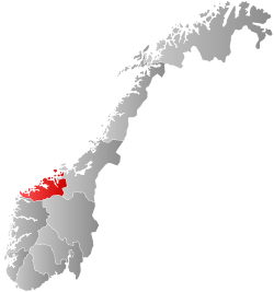 Møre og Romsdal within Norway | |
 Sula within Møre og Romsdal | |
| Coordinates: 62°25′29″N 06°12′22″E | |
| Country | Norway |
| County | Møre og Romsdal |
| District | Sunnmøre |
| Established | 1 Jan 1977 |
| Administrative centre | Langevåg |
| Government | |
| • Mayor (2015) | Jim Arve Røssevoll (Ap) |
| Area | |
| • Total | 58.51 km2 (22.59 sq mi) |
| • Land | 57.06 km2 (22.03 sq mi) |
| • Water | 1.45 km2 (0.56 sq mi) 2.5% |
| Area rank | 346 in Norway |
| Population (2020) | |
| • Total | 9,310 |
| • Rank | 119 in Norway |
| • Density | 163.2/km2 (423/sq mi) |
| • Change (10 years) | 17.4% |
| Demonym(s) | Sulalending[1] |
| Time zone | UTC+01:00 (CET) |
| • Summer (DST) | UTC+02:00 (CEST) |
| ISO 3166 code | NO-1531 |
| Official language form | Nynorsk[2] |
| Website | sula |
The 59-square-kilometre (23 sq mi) municipality is the 346th largest by area out of the 356 municipalities in Norway. Sula is the 119th most populous municipality in Norway with a population of 9,310. The municipality's population density is 163.2 inhabitants per square kilometre (423/sq mi) and its population has increased by 17.4% over the previous 10-year period.[4][5]
General information

Originally, most of the island of Sula was part of the old Borgund Municipality and the small southwestern part of the island was part of Ulstein Municipality (see formannskapsdistrikt). On 1 July 1958, the southwestern part of Sula island was transferred to Borgund Municipality. In 1968, Borgund Municipality (including all of the island of Sula) was merged with the town of Ålesund to form the large Ålesund Municipality. On 1 January 1977, the entire island of Sula and the many small islets around it were separated from Ålesund Municipality to become a separate municipality. The initial population of the new Sula Municipality was 6,302.[6]
Name
The municipality is named after the island of Sula. The name is probably identical with the word sula which means "cleft", probably referring to the cleft between the twin peaks of Rundehornet and Vardane.[3]
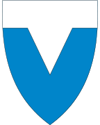
Coat of arms
The coat of arms was granted on 16 December 1983. The arms show a silver and blue figure which represents the cleft of the island.[7][8]
Churches
The Church of Norway has one parish (sokn) within the municipality of Sula. It is part of the Nordre Sunnmøre prosti (deanery) in the Diocese of Møre.
| Parish (sokn) | Church name | Location of the church | Year built |
|---|---|---|---|
| Sula | Langevåg Church | Langevåg | 1948 |
| Indre Sula Church | Mauseidvåg | 1984 |
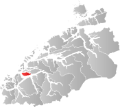
Geography
Sula Municipality includes one main island and many small surrounding islets. It is bordered by the Sulafjorden strait to the west, the Storfjorden to the south, the Hessafjorden and Borgundfjorden to the north, and the narrow Vegsundet strait to the east. The only road access to the island is the European route E39 highway bridge over the Vegsundet.
The natural environment is typically coastal with a sparse forest. The landscape is mostly rocky with heather covering the ground. The highest elevation is the 776-metre (2,546 ft) tall mountain Vardane. Its neighbouring municipalities are all separated from it by sea; Hareid Municipality to the west, Ørsta Municipality to the south, Giske Municipality to the northwest, and Ålesund Municipality to the north and east.
Government
All municipalities in Norway, including Sula, are responsible for primary education (through 10th grade), outpatient health services, senior citizen services, unemployment and other social services, zoning, economic development, and municipal roads. The municipality is governed by a municipal council of elected representatives, which in turn elect a mayor.[9] The municipality falls under the Sunnmøre District Court and the Frostating Court of Appeal.
Municipal council
The municipal council (Kommunestyre) of Sula is made up of 29 representatives that are elected to four year terms. The party breakdown of the council is as follows:
| Party Name (in Nynorsk) | Number of representatives | |
|---|---|---|
| Labour Party (Arbeidarpartiet) | 6 | |
| Progress Party (Framstegspartiet) | 9 | |
| Conservative Party (Høgre) | 4 | |
| Christian Democratic Party (Kristeleg Folkeparti) | 3 | |
| Socialist Left Party (Sosialistisk Venstreparti) | 2 | |
| Liberal Party (Venstre) | 1 | |
| Sula List (Sulalista) | 4 | |
| Total number of members: | 29 | |
| Party Name (in Nynorsk) | Number of representatives | |
|---|---|---|
| Labour Party (Arbeidarpartiet) | 6 | |
| Progress Party (Framstegspartiet) | 8 | |
| Green Party (Miljøpartiet Dei Grøne) | 1 | |
| Conservative Party (Høgre) | 5 | |
| Christian Democratic Party (Kristeleg Folkeparti) | 4 | |
| Liberal Party (Venstre) | 1 | |
| Sula List (Sulalista) | 4 | |
| Total number of members: | 29 | |
| Party Name (in Nynorsk) | Number of representatives | |
|---|---|---|
| Labour Party (Arbeidarpartiet) | 5 | |
| Progress Party (Framstegspartiet) | 9 | |
| Conservative Party (Høgre) | 5 | |
| Christian Democratic Party (Kristeleg Folkeparti) | 4 | |
| Liberal Party (Venstre) | 2 | |
| Sula List (Sulalista) | 4 | |
| Total number of members: | 29 | |
| Party Name (in Nynorsk) | Number of representatives | |
|---|---|---|
| Labour Party (Arbeidarpartiet) | 5 | |
| Progress Party (Framstegspartiet) | 10 | |
| Conservative Party (Høgre) | 2 | |
| Christian Democratic Party (Kristeleg Folkeparti) | 4 | |
| Centre Party (Senterpartiet) | 1 | |
| Liberal Party (Venstre) | 1 | |
| Sula List, party independent list for Sula (Sulalista, partipolitisk uavhengig liste for Sula) | 6 | |
| Total number of members: | 29 | |
| Party Name (in Nynorsk) | Number of representatives | |
|---|---|---|
| Labour Party (Arbeidarpartiet) | 4 | |
| Progress Party (Framstegspartiet) | 11 | |
| Conservative Party (Høgre) | 4 | |
| Christian Democratic Party (Kristeleg Folkeparti) | 4 | |
| Centre Party (Senterpartiet) | 1 | |
| Liberal Party (Venstre) | 1 | |
| Sula List, party independent list for Sula (Sulalista, partipolitisk uavhengig liste for Sula) | 4 | |
| Total number of members: | 29 | |
| Party Name (in Nynorsk) | Number of representatives | |
|---|---|---|
| Labour Party (Arbeidarpartiet) | 4 | |
| Progress Party (Framstegspartiet) | 5 | |
| Conservative Party (Høgre) | 4 | |
| Christian Democratic Party (Kristeleg Folkeparti) | 6 | |
| Liberal Party (Venstre) | 2 | |
| Sula List (Sulaliste) | 8 | |
| Total number of members: | 29 | |
| Party Name (in Nynorsk) | Number of representatives | |
|---|---|---|
| Labour Party (Arbeidarpartiet) | 5 | |
| Progress Party (Framstegspartiet) | 4 | |
| Conservative Party (Høgre) | 3 | |
| Christian Democratic Party (Kristeleg Folkeparti) | 6 | |
| Centre Party (Senterpartiet) | 1 | |
| Liberal Party (Venstre) | 2 | |
| Independent list for Sula (Uavhengig liste for Sula) | 8 | |
| Total number of members: | 29 | |
| Party Name (in Nynorsk) | Number of representatives | |
|---|---|---|
| Labour Party (Arbeidarpartiet) | 4 | |
| Progress Party (Framstegspartiet) | 2 | |
| Conservative Party (Høgre) | 5 | |
| Christian Democratic Party (Kristeleg Folkeparti) | 6 | |
| Liberal Party (Venstre) | 2 | |
| Independents list for Sula (Uavhengig liste for Sula) | 10 | |
| Total number of members: | 29 | |
| Party Name (in Nynorsk) | Number of representatives | |
|---|---|---|
| Labour Party (Arbeidarpartiet) | 4 | |
| Progress Party (Framstegspartiet) | 4 | |
| Conservative Party (Høgre) | 5 | |
| Christian Democratic Party (Kristeleg Folkeparti) | 6 | |
| Liberal Party (Venstre) | 3 | |
| Independent list for Inner Sula (Uavhengig liste for Indre Sula) | 4 | |
| Independent list for Outer Sula (Uavhengig liste for Ytre Sula) | 3 | |
| Total number of members: | 29 | |
| Party Name (in Nynorsk) | Number of representatives | |
|---|---|---|
| Labour Party (Arbeidarpartiet) | 5 | |
| Conservative Party (Høgre) | 6 | |
| Christian Democratic Party (Kristeleg Folkeparti) | 6 | |
| Liberal Party (Venstre) | 2 | |
| Non-party list for Inner Sula (Upolitisk liste for Indre Sula) | 5 | |
| Non-party list for Outer Sula (Upolitisk liste for Ytre Sula) | 5 | |
| Total number of members: | 29 | |
| Party Name (in Nynorsk) | Number of representatives | |
|---|---|---|
| Labour Party (Arbeidarpartiet) | 4 | |
| Conservative Party (Høgre) | 6 | |
| Christian Democratic Party (Kristeleg Folkeparti) | 6 | |
| Liberal Party (Venstre) | 2 | |
| Non-party election list for Inner Sula (Upolitisk valliste for Indre Sula) | 5 | |
| Non-party election list for Outer Sula (Upolitisk valliste for Ytre Sula) | 6 | |
| Total number of members: | 29 | |
Culture
Sula is noted for strong traditions in the field of music. Nils Petter Molvær grew up in Langevåg. Also, the community harbours a strong maritime heritage. The influence of neighbouring city of Ålesund is strong; many live in Sula while working in Ålesund, which is a short ferry ride or a longer car ride away.
Economy
Manufacturing and production is the most important economical sector. Shipyards, fish processing, textile manufacturing, and furniture production are especially vital. The most famous clothing brand from Sula is Devold of Norway, with high quality woolen sweaters and underwear.
Transportation

Transportation in the municipality includes the European route E39 highway and several minor highways. The E39 highway enters Sula from the north (Ålesund Municipality) and it crosses the bridge at Vegsundet and continues west and then south to the Solevågen ferry quay where there are regular ferry routes to Festøya in Ørsta Municipality, across the Storfjorden. Also, there is a ferry connection in southwestern Sula Municipality. This ferry has regular routes across the Sulafjorden from Sulasund to the village of Hareid on the island of Hareidlandet in Hareid Municipality.
References
- "Navn på steder og personer: Innbyggjarnamn" (in Norwegian). Språkrådet.
- "Forskrift om målvedtak i kommunar og fylkeskommunar" (in Norwegian). Lovdata.no.
- Thorsnæs, Geir, ed. (2018-03-05). "Sula". Store norske leksikon (in Norwegian). Kunnskapsforlaget. Retrieved 2019-08-11.
- Statistisk sentralbyrå (2020). "Table: 06913: Population 1 January and population changes during the calendar year (M)" (in Norwegian).
- Statistisk sentralbyrå (2020). "09280: Area of land and fresh water (km²) (M)" (in Norwegian).
- Jukvam, Dag (1999). "Historisk oversikt over endringer i kommune- og fylkesinndelingen" (PDF) (in Norwegian). Statistisk sentralbyrå.
- "Kommunevåpenet". Sula Kommune. Retrieved 2008-10-19.
- "Civic heraldry of Norway - Norske Kommunevåpen". Heraldry of the World. Retrieved 2019-08-11.
- Hansen, Tore, ed. (2016-05-12). "kommunestyre". Store norske leksikon (in Norwegian). Kunnskapsforlaget. Retrieved 2019-04-06.
- "Tall for Norge: Kommunestyrevalg 2019 - Møre og Romsdal" (in Norwegian). Statistics Norway. Retrieved 2019-10-19.
- "Table: 04813: Members of the local councils, by party/electoral list at the Municipal Council election (M)" (in Norwegian). Statistics Norway.
- "Tall for Norge: Kommunestyrevalg 2011 - Møre og Romsdal" (in Norwegian). Statistics Norway. Retrieved 2019-10-19.
- "Kommunestyrevalget 1995" (PDF) (in Norwegian). Oslo-Kongsvinger: Statistisk sentralbyrå. 1996. Retrieved 2020-05-01.
- "Kommunestyrevalget 1991" (PDF) (in Norwegian). Oslo-Kongsvinger: Statistisk sentralbyrå. 1993. Retrieved 2020-05-01.
- "Kommunestyrevalget 1987" (PDF) (in Norwegian). Oslo-Kongsvinger: Statistisk sentralbyrå. 1988. Retrieved 2020-05-01.
- "Kommunestyrevalget 1983" (PDF) (in Norwegian). Oslo-Kongsvinger: Statistisk sentralbyrå. 1984. Retrieved 2020-05-01.
- "Kommunestyrevalget 1979" (PDF) (in Norwegian). Oslo: Statistisk sentralbyrå. 1979. Retrieved 2020-05-01.
External links


- Municipal fact sheet from Statistics Norway (in Norwegian)
Møre og Romsdal county, Norway | |||||
|---|---|---|---|---|---|
 |
|  | |||
| Authority control |
|---|