Ytre Sula
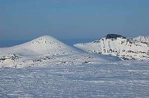
Ytre Sula (also called Nordviksula) is a mountain in the municipality of Surnadal in Møre og Romsdal county, Norway.[1] It lies just north of the village of Todalsøra and the Todalsfjorden.
| Ytre Sula | |
|---|---|
| Nordviksula | |
 | |
| Highest point | |
| Elevation | 1,318 m (4,324 ft) |
| Coordinates | 62.8553°N 8.7267°E[1] |
| Geography | |
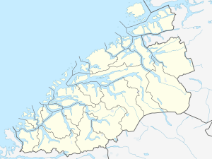 Ytre Sula Location of the mountain  Ytre Sula Ytre Sula (Norway) | |
| Location | Møre og Romsdal, Norway |
| Parent range | Trollheimen |
| Topo map | 1420 I Snota (summit) and 1420 IV Stangvik (ascent from west) |
Ytre Sula, meaning "Outer Sula", lies next to Indre Sula, meaning "Inner Sula". The route from Ytre Sula to Indre Sula is scrambling.
This article is issued from Wikipedia. The text is licensed under Creative Commons - Attribution - Sharealike. Additional terms may apply for the media files.