Solar eclipse of October 19, 1808
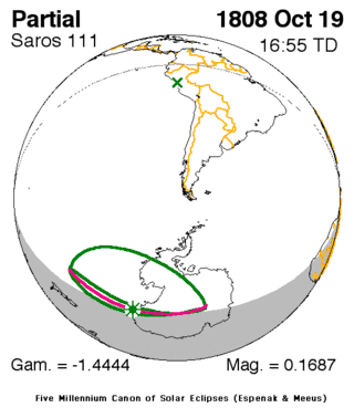
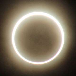
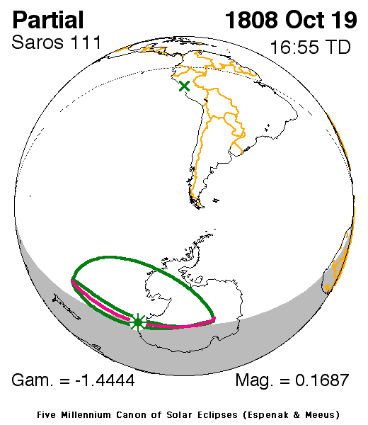
A partial solar eclipse occurred on October 19, 1808. A solar eclipse occurs when the Moon passes between Earth and the Sun, thereby totally or partly obscuring the image of the Sun for a viewer on Earth. A partial solar eclipse occurs in the polar regions of the Earth when the center of the Moon's shadow misses the Earth.
| Solar eclipse of October 19, 1808 | |
|---|---|
 Map | |
| Type of eclipse | |
| Nature | Partial |
| Gamma | -1.4443 |
| Magnitude | 0.1687 |
| Maximum eclipse | |
| Coordinates | 71.3°S 160.8°E |
| Times (UTC) | |
| Greatest eclipse | 16:55:30 |
| References | |
| Saros | 111 (72 of 79) |
| Catalog # (SE5000) | 9062 |
It was the second of three partial eclipses that took place that year, the first of two in two months, the next was on November 18 and covered a part of the Northern Hemisphere.[1] It was part of solar saros 111.[2]
Description
The eclipse was visible in Western Antarctica along with the easternmost portions including the sea in the west, the South Pole and a part of the Trans-Antarctic Mountains, it was also visible in a part of the southernmost of the Pacific. The eclipse edges nearly touch the southernmost of the Atlantic.
The eclipse started at sunrise in the Pacific at around the 45th parallel and east of the 180th meridian, it finished at sunset about 40% of the way between the South Pole and the Atlantic-Indian Ocean boundary.
It showed about up to 20-25% obscuration in Antarctica and over 25% west of the 180th meridian in Antarctica. The greatest eclipse was in Antarctica off the cost of the Pacific at 71.3 S, 160.8 E at 23:44 UTC (5:15 PM local time).[1]
The subsolar marking was in the area of Lima (then Ciudad dos Reyes), Peru at the time was at the final years of Spanish rule.
See also
- List of solar eclipses in the 19th century
- List of solar eclipses visible from Antarctica
References
- "Solar eclipse of October 19, 1808". NASA. Retrieved March 14, 2017.
- "Solar Saros 111". NASA. Retrieved March 13, 2017.
.jpg)
