Shizuoka Prefecture
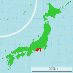
Shizuoka Prefecture (静岡県, Shizuoka-ken) is a prefecture of Japan located in the Chūbu region of Honshu.[1] Shizuoka Prefecture has a population of 3,637,998 (1 December 2019) and has a geographic area of 7,777.42 km² (3,002.88 sq mi). Shizuoka Prefecture borders Kanagawa Prefecture to the east, Yamanashi Prefecture to the northeast, Nagano Prefecture to the north, and Aichi Prefecture to the west.
Shizuoka Prefecture 静岡県 | |
|---|---|
| Japanese transcription(s) | |
| • Japanese | 静岡県 |
| • Rōmaji | Shizuoka-ken |
 Flag  Symbol | |
 | |
| Coordinates: 34°55′N 138°19′E | |
| Country | Japan |
| Region | Chūbu (Tōkai) |
| Island | Honshu |
| Capital | Shizuoka |
| Largest city | Hamamatsu |
| Subdivisions | Districts: 5, Municipalities: 35 |
| Government | |
| • Governor | Heita Kawakatsu |
| Area | |
| • Total | 7,777.42 km2 (3,002.88 sq mi) |
| Area rank | 13th |
| Population (December 1, 2019) | |
| • Total | 3,637,998 |
| • Rank | 10th |
| • Density | 470/km2 (1,200/sq mi) |
| ISO 3166 code | JP-22 |
| Website | www |
| Symbols | |
| Bird | Japanese paradise flycatcher (Terpsiphone atrocaudata) |
| Flower | Azalea (Rhododendron) |
| Tree | Sweet osmanthus (Osmanthus fragrans var. aurantiacus) |
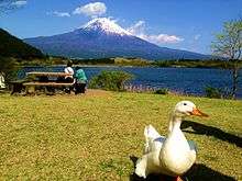
Shizuoka is the capital and Hamamatsu is the largest city in Shizuoka Prefecture, with other major cities including Fuji, Numazu, and Iwata.[2] Shizuoka Prefecture is located on Japan's Pacific Ocean coast and features Suruga Bay formed by the Izu Peninsula, and Lake Hamana which is considered to be one of Japan's largest lakes. Mount Fuji, the tallest volcano in Japan and cultural icon of the country, is partially located in Shizuoka Prefecture on the border with Yamanashi Prefecture. Shizuoka Prefecture has a significant motoring heritage as the founding location of Honda, Suzuki, and Yamaha, and is home to the Fuji International Speedway.
History
Shizuoka Prefecture was established from the former Tōtōmi, Suruga and Izu provinces.[3]
The area was the home of the first Tokugawa shōgun. Tokugawa Ieyasu held the region until he conquered the lands of the Hōjō clan in the Kantō region and placed land under the stewardship of Toyotomi Hideyoshi. After becoming shōgun, Tokugawa took the land back for his family and put the area around modern-day Shizuoka city under the direct supervision of the shogunate. With the creation of Shizuoka han in 1868, it once again became the residence of the Tokugawa family.
Geography

Government Ordinance Designated City City Town
Shizuoka Prefecture is an elongated region following the coast of the Pacific Ocean at the Suruga Bay. In the west, the prefecture extends deep into the Japan Alps. In the east, it becomes a narrower coast bounded in the north by Mount Fuji, until it comes to the Izu Peninsula, a popular resort area pointing south into the Pacific.
As of 1 April 2012, 11% of the total land area of the prefecture was designated as Natural Parks, namely the Fuji-Hakone-Izu and Minami Alps National Parks; Tenryū-Okumikawa Quasi-National Park; and four Prefectural Natural Parks.[4]
Tokai earthquakes
Throughout history, a disastrous earthquake called the Tokai earthquake has hit Shizuoka every 100 to 150 years. On Tuesday, March 15, 2011, Shizuoka Prefecture was hit with a magnitude 6.2 earthquake approximately 42 km (26 mi) NNE of Shizuoka City.
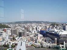
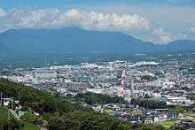
Cities
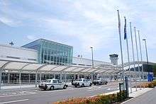
.jpg)

%E6%B5%B7%E6%B0%B4%E6%B5%B4%E5%A0%B4_-_panoramio.jpg)
Twenty-three cities are located in Shizuoka:
Towns
These are the towns in each district:
- Haibara District
- Kawanehon
- Yoshida
- Kamo District
- Shūchi District
- Suntō District
- Tagata District
- Kannami
Mergers
List of governors of Shizuoka (since 1947)
| # | Name (Birth–Death) |
Term of office | Political Party | |
|---|---|---|---|---|
| 1 | Takeji Kobayashi (小林武治) (1899-1988) |
23 April, 1947 | 22 April, 1951 | Independent |
| 2 | Toshio Saito (斎藤寿夫) (1908-1999) |
1 May, 1951 | 8 January, 1967 | Liberal Party (1951-1959) Liberal Democratic Party (1959-1967) |
| 3 | Yutaro Takeyama (竹山祐太郎) (1901-1982) |
31 January, 1967 | 24 June, 1974 | LDP |
| 4 | Keizaburo Yamamoto (山本敬三郎) (1913-2006) |
10 June, 1974 | 6 July, 1986 | LDP |
| 5 | Shigeyoshi Saito (斉藤滋与史) (1918-2018) |
7 July, 1986 | 23 June, 1993 | LDP |
| 6 | Yoshinobu Ishikawa (石川嘉延) (born in 1940) |
3 August, 1993 | 17 June, 2009 | Independent |
| 7 | Heita Kawakatsu (川勝平太) (born in 1948) |
7 July, 2009 | Incumbent | Independent |
Transportation
Rail
- JR East
- JR Central
- Tōkaidō Shinkansen
- Tōkaidō Line (Atami–Toyohashi)
- Gotenba Line
- Minobu Line
- Iida Line
- Izukyū
- Izuhakone Railway
- Daiyūzan Line
- Sunzu Line
- Gakunan Railway
- Shizuoka Railway
- Ōigawa Railway
- Enshū Railway
- Tenryū Hamanako Railroad
Roads
Expressways
Toll roads
- Shizuoka East-West Road
- Shizuoka South-North Road
- West Fuji Road (not a toll road anymore as of 2012)
- Fujinomiya Road
National highways
- National Route 1
- National Route 42
- National Route 52
- National Route 135
- National Route 136
- National Route 138
- National Route 139
- National Route 149
- National Route 150
- National Route 152
- National Route 246
- National Route 257
- National Route 301
- National Route 362
- National Route 414
- National Route 469
- National Route 473
- National Route 474
Ports
- Shimizu Port
- Atami Port and Shimoda Port - Mainly ferry route to Izu Island
- Numazu Port
Education
Universities
National universities
- Hamamatsu University School of Medicine
- Shizuoka University
- Graduate University for Advanced Studies (Mishima Campus, National Institute of Genetics)
Public universities
Private universities
- Fuji Tokoha University
- Hamamatsu University
- Hamamatsu Gakuin University
- Juntendo University (Mishima Campus)
- Nihon University (Mishima Campus)
- Shizuoka Eiwa Gakuin University
- Shizuoka Institute of Science and Technology
- Shizuoka Sangyo University
- Shizuoka University of Welfare
- Tokyo Women's Medical University (Daito Campus)
- Tokai University (Shimizu and Numazu Campuses)
- Tokoha Gakuen University
Senior high schools
- Numazu Commercial High School
- Shizuoka Prefectural Susono High School
- Shizuoka Prefectural High School
Sports
The sports teams listed below are based in Shizuoka.
Basketball
Motorsport
- Fuji International Speedway
Rugby
Football
- Shimizu S-Pulse (Shimizu, Shizuoka)
- Júbilo Iwata (Iwata)
- Matches between the above two teams, both currently in the top flight of the J. League, are known as the Shizuoka Derby.
- Honda F.C. (Hamamatsu)
- Azul Claro Numazu (Numazu)
- Fujieda MYFC (Fujieda)
Volleyball
- Toray Arrows (men's volleyball team) (Mishima city)
Tourism
Theme parks
Festivals and events
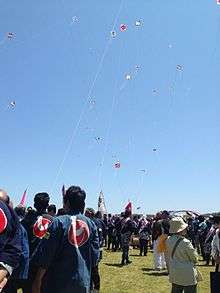
- Shimoda Black Ship Festival, held in May
- Shimizu Port Festival, held on August 5 to 7
- Shizuoka Festival, held in April
- Daidogei World Cup in central Shizuoka City, held in November
- Enshu Daimyo Festival in Iwata, held in April
- Numazu Festival, held in July
- Mishima Festival, held in August
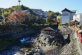 Shuzenji Onsen Izu
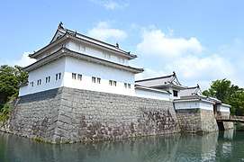 Sunpu Castle ShizuokaAoi-ku

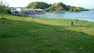
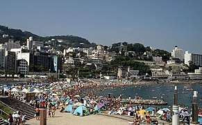 Atami Sun Beach Atami
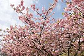 Kawazu Cherry blossom Kamo DistrictKawazu
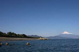 Miho no Matsubara ShizuokaShimizu-ku
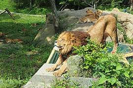 Fuji Safari Park Susono
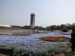
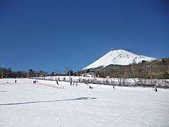 Snowtown Yeti & Mount Fuji Susono
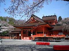
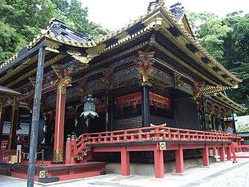 Kunōzan Tōshō-gū ShizuokaSuruga-ku
 Jogasaki Coast Itō
Notes
- Nussbaum, Louis-Frédéric. (2005). "Shizuoka-ken" in Japan Encyclopedia, p. 876, p. 876, at Google Books; "Chūbu" in p. 126, p. 126, at Google Books
- Nussbaum, "Shizuoka" at p. 876, p. 876, at Google Books.
- Nussbaum, "Provinces and prefectures" at p. 780, p. 780, at Google Books.
- "General overview of area figures for Natural Parks by prefecture" (PDF). Ministry of the Environment. 1 April 2012. Retrieved 10 August 2014.
- "About Air Park Japan Air Self-Defense Force Hamamatsu Public Information Building - Shizuoka Travel Guide | Planetyze". Planetyze. Retrieved 2017-11-17.
- "About Shimizu Sushi Museum - Shizuoka Travel Guide | Planetyze". Planetyze. Retrieved 2017-11-17.
References
- Nussbaum, Louis-Frédéric and Käthe Roth. (2005). Japan encyclopedia. Cambridge: Harvard University Press. ISBN 978-0-674-01753-5; OCLC 58053128
External links
| Wikimedia Commons has media related to Shizuoka prefecture. |
Shizuoka (capital) | ||
| Wards of Shizuoka |
| |
| Wards of Hamamatsu | ||
| Special cities |
| |
| Cities | ||
| Districts |
| |
| Authority control |
|
|---|