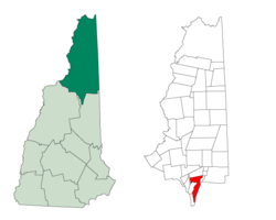
Sargent's Purchase, New Hampshire
Sargent's Purchase is a township located in Coos County, New Hampshire, United States. The purchase lies entirely within the White Mountain National Forest. As of the 2010 census, the purchase had a population of three.[2]
Sargent's Purchase, New Hampshire | |
|---|---|
 Mount Washington Auto Road, approaching the summit | |
 | |
| Coordinates: 44°15′45″N 71°17′54″W | |
| Country | United States |
| State | New Hampshire |
| County | Coos |
| Area | |
| • Total | 25.9 sq mi (67 km2) |
| Elevation | 6,288 ft (1,917 m) |
| Population (2010) | |
| • Total | 3 |
| Time zone | UTC-5 (EST) |
| • Summer (DST) | UTC-4 (EDT) |
| ZIP codes | 03589[lower-alpha 1] |
| Area code(s) | 603 |
In New Hampshire, locations, grants, townships (which are different from towns), and purchases are unincorporated portions of a county which are not part of any town or city and have limited self-government (if any, as many are uninhabited).
History
The first known explorer to have set foot in what is now known as Sargent's Purchase was Darby Field, who claimed to have made the first ascent of Mount Washington in 1642. Sargent's Purchase was granted to Jacob Sargent and others on May 31, 1832.[3] In May 1866, Sylvester Marsh of Campton, New Hampshire, began construction of the Mount Washington Cog Railway,[4] primarily in Thompson and Meserve's Purchase, but the uppermost half mile being within Sargent's Purchase. The Cog Railway was completed in 1869.[5]
Geography
According to the United States Census Bureau, the township has a total area of 25.9 square miles (67 km2), of which 0.04% is water.
Mount Washington, with an elevation of 6,288 feet (1,917 m) above sea level, the highest mountain in New England, is located in Sargent's Purchase. Other notable summits within the purchase include Mount Monroe, at 5,380 feet (1,640 m); Mount Isolation, at 4,004 feet (1,220 m); and Stairs Mountain, at 3,468 feet (1,057 m). The Ammonoosuc River has its headwaters in the township.
Demographics
| Historical population | |||
|---|---|---|---|
| Census | Pop. | %± | |
| 1860 | 6 | — | |
| 1930 | 0 | — | |
| 1940 | 0 | — | |
| 1950 | 16 | — | |
| 1960 | 17 | 6.3% | |
| 1970 | 0 | −100.0% | |
| 1980 | 1 | — | |
| 1990 | 0 | −100.0% | |
| 2000 | 0 | — | |
| 2010 | 3 | — | |
| Est. 2017 | 0 | [6] | −100.0% |
| U.S. Decennial Census[7] | |||
As of the 2010 census,[8] there were three people living in the township.
Notes
- Used by a small post office in the Sherman Adams summit building at the Mount Washington Observatory, for outgoing mail[1]
References
- Rogers, Barbara Radcliffe (May 9, 2019). "A trip to the Mt. Washington summit". nhmagazine.com. Retrieved August 28, 2019.
- United States Census Bureau, American FactFinder, 2010 Census figures. Retrieved March 23, 2011.
- Noah Barker (1864). An essay on the cardinal points. Retrieved November 25, 2011.
-

- http://cograilway.com/history.htm
- "Annual Estimates of the Resident Population: April 1, 2010 to July 1, 2017 (PEPANNRES): Minor Civil Divisions – New Hampshire". Archived from the original on February 13, 2020. Retrieved November 14, 2018.
- "Census of Population and Housing". Census.gov. Retrieved June 4, 2016.
- "U.S. Census website". United States Census Bureau. Retrieved 2008-01-31.
Places adjacent to Sargent's Purchase, New Hampshire | |
|---|---|
Municipalities and communities of Coös County, New Hampshire, United States | ||
|---|---|---|
| City |  Map of New Hampshire highlighting Coos County | |
| Towns | ||
| Townships |
| |
| CDPs | ||
| Other communities | ||