Odell, New Hampshire
Odell is a township in Coos County, New Hampshire, United States. In New Hampshire, locations, grants, townships (which are different from towns), and purchases are unincorporated portions of a county which are not part of any town and have limited self-government (if any, as many are uninhabited). The population was 4 at the 2010 census.[1]
Odell, New Hampshire | |
|---|---|
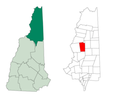 Location in Coos County, New Hampshire | |
| Coordinates: 44°44′51″N 71°22′47″W | |
| Country | United States |
| State | New Hampshire |
| County | Coos |
| Area | |
| • Total | 45.2 sq mi (117 km2) |
| • Land | 44.5 sq mi (115 km2) |
| • Water | 0.7 sq mi (1.8 km2) 1.51% |
| Elevation | 3,661 ft (1,116 m) |
| Population (2010) | |
| • Total | 4 |
| Time zone | UTC-5 (Eastern) |
| • Summer (DST) | UTC-4 (Eastern) |
| Area code(s) | 603 |
History
The township takes its name from Richard Odell of Conway, who bought 23,751 acres (96.12 km2) from the state in 1834 for $1,863.
Geography
Odell is bounded to the west by Stratford, to the south by Stark, to the east by Dummer and Millsfield, and to the north by Erving's Location and Columbia.
A substantial portion of the state-owned Nash Stream Forest lies within the township. There are three mountains, each having elevations above 3,000 feet (910 m): Muise Mountain, Whitcomb Mountain and Long Mountain, whose two summits are the two highest points in Odell, at 3,661 feet (1,116 m) above sea level each. There are only a few rough roads and no highways here.
According to the United States Census Bureau, the township has a total area of 45.2 square miles (117 km2), of which 44.5 sq mi (115 km2) is land and 0.7 sq mi (1.8 km2), or 1.51%, is water.
Demographics
| Historical population | |||
|---|---|---|---|
| Census | Pop. | %± | |
| 1860 | 1 | — | |
| 1920 | 73 | — | |
| 1930 | 0 | −100.0% | |
| 1940 | 82 | — | |
| 1950 | 12 | −85.4% | |
| 1960 | 0 | −100.0% | |
| 1970 | 3 | — | |
| 1980 | 0 | −100.0% | |
| 1990 | 0 | — | |
| 2000 | 5 | — | |
| 2010 | 4 | −20.0% | |
| Est. 2017 | 4 | [2] | 0.0% |
| U.S. Decennial Census[3] | |||
As of the 2000 census,[4] there were 5 people, 4 households, and 1 family residing in the township. There were 73 housing units at an average density of 1.6 per square mile (0.6/km²). The racial makeup of the township was 100.00% White.
Of the 4 households 1 was a married couple living together and 3 were non-families. 3 households were one person and 2 had someone living alone who was 65 or older. The average household size was 1.25 and the average family size was 2.00.
The age distribution was 1 person from 18 to 24, 1 person from 25 to 44, 1 person from 45 to 64, and 2 people who were 65 or older. The median age was 50 years. For every 100 females, there were 66.7 males. For every 100 females age 18 and over, there were 66.7 males.
References
- United States Census Bureau, American FactFinder, 2010 Census figures. Retrieved March 23, 2011.
- "Annual Estimates of the Resident Population: April 1, 2010 to July 1, 2017 (PEPANNRES): Minor Civil Divisions – New Hampshire". Archived from the original on February 13, 2020. Retrieved November 14, 2018.
- "Census of Population and Housing". Census.gov. Retrieved June 4, 2016.
- "U.S. Census website". United States Census Bureau. Retrieved 2008-01-31.
Places adjacent to Odell, New Hampshire | |
|---|---|
Municipalities and communities of Coös County, New Hampshire, United States | ||
|---|---|---|
| City |  Map of New Hampshire highlighting Coos County | |
| Towns | ||
| Townships |
| |
| CDPs | ||
| Other communities | ||