Cambridge, New Hampshire
Cambridge is a township in Coos County in the state of New Hampshire. The population was 8 at the 2010 census.[1] In New Hampshire, locations, grants, townships (which are different from towns), and purchases are unincorporated portions of a county which are not part of any town and have limited self-government (if any, as many are uninhabited).
Cambridge, New Hampshire | |
|---|---|
 The Androscoggin River along New Hampshire Route 16 in Cambridge | |
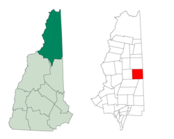 Location in Coos County, New Hampshire | |
| Coordinates: 44°39′35″N 71°06′31″W | |
| Country | United States |
| State | New Hampshire |
| County | Coos |
| Area | |
| • Total | 51.1 sq mi (132.3 km2) |
| • Land | 50.4 sq mi (130.5 km2) |
| • Water | 0.7 sq mi (1.8 km2) 1.39% |
| Elevation | 2,780 ft (850 m) |
| Population (2010) | |
| • Total | 8 |
| Time zone | UTC-5 (Eastern) |
| • Summer (DST) | UTC-4 (Eastern) |
| Area code(s) | 603 |
Most of the township is forested wilderness, but it contains the southernmost edge of Umbagog Lake, accessed via New Hampshire Route 26 from Errol or from Upton, Maine. It contains a section of the 13-Mile Woods Scenic Area along the Androscoggin River. New Hampshire Route 16 also crosses the northwest corner of the township. It is part of the Berlin, NH–VT Micropolitan Statistical Area.
History
It was granted in 1793 to Nathaniel Rogers and others and contained about 23,160 acres (9,370 ha).[2]
Geography
According to the United States Census Bureau, the township has a total area of 51.1 square miles (132.3 km2), of which 50.4 square miles (130.5 km2) is land and 0.7 square miles (1.8 km2), or 1.39%, is water.[3] The highest point is the summit of Cambridge Black Mountain, at 2,780 feet (850 m) above sea level.
Demographics
| Historical population | |||
|---|---|---|---|
| Census | Pop. | %± | |
| 1840 | 5 | — | |
| 1850 | 33 | 560.0% | |
| 1860 | 49 | 48.5% | |
| 1870 | 28 | −42.9% | |
| 1880 | 36 | 28.6% | |
| 1890 | 31 | −13.9% | |
| 1900 | 17 | −45.2% | |
| 1910 | 5 | −70.6% | |
| 1920 | 1 | −80.0% | |
| 1930 | 1 | 0.0% | |
| 1940 | 0 | −100.0% | |
| 1950 | 8 | — | |
| 1960 | 0 | −100.0% | |
| 1970 | 4 | — | |
| 1980 | 5 | 25.0% | |
| 1990 | 0 | −100.0% | |
| 2000 | 10 | — | |
| 2010 | 8 | −20.0% | |
| Est. 2017 | 7 | [4] | −12.5% |
| U.S. Decennial Census[5] | |||
As of the 2000 census,[6] there were 10 people, 5 households, and 3 families living in the township. The population density was 0.2 people per square mile (0.1/km²). There were 39 housing units at an average density of 0.8 per square mile (0.3/km²). The racial makeup of the township was 100.00% White.
Of the 5 households 40.0% had children under the age of 18 living with them, 60.0% were married couples living together, and 40.0% were non-families. 40.0% of households were one person and 20.0% were one person aged 65 or older. The average household size was 2.00 and the average family size was 2.67.
The age distribution was 20.0% under the age of 18, 30.0% from 25 to 44, 40.0% from 45 to 64, and 10.0% 65 or older. The median age was 44 years. For every female of any age, there was one male.
References
- United States Census Bureau, American FactFinder, 2010 Census figures. Retrieved March 23, 2011.
- Article in Statistics and Gazetteer of New-Hampshire (1875)
- "Geographic Identifiers: 2010 Demographic Profile Data (G001) - Cambridge township, New Hampshire". United States Census Bureau. Retrieved November 9, 2011.
- "Annual Estimates of the Resident Population: April 1, 2010 to July 1, 2017 (PEPANNRES): Minor Civil Divisions – New Hampshire". Archived from the original on February 13, 2020. Retrieved November 14, 2018.
- "Census of Population and Housing". Census.gov. Retrieved June 4, 2016.
- "U.S. Census website". United States Census Bureau. Retrieved 2008-01-31.
Places adjacent to Cambridge, New Hampshire | |
|---|---|
Municipalities and communities of Coös County, New Hampshire, United States | ||
|---|---|---|
| City |  Map of New Hampshire highlighting Coos County | |
| Towns | ||
| Townships |
| |
| CDPs | ||
| Other communities | ||