Santa Maria, Davao Occidental
Santa Maria, officially the Municipality of Santa Maria, is a 2nd class municipality in the province of Davao Occidental, Philippines. According to the 2015 census, it has a population of 53,671 people.[3]
Santa Maria | |
|---|---|
| Municipality of Santa Maria | |
 Seal | |
| Nickname(s): Gateway to the South | |
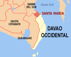 Map of Davao Occidental with Santa Maria highlighted | |

| |
.svg.png) Santa Maria Location within the Philippines | |
| Coordinates: 6°33′N 125°28′E | |
| Country | |
| Region | Davao Region (Region XI) |
| Province | Davao Occidental |
| District | Lone District |
| Barangays | 22 (see Barangays) |
| Government | |
| • Type | Sangguniang Bayan |
| • Mayor | Rudy P. Mariscal Sr. |
| • Vice Mayor | Josephine B. Mariscal |
| • Congressman | Lorna B. Bandigan |
| • Electorate | 33,771 voters (2019) |
| Area | |
| • Total | 175.00 km2 (67.57 sq mi) |
| Elevation | 30.2 m (99.1 ft) |
| Population (2015 census)[3] | |
| • Total | 53,671 |
| • Density | 310/km2 (790/sq mi) |
| • Households | 13,590 |
| Economy | |
| • Income class | 2nd municipal income class |
| • Poverty incidence | 55.04% (2015)[4] |
| • Revenue (₱) | 126,784,537.98 (2016) |
| Time zone | UTC+8 (PST) |
| ZIP code | 8011 |
| PSGC | |
| IDD : area code | +63 (0)82 |
| Climate type | tropical rainforest climate |
| Native languages | Davawenyo Cebuano Four Reigns Kalagan language Tagalog |
The municipality, located on Mindanao Island, is about 40 kilometres (25 mi) north-west of province capital municipality of Malita and about 1,023 kilometres (636 mi) south-south-east of Philippine main capital Manila. The noted features of Santa Maria is the Mt. Cuiawa, standing about more than a hundred-meter above sea level. And at the foot of this mountain, the Municipal Hall where it is located.
Barangays
Santa Maria is politically subdivided into 22 barangays.
- Basiawan
- Buca
- Cadaatan
- Kidadan
- Kisulad
- Malalag Tubig
- Mamacao
- Ogpao
- Poblacion
- Pongpong
- San Agustin
- San Antonio
- San Isidro
- San Juan
- San Pedro
- San Roque
- Tanglad
- Santo Niño
- Santo Rosario
- Datu Daligasao
- Datu Intan
- Kinilidan
Demographics
| Population census of Santa Maria | ||
|---|---|---|
| Year | Pop. | ±% p.a. |
| 1970 | 24,271 | — |
| 1975 | 28,754 | +3.46% |
| 1980 | 30,512 | +1.19% |
| 1990 | 40,036 | +2.75% |
| 1995 | 41,919 | +0.86% |
| 2000 | 45,571 | +1.81% |
| 2007 | 48,362 | +0.82% |
| 2010 | 49,349 | +0.74% |
| 2015 | 53,671 | +1.61% |
| Source: Philippine Statistics Authority[3][5][6][7] | ||
Climate
| Climate data for Santa Maria, Davao Occidental | |||||||||||||
|---|---|---|---|---|---|---|---|---|---|---|---|---|---|
| Month | Jan | Feb | Mar | Apr | May | Jun | Jul | Aug | Sep | Oct | Nov | Dec | Year |
| Average high °C (°F) | 30 (86) |
30 (86) |
31 (88) |
32 (90) |
31 (88) |
30 (86) |
29 (84) |
30 (86) |
30 (86) |
30 (86) |
30 (86) |
30 (86) |
30 (87) |
| Average low °C (°F) | 23 (73) |
23 (73) |
23 (73) |
24 (75) |
24 (75) |
24 (75) |
24 (75) |
24 (75) |
24 (75) |
24 (75) |
24 (75) |
23 (73) |
24 (74) |
| Average precipitation mm (inches) | 38 (1.5) |
29 (1.1) |
37 (1.5) |
45 (1.8) |
102 (4.0) |
166 (6.5) |
179 (7.0) |
176 (6.9) |
157 (6.2) |
133 (5.2) |
86 (3.4) |
46 (1.8) |
1,194 (46.9) |
| Average rainy days | 8.1 | 7.0 | 8.9 | 11.1 | 22.1 | 26.1 | 26.7 | 26.5 | 25.6 | 25.5 | 19.5 | 11.7 | 218.8 |
| Source: Meteoblue [8] | |||||||||||||
Language and dialects
- Tagakaulo - a native dialect originates from the mixture of Bagobo, Mandaya, Davawenyo, and the Lumad peoples of Davao City.
- Cebuano
Customs and Beliefs
The Tagakaulu Kalagan are self-sufficient farmers, producing nearly all of their own food. Wet-rice is grown in the lowlands, and dry-rice and corn are farmed in the upland areas. Yams and sweet potatoes are also staple crops. Vegetables such as tomatoes, squash, and beans are grown; coconuts abound; and many kinds of fruit are available. Goats are raised for meat, and chickens are raised for both eggs and meat. In addition to farming, the Tagakaulu Kalagan catch fish and obtain wild foods and other various materials from the marshes around them. [9]
Those of highest rank in their society do not perform manual labor. Among the rest of the population, male/female division of labor is not very pronounced. Generally, men do the plowing, tilling, and other heavy farm work. The women do most of the domestic work, often assisted by their older children. [10]
Tagakaulu Kalagan art is confined mostly to weaving, basket making, and producing certain ornaments. Personal adornment in the form of bright clothing, beaded jewelry, and other accessories is distinctive and colorful. On special occasions, graceful dances are performed to the rhythmic music of gongs and other instruments. [11]
The Tagakaulu Kalagan social structure is unusual because it is modified by a system of social rank, certain rules of descent, and distinctive marriage patterns. For most purposes, social rank is less important than blood ties. Higher-ranking families maintain elaborate genealogies to prove their claims of descent. [12]
There is a strong preference for marriage between related families, especially marriage to second cousins. After marriage, the couple usually resides in the husband's community. Today, however, many young couples form their own independent households.
The Tagakaulu Kalagan were not introduced to Islam until Muslim missionaries arrived in the area during the 1500s. About half of the entire group of Kalagan came under Islamic influence at that time, and the group divided. Most of the Tagakaolo Kalagan became Muslims; however, the majority of the Tagakaulu Kalagan remained animists (believe that non-human objects have spirits). Today, many of them are still ethnic religionists, believing in the traditions and religions of their forefathers. They continue to believe in a variety of "environmental spirits." Many tales are also told of magic, sorcery, and supernatural beings. [13]
Local government
Municipal officials 2013-2016:
- Mayor: Rudy P. Mariscal, Sr.
- Vice Mayor: George P. Mariscal
- Councilors:
- Lino Solo
- Benjamin Wong
- Max Monsad
- Veronica Tubat-Alvarez
- Neil Abe
- Annalie Lumain
- Charles Dupitas
- Carloman Cabanero
References
- "Municipality". Quezon City, Philippines: Department of the Interior and Local Government. Retrieved 31 May 2013.
- "Province: Davao Occidental". PSGC Interactive. Quezon City, Philippines: Philippine Statistics Authority. Retrieved 12 November 2016.
- Census of Population (2015). "Region XI (Davao Region)". Total Population by Province, City, Municipality and Barangay. PSA. Retrieved 20 June 2016.
- "PSA releases the 2015 Municipal and City Level Poverty Estimates". Quezon City, Philippines. Retrieved 12 October 2019.
- Census of Population and Housing (2010). "Region XI (Davao Region)". Total Population by Province, City, Municipality and Barangay. NSO. Retrieved 29 June 2016.
- Censuses of Population (1903–2007). "Region XI (Davao Region)". Table 1. Population Enumerated in Various Censuses by Province/Highly Urbanized City: 1903 to 2007. NSO.
- "Province of Davao del Sur". Municipality Population Data. Local Water Utilities Administration Research Division. Retrieved 17 December 2016.
- "Santa Maria: Average Temperatures and Rainfall". Meteoblue. Retrieved 28 January 2020.
- https://joshuaproject.net/people_groups/15173/RP
- https://joshuaproject.net/people_groups/15173/RP
- https://joshuaproject.net/people_groups/15173/RP
- https://joshuaproject.net/people_groups/15173/RP
- https://joshuaproject.net/people_groups/15173/RP
External links
| Wikimedia Commons has media related to Santa Maria, Davao Occidental. |
- Santa Maria Profile at PhilAtlas.com
- http://www.gmanetwork.com/news/video/135238/balitapilipinas/bodega-ng-fiber-sa-sta-maria-davao-del-sur-nasunog
- Philippine Standard Geographic Code
- Philippine Census Information
- Local Governance Performance Management System
Places adjacent to Santa Maria, Davao Occidental | ||||||||||
|---|---|---|---|---|---|---|---|---|---|---|
| ||||||||||
Malita (capital) | |
| Municipalities | |