San Miguel, Bohol
San Miguel, officially the Municipality of San Miguel, (Cebuano: Lungsod sa San Miguel; Tagalog: Bayan ng San Miguel), is a 4th class municipality in the province of Bohol, Philippines. According to the 2015 census, it has a population of 24,135 people.[4]
San Miguel | |
|---|---|
| Municipality of San Miguel | |
 San Miguel, Bohol | |
 Flag  Seal | |
 Map of Bohol with San Miguel highlighted | |
OpenStreetMap 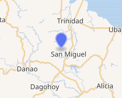
| |
.svg.png) San Miguel Location within the Philippines | |
| Coordinates: 10°00′N 124°19′E | |
| Country | |
| Region | Central Visayas (Region VII) |
| Province | Bohol |
| District | 2nd District |
| Founded | 14 March 1961 |
| Barangays | 18 (see Barangays) |
| Government | |
| • Type | Sangguniang Bayan |
| • Mayor | Virgilio L. Mendez |
| • Vice Mayor | Faustino D. Bulaga |
| • Congressman | Erico Aristotle C. Aumentado |
| • Electorate | 15,952 voters (2019) |
| Area | |
| • Total | 123.29 km2 (47.60 sq mi) |
| Elevation | 37.3 m (122.4 ft) |
| Population (2015 census)[4] | |
| • Total | 24,135 |
| • Density | 200/km2 (510/sq mi) |
| • Households | 5,393 |
| Economy | |
| • Income class | 4th municipal income class |
| • Poverty incidence | 31.57% (2015)[5] |
| • Revenue (₱) | 89,992,996.05 (2016) |
| Time zone | UTC+8 (PST) |
| ZIP code | 6323 |
| PSGC | |
| IDD : area code | +63 (0)38 |
| Climate type | tropical monsoon climate |
| Native languages | Boholano dialect Cebuano Tagalog |
San Miguel is located in the northern interior of the province. It is 86 kilometers (two to three hours bus ride) from Tagbilaran with a total land area of 12,329 hectares (30,466 acres) bounded in the north by the municipality of Trinidad, in the south by the municipality of Dagohoy, in the west municipality of Danao and in the east by the municipality of Ubay.
San Miguel has eighteen barangays and has an estimated population of more than 24,000. The western portion of the municipality is generally hilly while the eastern portions are level lands primarily cultivated for agriculture.
The town of San Miguel, Bohol celebrates its feast on May 10, to honor the town patron Saint Michael.[6]
History
The Municipality was established in July 1961 by virtue of Executive Order No. 423 dated 14 March 1961.[7] Its mother town is the municipality of Trinidad which also was formerly barrio Ipil of the Municipality of Talibon. The seat of government in the San Miguel was formerly Cambangay Sur which was formerly a part of Talibon when the latter became a pueblo during the Spanish regime.
The place which is now the town site was one a forest area teeming with all kinds of games. The early years of American regime saw the migration of a handful of natives from Ipil which was settlement in the north along the Ipil River. The search for greener pastures brought more settlers into the area. The bulk of migrants came from the municipality of Loon.
San Miguel got its name from St. Michael the Archangel, the town's patron saint.[8]
Barangays
San Miguel comprises 18 barangays:
| PSGC | Barangay | Population | ±% p.a. | Area | PD 2015 | |||||
|---|---|---|---|---|---|---|---|---|---|---|
| 2015[4] | 2010[9] | ha | acre | /km2 | /sq mi | |||||
| 071238001 | Bayongan | 9.5% | 2,281 | 2,251 | 0.25% | 1,250 | 3,089 | 180 | 470 | |
| 071238003 | Bugang | 5.3% | 1,287 | 1,111 | 2.84% | 444 | 1,097 | 290 | 750 | |
| 071238004 | Cabangahan | 2.8% | 671 | 785 | −2.94% | 345 | 853 | 190 | 500 | |
| 071238012 | Caluasan | 2.3% | 550 | 679 | −3.93% | 526 | 1,300 | 100 | 270 | |
| 071238006 | Camanaga | 6.8% | 1,648 | 1,705 | −0.65% | 670 | 1,656 | 250 | 640 | |
| 071238007 | Cambangay Norte | 6.8% | 1,635 | 1,566 | 0.82% | 847 | 2,093 | 190 | 500 | |
| 071238008 | Capayas | 4.3% | 1,032 | 1,033 | −0.02% | 591 | 1,460 | 170 | 450 | |
| 071238009 | Corazon | 8.4% | 2,037 | 1,691 | 3.61% | 844 | 2,086 | 240 | 630 | |
| 071238010 | Garcia | 2.6% | 619 | 646 | −0.81% | 581 | 1,436 | 110 | 280 | |
| 071238011 | Hagbuyo | 5.2% | 1,254 | 1,214 | 0.62% | 365 | 902 | 340 | 890 | |
| 071238005 | Kagawasan | 5.1% | 1,242 | 1,190 | 0.82% | 817 | 2,019 | 150 | 390 | |
| 071238013 | Mahayag | 10.0% | 2,411 | 2,329 | 0.66% | 501 | 1,238 | 480 | 1,200 | |
| 071238014 | Poblacion | 10.2% | 2,459 | 2,514 | −0.42% | 357 | 882 | 690 | 1,800 | |
| 071238015 | San Isidro | 6.8% | 1,649 | 1,541 | 1.30% | 471 | 1,164 | 350 | 910 | |
| 071238016 | San Jose | 3.4% | 823 | 827 | −0.09% | 241 | 596 | 340 | 880 | |
| 071238017 | San Vicente | 3.1% | 750 | 734 | 0.41% | 252 | 623 | 300 | 770 | |
| 071238018 | Santo Niño | 3.0% | 721 | 695 | 0.70% | 445 | 1,100 | 160 | 420 | |
| 071238019 | Tomoc | 4.4% | 1,066 | 1,063 | 0.05% | 870 | 2,150 | 120 | 320 | |
| Total | 24,135 | 23,574 | 0.45% | 12,329 | 30,466 | 200 | 510 | |||
Climate
| Climate data for San Miguel, Bohol | |||||||||||||
|---|---|---|---|---|---|---|---|---|---|---|---|---|---|
| Month | Jan | Feb | Mar | Apr | May | Jun | Jul | Aug | Sep | Oct | Nov | Dec | Year |
| Average high °C (°F) | 28 (82) |
28 (82) |
29 (84) |
31 (88) |
31 (88) |
30 (86) |
30 (86) |
30 (86) |
30 (86) |
29 (84) |
29 (84) |
28 (82) |
29 (85) |
| Average low °C (°F) | 23 (73) |
23 (73) |
23 (73) |
23 (73) |
24 (75) |
24 (75) |
24 (75) |
24 (75) |
24 (75) |
24 (75) |
24 (75) |
23 (73) |
24 (74) |
| Average precipitation mm (inches) | 98 (3.9) |
82 (3.2) |
96 (3.8) |
71 (2.8) |
104 (4.1) |
129 (5.1) |
101 (4.0) |
94 (3.7) |
99 (3.9) |
135 (5.3) |
174 (6.9) |
143 (5.6) |
1,326 (52.3) |
| Average rainy days | 18.0 | 14.1 | 17.1 | 16.8 | 23.7 | 25.7 | 25.8 | 23.3 | 24.2 | 25.9 | 24.0 | 20.6 | 259.2 |
| Source: Meteoblue [10] | |||||||||||||
Demographics
| Population census of San Miguel | ||
|---|---|---|
| Year | Pop. | ±% p.a. |
| 1970 | 10,051 | — |
| 1975 | 11,117 | +2.04% |
| 1980 | 12,220 | +1.91% |
| 1990 | 16,775 | +3.22% |
| 1995 | 17,979 | +1.31% |
| 2000 | 20,828 | +3.20% |
| 2007 | 22,199 | +0.88% |
| 2010 | 23,574 | +2.21% |
| 2015 | 24,135 | +0.45% |
| Source: Philippine Statistics Authority[4][9][11][12] | ||
Local government

Since its township, 9 mayors have been elected into office.
Mayors of San Miguel
- Enrique Alvarez
- Mateo Almedilla
- Teodorico Palma
- Mauricio Bonior
- Segundino Hencianos
- Hermogenes Ricafort
(acted as OIC Mayor after the EDSA Revolution) - Silvino Evangelista
- Claudio Bonior
- Nunila Mendez-Pinat
- Atty. Virgilio Mendez
References
- "Municipality". Quezon City, Philippines: Department of the Interior and Local Government. Retrieved 31 May 2013.
- "Province: Bohol". PSGC Interactive. Quezon City, Philippines: Philippine Statistics Authority. Retrieved 12 November 2016.
- "San Miguel, Bohol Profile". PhilAtlas.com. Retrieved 15 June 2020.
- Census of Population (2015). "Region VII (Central Visayas)". Total Population by Province, City, Municipality and Barangay. PSA. Retrieved 20 June 2016.
- "PSA releases the 2015 Municipal and City Level Poverty Estimates". Quezon City, Philippines. Retrieved 12 October 2019.
- "Bohol Festivals Timetable". "www.bohol-philippines.com". Retrieved 2019-03-28.
- Executive Order No. 423, s. 1961 (14 March 1961), Creating the Municipality of San Miguel in the province of Bohol, retrieved 16 July 2016CS1 maint: multiple names: authors list (link)
- "San Miguel - Bohol". "www.bohol-philippines.com". Retrieved 2019-02-27.
- Census of Population and Housing (2010). "Region VII (Central Visayas)". Total Population by Province, City, Municipality and Barangay. NSO. Retrieved 29 June 2016.
- "San Miguel: Average Temperatures and Rainfall". Meteoblue. Retrieved 9 May 2020.
- Censuses of Population (1903–2007). "Region VII (Central Visayas)". Table 1. Population Enumerated in Various Censuses by Province/Highly Urbanized City: 1903 to 2007. NSO.
- "Province of Bohol". Municipality Population Data. Local Water Utilities Administration Research Division. Retrieved 17 December 2016.
External links