Saint Patrick Parish, New Brunswick
Saint Patrick Parish is a Statistics Canada census subdivision, and local service district in the province of New Brunswick.
Saint Patrick Parish Paroisse de Saint-Patrick | |
|---|---|
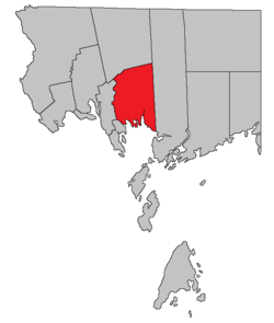 Location within Charlotte County. | |
| Country | |
| Province | |
| County | Charlotte County |
| Established | 1756 |
| Government | |
| • Type | Local service district |
| Area | |
| • Land | 236.89 km2 (91.46 sq mi) |
| Population (2016)[1] | |
| • Total | 689 |
| • Density | 2.9/km2 (8/sq mi) |
| • Pop 2011-2016 | |
| • Dwellings | 545 |
| Time zone | UTC-4 (AST) |
| • Summer (DST) | UTC-3 (ADT) |
| Highways | Route 127 / Route 760 / Route 770[2] |
The parish was established in 1786 along with Charlotte County when New Brunswick was partitioned from Nova Scotia.[3] It included Dumbarton Parish until 1856.[4]
The local service district was established to assess for fire protection following the abolition of county councils with the 1966 Municipalities Act.[5] First aid and ambulance services were added in 1975. Like most of Charlotte County, it is part of Southwest New Brunswick Service Commission.[6]
Delineation
Saint Patrick Parish is defined in the Territorial Division Act[7] as being bounded:
- West and northwest by Saint Andrews Parish and Saint Croix Parish; east by the west line of the grant to Philip Bailey and others, and its northerly prolongation; north by a line commencing at the most southern angle of lot number five, granted to John Gilman, on the southwestern side of Digdeguash River; thence northeasterly along the southeasterly line of said lot to the Digdeguash River; thence down stream along the same to the lower line of the lot granted to John Campbell; thence along the same easterly to the rear thereof; thence northerly along the rear of the said last mentioned lot to meet the westerly prolongation of the line dividing the lots ten and eleven in the Clarence Hill grant plan, and thence easterly along the said line dividing the lots number ten and number eleven to the eastern boundary of the parish; and south by Passamaquoddy bay, including all the islands west of the east line of the said parish within two miles of the shore.
Census data
The parish includes the unincorporated settlements of Bethel, Bocabec, Bocabec Cove, Digdeguash, Elmsville, and Johnson Settlement.
Population
| Canada census – Saint Patrick Parish, New Brunswick community profile | |||
|---|---|---|---|
| 2016 | 2011 | 2006 | |
| Population: | 689 (+6.5% from 2011) | 647 (-10.3% from 2006) | 721 (+6.5% from 2001) |
| Land area: | 236.89 km2 (91.46 sq mi) | 236.88 km2 (91.46 sq mi) | 236.76 km2 (91.41 sq mi) |
| Population density: | 2.9/km2 (7.5/sq mi) | 2.7/km2 (7.0/sq mi) | 3.0/km2 (7.8/sq mi) |
| Median age: | 53.9 (M: 53.2, F: 54.1) | 48.5 (M: 50.1, F: 47.8) | 44.3 (M: 45.9, F: 43.1) |
| Total private dwellings: | 545 | 349 | 526 |
| Median household income: | $.N/A | $.N/A | $43,854 |
| Notes: 2011 income data for this area has been suppressed for data quality or confidentiality reasons. – References: 2016[8] 2011[9] 2006[10] earlier[11] | |||
| Historical Census Data - Saint Patrick Parish, New Brunswick | |||||||||||||||||||||||||||||
|---|---|---|---|---|---|---|---|---|---|---|---|---|---|---|---|---|---|---|---|---|---|---|---|---|---|---|---|---|---|
|
|
| |||||||||||||||||||||||||||
| [12][1] | |||||||||||||||||||||||||||||
Language
| Canada Census Mother Tongue - Saint Patrick Parish, New Brunswick[12] | ||||||||||||||||||
|---|---|---|---|---|---|---|---|---|---|---|---|---|---|---|---|---|---|---|
| Census | Total | English |
French |
English & French |
Other | |||||||||||||
| Year | Responses | Count | Trend | Pop % | Count | Trend | Pop % | Count | Trend | Pop % | Count | Trend | Pop % | |||||
2011 |
645 |
625 | 96.90% | 15 | 2.33% | 0 | 0.00% | 5 | 0.77% | |||||||||
2006 |
715 |
700 | 97.90% | 15 | 2.10% | 0 | 0.00% | 0 | 0.00% | |||||||||
2001 |
670 |
645 | 96.27% | 0 | 0.00% | 10 | 1.49% | 15 | 2.24% | |||||||||
1996 |
640 |
610 | n/a | 95.31% | 0 | n/a | 0.00% | 0 | n/a | 0.00% | 30 | n/a | 4.69% | |||||
See also
References
- "Census Profile, 2016 Census: Saint Patrick, Parish [Census subdivision], New Brunswick". Statistics Canada. Retrieved 7 September 2019.
- Atlantic Canada Back Road Atlas ISBN 978-1-55368-618-7 Pages 4, 12
- Slumkoski, Corey (2005). "The Partition of Nova Scotia". The Winslow Papers. Electronic text centre (UNB Libraries). Retrieved 5 May 2020.
- "Saint Patrick Parish". archives.gnb.ca. Provincial Archives of New Brunswick. Retrieved 13 June 2020.
- "Local Government Legislation in New Brunswick" (PDF). Government of New Brunswick. Retrieved 24 June 2020.
- "Southwest New Brunswick Service Commission Annual Report & Financial Statements 2018" (PDF). Southwest New Brunswick Service Commission. Retrieved 24 June 2020.
- "Territorial Division Act (R.S.N.B. 1973, c. T-3)". Government of New Brunswick website. Retrieved 25 August 2016.
- "2016 Community Profiles". 2016 Canadian Census. Statistics Canada. 21 February 2017. Retrieved 7 September 2019.
- "2011 Community Profiles". 2011 Canadian Census. Statistics Canada. 5 July 2013. Retrieved 17 March 2014.
- "2006 Community Profiles". 2006 Canadian Census. Statistics Canada. 30 March 2011. Retrieved 17 March 2014.
- "2001 Community Profiles". 2001 Canadian Census. Statistics Canada. 17 February 2012.
- Statistics Canada: 1996, 2001, 2006, 2011 census
Places adjacent to Saint Patrick Parish, New Brunswick | ||||||||||
|---|---|---|---|---|---|---|---|---|---|---|
| ||||||||||
| Subdivisions |
|
|---|---|
| Cities | |
| Counties | |
| |